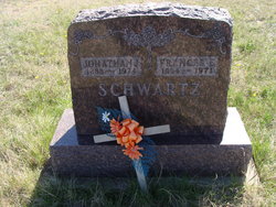
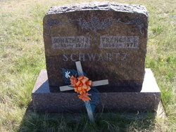
Frances “Freni” Graber Schwartz
| Birth | : | 5 Aug 1884 Pretty Prairie, Reno County, Kansas, USA |
| Death | : | 10 Jun 1971 Glendive, Dawson County, Montana, USA |
| Burial | : | Bethlehem Mennonite Cemetery, Bloomfield, Dawson County, USA |
| Coordinate | : | 47.5280000, -104.8747000 |
frequently asked questions (FAQ):
-
Where is Frances “Freni” Graber Schwartz's memorial?
Frances “Freni” Graber Schwartz's memorial is located at: Bethlehem Mennonite Cemetery, Bloomfield, Dawson County, USA.
-
When did Frances “Freni” Graber Schwartz death?
Frances “Freni” Graber Schwartz death on 10 Jun 1971 in Glendive, Dawson County, Montana, USA
-
Where are the coordinates of the Frances “Freni” Graber Schwartz's memorial?
Latitude: 47.5280000
Longitude: -104.8747000
Family Members:
Parent
Spouse
Siblings
Children
Flowers:
Nearby Cemetories:
1. Bethlehem Mennonite Cemetery
Bloomfield, Dawson County, USA
Coordinate: 47.5280000, -104.8747000
2. Kiempel Cemetery
Dawson County, USA
Coordinate: 47.5780983, -104.7574997
3. Red Top Mennonite Cemetery
Red Top, Dawson County, USA
Coordinate: 47.4160995, -104.8106003
4. Immanuel Evangelical Lutheran Cemetery
Bloomfield, Dawson County, USA
Coordinate: 47.4415000, -104.6735000
5. Richey Cemetery
Richey, Dawson County, USA
Coordinate: 47.6542015, -105.0417023
6. Community Memorial Cemetery
Lambert, Richland County, USA
Coordinate: 47.6719017, -104.6211014
7. Saint Theresa Cemetery
Lambert, Richland County, USA
Coordinate: 47.6889000, -104.6138992
8. West Church Cemetery
Dawson County, USA
Coordinate: 47.3266983, -105.1502991
9. Grand View Cemetery
Dawson County, USA
Coordinate: 47.2971992, -104.5378036
10. Arnett Cemetery
Dawson County, USA
Coordinate: 47.4542007, -105.3638992
11. Riverview Cemetery
Savage, Richland County, USA
Coordinate: 47.4453011, -104.3443985
12. Elmdale Cemetery
Richland County, USA
Coordinate: 47.9113998, -104.7617035
13. Prairie Lawn Cemetery
Dawson County, USA
Coordinate: 47.7611008, -105.3422012
14. Crane Cemetery
Richland County, USA
Coordinate: 47.5727997, -104.2649994
15. Dawson County Cemetery
Glendive, Dawson County, USA
Coordinate: 47.1105995, -104.6971970
16. Immanuel Lutheran Cemetery
McCone County, USA
Coordinate: 47.6835000, -105.4920000
17. Dawson Memorial Park
Glendive, Dawson County, USA
Coordinate: 47.0889015, -104.7746964
18. Union Cemetery
Dawson County, USA
Coordinate: 47.1822014, -105.2882996
19. Newlon Cemetery
Sidney, Richland County, USA
Coordinate: 47.6525002, -104.2268982
20. Mona Cemetery
Richland County, USA
Coordinate: 47.9686012, -104.6977997
21. Riverside Cemetery
McCone County, USA
Coordinate: 47.8972015, -105.2835999
22. Sacred Heart Catholic Cemetery
Vida, McCone County, USA
Coordinate: 47.8976000, -105.2840000
23. Grandview Cemetery
Richland County, USA
Coordinate: 47.9556007, -105.1343994
24. Lone Butte Cemetery
Richland County, USA
Coordinate: 47.8824997, -104.4281006

