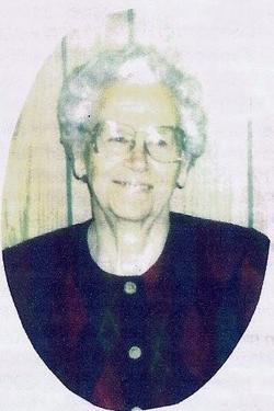
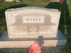
Frances Jane Duncan Werle
| Birth | : | 17 Dec 1914 Clay County, Missouri, USA |
| Death | : | 11 Apr 2005 Excelsior Springs, Clay County, Missouri, USA |
| Burial | : | Lower Valley Memorial Gardens, Sunnyside, Yakima County, USA |
| Coordinate | : | 46.3450012, -120.0117035 |
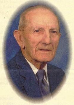
| Description | : | ~~Frances Jane Duncan was born the daughter of Franklin Duncan and Sarah Duncan (O"Dell) on Dec. 17, 1914, in rural Excelsior Springs, Missouri. Frances lived in Ray County, Missouri her entire lifetime. She was a member of the Rock Falls Baptist Church. On Dec. 3, 1930, Frances was united in marriage to Wilbur Raymond Werle of rural Orrick, Missouri. Wilbur passed away on Nov. 26, 1999. To this union was born one son, Raymond Keith Werle and one daughter, Joyce M. Werle. Frances passed away on April 11, 2005, at the Royal Care Center in Excelsior Springs, Missouri.... Read More |
frequently asked questions (FAQ):
-
Where is Frances Jane Duncan Werle's memorial?
Frances Jane Duncan Werle's memorial is located at: Lower Valley Memorial Gardens, Sunnyside, Yakima County, USA.
-
When did Frances Jane Duncan Werle death?
Frances Jane Duncan Werle death on 11 Apr 2005 in Excelsior Springs, Clay County, Missouri, USA
-
Where are the coordinates of the Frances Jane Duncan Werle's memorial?
Latitude: 46.3450012
Longitude: -120.0117035
Family Members:
Parent
Spouse
Siblings
Children
Nearby Cemetories:
1. Lower Valley Memorial Gardens
Sunnyside, Yakima County, USA
Coordinate: 46.3450012, -120.0117035
2. Holy Trinity Episcopal Close
Sunnyside, Yakima County, USA
Coordinate: 46.3235000, -120.0158500
3. Outlook Cemetery
Yakima, Yakima County, USA
Coordinate: 46.3208008, -120.0811005
4. Grandview Cemetery
Grandview, Yakima County, USA
Coordinate: 46.2658005, -119.8902969
5. Mabton Cemetery
Mabton, Yakima County, USA
Coordinate: 46.2285995, -119.9852982
6. Smohalla Cemetery
Toppenish, Yakima County, USA
Coordinate: 46.3009660, -120.2186250
7. Black Rock Cemetery
Moxee City, Yakima County, USA
Coordinate: 46.5111084, -119.9985962
8. Zillah German Baptist Cemetery
Zillah, Yakima County, USA
Coordinate: 46.4128550, -120.2506400
9. McCoy Cemetery
Toppenish, Yakima County, USA
Coordinate: 46.3835983, -120.2755966
10. Zillah Cemetery
Zillah, Yakima County, USA
Coordinate: 46.4055202, -120.2726072
11. Prosser Pioneer Cemetery
Prosser, Benton County, USA
Coordinate: 46.1947937, -119.8095245
12. Winnier Cemetery
Toppenish, Yakima County, USA
Coordinate: 46.3590060, -120.3192450
13. Elmwood Cemetery
Toppenish, Yakima County, USA
Coordinate: 46.3673830, -120.3334530
14. Prosser Cemetery
Prosser, Benton County, USA
Coordinate: 46.2047539, -119.7541504
15. Glade Cemetery
Yakima County, USA
Coordinate: 46.0778008, -120.0914001
16. Smina Cemetery
Yakima County, USA
Coordinate: 46.2372017, -120.4269028
17. Beaver Cemetery
Yakima County, USA
Coordinate: 46.0993996, -120.2866974
18. Holy Rosary Cemetery
Moxee City, Yakima County, USA
Coordinate: 46.5531006, -120.3585968
19. Holland Cemetery
Moxee City, Yakima County, USA
Coordinate: 46.5766983, -120.3861008
20. Meninick Cemetery
Yakima County, USA
Coordinate: 46.1981010, -120.4741974
21. Evergreen Cemetery
Benton City, Benton County, USA
Coordinate: 46.2867012, -119.4938965
22. Union Gap Cemetery
Yakima County, USA
Coordinate: 46.5209084, -120.4850998
23. Reservation Community Memorial Park
Wapato, Yakima County, USA
Coordinate: 46.4484291, -120.5375519
24. Toweatmy Cemetery
Toppenish, Yakima County, USA
Coordinate: 46.1794014, -120.5056000


