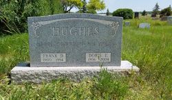
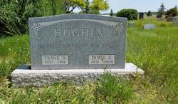
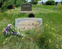
Frank Donald Hughes
| Birth | : | 15 Jun 1900 Monticello, White County, Indiana, USA |
| Death | : | 1984 Scobey, Daniels County, Montana, USA |
| Burial | : | Daniels County Cemetery, Scobey, Daniels County, USA |
| Coordinate | : | 48.7942009, -105.4421997 |
| Inscription | : | HAPPILY MARRIED 58 YEARS |
| Description | : | Married Doris E. Fee Sept. 4, 1926, in Scobey. __________ In 1904, he came to Scobey with his family to farm and spent the rest of his life there. Attended school in Daniels County. Married Doris Fee in 1926 at Scobey, MT. Waller Funeral Home in charge of arrangements. Survivors include his wife; two sons, F. Don of Kalispell, MT and J.D. of Mojave, Calif; daughter, Lynn Ophus of Havre; brother, Arthur of Phoenix, Ariz.; sister, Estella Colby of Conrad; and eight grandchildren.--Info from obituary in the Great Falls Tribune, Tuesday, Oct. 9, 1984, Pg. 4-A |
frequently asked questions (FAQ):
-
Where is Frank Donald Hughes's memorial?
Frank Donald Hughes's memorial is located at: Daniels County Cemetery, Scobey, Daniels County, USA.
-
When did Frank Donald Hughes death?
Frank Donald Hughes death on 1984 in Scobey, Daniels County, Montana, USA
-
Where are the coordinates of the Frank Donald Hughes's memorial?
Latitude: 48.7942009
Longitude: -105.4421997
Family Members:
Parent
Spouse
Siblings
Flowers:
Nearby Cemetories:
1. Fairview Cemetery
Daniels County, USA
Coordinate: 48.6431007, -105.4972000
2. Saint Michaels Cemetery
Daniels County, USA
Coordinate: 48.9500008, -105.4244003
3. Orville Cemetery
Flaxville, Daniels County, USA
Coordinate: 48.7364006, -105.2016983
4. Flaxville Cemetery
Flaxville, Daniels County, USA
Coordinate: 48.8102989, -105.1697006
5. Whitetail Cemetery
Daniels County, USA
Coordinate: 48.8967018, -105.1477966
6. East Poplar Cemetery
Coronach, Assiniboia Census Division, Canada
Coordinate: 49.0649250, -105.3677700
7. West Fork Cemetery
Daniels County, USA
Coordinate: 48.6648000, -105.8567700
8. Buffalo Gap Cemetery
Buffalo Gap, Assiniboia Census Division, Canada
Coordinate: 49.0874100, -105.2777000
9. Coronach Cemetery
Coronach, Assiniboia Census Division, Canada
Coordinate: 49.1118600, -105.5017090
10. Pleasant Prairie Cemetery
Daniels County, USA
Coordinate: 48.5635986, -105.0871964
11. Mount Pleasant Cemetery
Coronach, Assiniboia Census Division, Canada
Coordinate: 49.1239380, -105.4126170
12. Valleyview Cemetery
Redstone, Sheridan County, USA
Coordinate: 48.8133011, -104.9356003
13. Saint John Lutheran Cemetery
Coronach, Assiniboia Census Division, Canada
Coordinate: 49.1308190, -105.6129560
14. Old Redstone Cemetery
Sheridan County, USA
Coordinate: 48.8306007, -104.9060974
15. Big Beaver Union Cemetery
Big Beaver, Weyburn Census Division, Canada
Coordinate: 49.0889460, -105.0563550
16. Berg Cemetery
Willow Bunch, Assiniboia Census Division, Canada
Coordinate: 49.1673810, -105.6112070
17. Faith Lutheran Cemetery
Sheridan County, USA
Coordinate: 48.6217003, -104.9039001
18. Archer Cemetery
Sheridan County, USA
Coordinate: 48.7811012, -104.8153000
19. Poplar Valley Cemetery
Rockglen, Assiniboia Census Division, Canada
Coordinate: 49.1012550, -105.8785270
20. Fife Lake Municipal Cemetery
Fife Lake, Assiniboia Census Division, Canada
Coordinate: 49.1742300, -105.7352760
21. Marshall Cemetery
Big Beaver, Weyburn Census Division, Canada
Coordinate: 49.0269260, -104.8803420
22. Highland Cemetery
Outlook, Sheridan County, USA
Coordinate: 48.8732986, -104.7755966
23. Christ the King Roman Catholic Cemetery
Fife Lake, Assiniboia Census Division, Canada
Coordinate: 49.2036630, -105.7281090
24. Volt Cemetery
Volt, Roosevelt County, USA
Coordinate: 48.3775000, -105.7160500

