
| Birth | : | 17 Aug 1910 Monroe, Platte County, Nebraska, USA |
| Death | : | 24 Apr 2002 Genoa, Nance County, Nebraska, USA |
| Burial | : | Surteby Kyrkogård, Surteby, Marks kommun, Sweden |
| Coordinate | : | 57.4415428, 12.5166545 |
| Description | : | Son of Erick & Edith B. (Keeler) Johnson. He was raised in Platte County and graduated from school in Monroe in 1937. He farmed in Platte county for over 60 years. He was a member of the Okay Church in rural Monroe, the United Methodist Church in Monroe, the Methodist Brotherhood, the Lions Club, and served on the New Hope Cemetery Board. He is survived by: Nephew Eugene Hobbensiefken of Monroe, NE Nephew Clyde Johnson Nephew Robert Johnson of Spokane, WA Niece Marsha Stacy of Aurora, CO Niece Mardette Lewis of Sand Point, ID Niece Lois Westfall of Madison, NE Niece Donna... Read More |
frequently asked questions (FAQ):
-
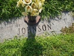
Where is Frank Leonard Johnson's memorial?
Frank Leonard Johnson's memorial is located at: Surteby Kyrkogård, Surteby, Marks kommun, Sweden.
-
When did Frank Leonard Johnson death?
Frank Leonard Johnson death on 24 Apr 2002 in Genoa, Nance County, Nebraska, USA
-
Where are the coordinates of the Frank Leonard Johnson's memorial?
Latitude: 57.4415428
Longitude: 12.5166545
Family Members:
Parent

Siblings
Flowers:


Nearby Cemetories:
1. Surteby Kyrkogård
Surteby, Marks kommun, Sweden
Coordinate: 57.4415428, 12.5166545
2. Kattunga Kyrkogård
Kattunga, Marks kommun, Sweden
Coordinate: 57.4103879, 12.5360568
3. Berghems Kyrkogård
Berghem, Marks kommun, Sweden
Coordinate: 57.4618151, 12.5881601
4. Hajoms Kyrkogård
Hajom, Marks kommun, Sweden
Coordinate: 57.5039644, 12.5509172
5. Orby Kyrkogard
Örby, Marks kommun, Sweden
Coordinate: 57.4818140, 12.7005510
6. Idala kyrkogard
Idala, Kungsbacka kommun, Sweden
Coordinate: 57.3807920, 12.3236715
7. Fritsla gamla kyrkogård
Fritsla, Marks kommun, Sweden
Coordinate: 57.5574232, 12.7928255
8. Skephult kyrkogård
Skepphult, Marks kommun, Sweden
Coordinate: 57.5361110, 12.8811110
9. Bollebygd Cemetery
Bollebygd, Bollebygds kommun, Sweden
Coordinate: 57.6666679, 12.5500002
10. Onsala Kyrkogård
Kungsbacka kommun, Sweden
Coordinate: 57.4132398, 12.0226945
11. Kållered kyrka
Kallered, Mölndals kommun, Sweden
Coordinate: 57.6060222, 12.0556331
12. Rolfstorps Kyrkogård
Himle, Varbergs kommun, Sweden
Coordinate: 57.1437882, 12.4673786
13. Mårdaklevs Gamla Kyrkogård
Mardaklev, Svenljunga kommun, Sweden
Coordinate: 57.2589286, 12.9950129
14. Billdals kyrkogård
Billdal, Göteborgs kommun, Sweden
Coordinate: 57.5805229, 11.9794241
15. Kikås Cemetery
Mölndals kommun, Sweden
Coordinate: 57.6489610, 12.0472210
16. Svenska Kyrkan
Svenljunga, Svenljunga kommun, Sweden
Coordinate: 57.4951300, 13.1159100
17. Ljushults Kyrkogård
Borås, Borås kommun, Sweden
Coordinate: 57.6174795, 13.0432013
18. Sankt Sigfrids griftegård
Borås, Borås kommun, Sweden
Coordinate: 57.7049706, 12.9184835
19. Jonsereds griftegård
Jonsered, Partille kommun, Sweden
Coordinate: 57.7420182, 12.1762995
20. Sankta Birgittas griftegård
Borås, Borås kommun, Sweden
Coordinate: 57.7142538, 12.9332699
21. Kvastekulla Griftegård
Partille, Partille kommun, Sweden
Coordinate: 57.7337760, 12.1428190
22. Askims Södra kyrkogård
Hovas, Göteborgs kommun, Sweden
Coordinate: 57.6157113, 11.9416889
23. Sankt Ansgars griftegård
Borås, Borås kommun, Sweden
Coordinate: 57.7182057, 12.9351487
24. Lerums gamla kyrkogård
Lerums kommun, Sweden
Coordinate: 57.7757400, 12.2826970