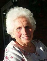
| Birth | : | 17 Jun 1927 Randolph County, North Carolina, USA |
| Death | : | 18 Oct 2008 Randolph County, North Carolina, USA |
| Burial | : | Cedar Square Friends Meeting Cemetery, Randolph County, USA |
| Coordinate | : | 35.8872860, -79.8696320 |
| Description | : | RANDLEMAN - Mr. Frederic (Freddie) Monroe Farlow, retired m/sgt, 81, of 7522 Cedar Square Rd. died October 18th, 2008 at his home. Mr. Farlow was born June 17th, 1927 in Randolph County, a son to Dallas and Ethel Cox Farlow. He was a member of Cedar Square Friends Meeting and co-owner of Country Store and Deli in Asheboro. He also was retired from the U.S. Air Force after serving 20 years. In 1950, he married the former Marjorie Nichols who survives of the home. In addition to his parents, he was preceded in death by a sister, Emma Hall and a... Read More |
frequently asked questions (FAQ):
-
Where is Frederic Monroe “Freddie” Farlow's memorial?
Frederic Monroe “Freddie” Farlow's memorial is located at: Cedar Square Friends Meeting Cemetery, Randolph County, USA.
-
When did Frederic Monroe “Freddie” Farlow death?
Frederic Monroe “Freddie” Farlow death on 18 Oct 2008 in Randolph County, North Carolina, USA
-
Where are the coordinates of the Frederic Monroe “Freddie” Farlow's memorial?
Latitude: 35.8872860
Longitude: -79.8696320
Family Members:
Parent
Spouse
Siblings
Flowers:
Nearby Cemetories:
1. Cedar Square Friends Meeting Cemetery
Randolph County, USA
Coordinate: 35.8872860, -79.8696320
2. Galilee United Church of God Cemetery
Randleman, Randolph County, USA
Coordinate: 35.8887990, -79.8648480
3. Ebenezer United Methodist Church Cemetery
Archdale, Randolph County, USA
Coordinate: 35.9018700, -79.8760100
4. Faith Baptist Church Cemetery
Randolph County, USA
Coordinate: 35.8919040, -79.9005590
5. Glenola Baptist Church Cemetery
Archdale, Randolph County, USA
Coordinate: 35.8688390, -79.9041930
6. Glenola Community Cemetery
Glenola, Randolph County, USA
Coordinate: 35.8687190, -79.9052570
7. Bethel United Methodist Church Cemetery
Archdale, Randolph County, USA
Coordinate: 35.8707360, -79.9104050
8. Shady Grove Baptist Church Cemetery
Randolph County, USA
Coordinate: 35.8673020, -79.9154950
9. Fairfield United Methodist Church Cemetery
High Point, Guilford County, USA
Coordinate: 35.9208200, -79.9076600
10. Bell Welborn Cemetery
Randolph County, USA
Coordinate: 35.8400950, -79.8515080
11. Level Cross Baptist Church Cemetery
Randleman, Randolph County, USA
Coordinate: 35.8879530, -79.8081950
12. Marlboro Friends Meeting Cemetery
Sophia, Randolph County, USA
Coordinate: 35.8391650, -79.8854900
13. Guil-Rand Memorial Park
High Point, Guilford County, USA
Coordinate: 35.9218254, -79.9157677
14. Level Cross United Methodist Church Cemetery
Randleman, Randolph County, USA
Coordinate: 35.8871100, -79.8066620
15. Old Union United Methodist Church Cemetery
Sophia, Randolph County, USA
Coordinate: 35.8345500, -79.8571860
16. Mount Vernon United Methodist Church Cemetery
Trinity, Randolph County, USA
Coordinate: 35.8593270, -79.9372480
17. Centre Friends Meeting Cemetery
Greensboro, Guilford County, USA
Coordinate: 35.9212000, -79.8014000
18. Saint Peters UMC Cemetery
Randleman, Randolph County, USA
Coordinate: 35.8601310, -79.7956760
19. Saint Peter United Methodist Church Cemetery
Randleman Township, Randolph County, USA
Coordinate: 35.8601570, -79.7956300
20. Burnetts Chapel United Methodist Church Cemetery
Greensboro, Guilford County, USA
Coordinate: 35.9454800, -79.8276920
21. Community Baptist Church Cemetery
Greensboro, Guilford County, USA
Coordinate: 35.9548060, -79.8481770
22. Branson Mill Baptist Church Cemetery
Randolph County, USA
Coordinate: 35.9062540, -79.7822510
23. Mount Olive Wesleyan Church Cemetery
Sophia, Randolph County, USA
Coordinate: 35.8228920, -79.9131380
24. Trinity Holiness Church Cemetery
Sophia, Randolph County, USA
Coordinate: 35.8146050, -79.8427561


