
| Birth | : | 29 Jun 1910 Trumbull County, Ohio, USA |
| Death | : | 7 Dec 1970 Loudonville, Ashland County, Ohio, USA |
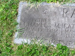
| Burial | : | Loudonville Cemetery, Loudonville, Ashland County, USA |
| Coordinate | : | 40.6309013, -82.2323990 |
| Description | : | ~~~~~~~~~~ Freeman was the son of Milo G. & Laura Morrow Rader. He married Emma Catherine Daubenmire 10 Dec 1932, Brooke County, West Virginia. Children: Patricia Ann Rader Lawrence F. Rader Laurel Lee Rader *************** Ohio, Rutherford B. Hayes Presidential Center Obituary Index, 1810s-2013 Name: Freeman K Rader[Pete Rader] Birth Date: 29 Jun 1910 Age at Death: 60 Death Date: 7 Dec 1970 Death Place: Loudonville, Ohio Spouse: Emma Parents: MILO and LAURA (MORROW) Newspaper Information: Newspaper: Ashland Times-Gazette; Newspaper Date: 07 Dec 1970; Newspaper Page: 3 Column: 5; Repository: Ashland Public Library; Years Available: 1919-1940, 2010 - current Newspaper Information: Newspaper: Ashland Times-Gazette; Newspaper Date: 08 Dec 1970; Newspaper Page: 2 Column: 4; Repository: Ashland Public Library;... Read More |
frequently asked questions (FAQ):
-
Where is Freeman Kisner “Pete” Rader's memorial?
Freeman Kisner “Pete” Rader's memorial is located at: Loudonville Cemetery, Loudonville, Ashland County, USA.
-
When did Freeman Kisner “Pete” Rader death?
Freeman Kisner “Pete” Rader death on 7 Dec 1970 in Loudonville, Ashland County, Ohio, USA
-
Where are the coordinates of the Freeman Kisner “Pete” Rader's memorial?
Latitude: 40.6309013
Longitude: -82.2323990
Family Members:
Parent

Spouse
Siblings
Children
Flowers:


Nearby Cemetories:
1. Loudonville Cemetery
Loudonville, Ashland County, USA
Coordinate: 40.6309013, -82.2323990
2. Saint Peters Cemetery
Loudonville, Ashland County, USA
Coordinate: 40.6455500, -82.2295000
3. Ullman Cemetery
Washington Township, Holmes County, USA
Coordinate: 40.6241989, -82.2007980
4. Plum Run Cemetery
Washington Township, Holmes County, USA
Coordinate: 40.6547821, -82.2015461
5. Daubert Cemetery
Holmes County, USA
Coordinate: 40.6552140, -82.2015490
6. Drake Valley Cemetery
Holmes County, USA
Coordinate: 40.6125310, -82.1725540
7. McFall Cemetery
Perrysville, Ashland County, USA
Coordinate: 40.6322823, -82.2973932
8. Stout Cemetery
Holmes County, USA
Coordinate: 40.6122017, -82.1718979
9. Greenlawn Union Cemetery
Perrysville, Ashland County, USA
Coordinate: 40.6542015, -82.2972031
10. Wolfe Cemetery
Ashland County, USA
Coordinate: 40.5738907, -82.2419434
11. Heyd Cemetery
Loudonville, Ashland County, USA
Coordinate: 40.5699330, -82.2339000
12. Perrysville Union Cemetery
Perrysville, Ashland County, USA
Coordinate: 40.6558400, -82.3116900
13. Saint Michaels Catholic Cemetery
Jelloway, Knox County, USA
Coordinate: 40.5596970, -82.2600510
14. McKay Cemetery
Hayesville, Ashland County, USA
Coordinate: 40.7044487, -82.2457809
15. Sandridge Cemetery
Loudonville, Ashland County, USA
Coordinate: 40.5889282, -82.3160934
16. Sunset Cemetery
Ashland County, USA
Coordinate: 40.7117004, -82.2506027
17. Pioneer Cemetery
Loudonville, Ashland County, USA
Coordinate: 40.6952800, -82.1637400
18. Bethesda Cemetery
Ashland County, USA
Coordinate: 40.7125015, -82.2600021
19. Lakeville Cemetery
Lakeville, Holmes County, USA
Coordinate: 40.6481078, -82.1232048
20. Baker-Severns Cemetery
Danville, Knox County, USA
Coordinate: 40.5459440, -82.2089890
21. County Line Cemetery
Ashland County, USA
Coordinate: 40.7181015, -82.2221985
22. Hay Cemetery
Perrysville, Ashland County, USA
Coordinate: 40.5861990, -82.3316480
23. Saint John Cemetery
McZena, Ashland County, USA
Coordinate: 40.6968900, -82.1524700
24. Saint John Cemetery
Monroe Township, Richland County, USA
Coordinate: 40.6455994, -82.3494034