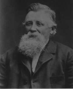
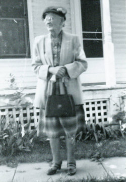
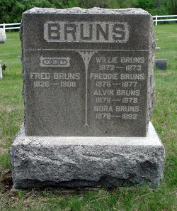
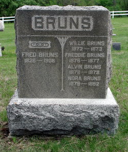
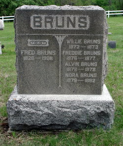
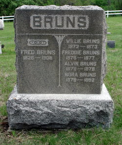
Fritz Bruns
| Birth | : | 15 Aug 1826 Germany |
| Death | : | 16 Nov 1908 Niobrara, Knox County, Nebraska, USA |
| Burial | : | L'Eau Qui Court Cemetery, Niobrara, Knox County, USA |
| Coordinate | : | 42.7458000, -98.0231018 |
| Description | : | Fritz Bruns, Pioneer, Dead Lived in Niobrara Since 1861 - Died in His Eighty-Third Year Niobrara, Neb, Nov. 20 - From a staff correspondent: Fritz Bruns, possibly, in fact very probably, the oldest of early settlers in Knox county, passed quietly away this week. He was in his eighty third year and had come to this section of the country in 1861, locating on what became in later years the townsite of the river town Niobrara. Up to the "year of the big flood" - 1881 - Mr. Bruns with H. Westermann conducted a general merchandise store on the river front and opened... Read More |
frequently asked questions (FAQ):
-
Where is Fritz Bruns's memorial?
Fritz Bruns's memorial is located at: L'Eau Qui Court Cemetery, Niobrara, Knox County, USA.
-
When did Fritz Bruns death?
Fritz Bruns death on 16 Nov 1908 in Niobrara, Knox County, Nebraska, USA
-
Where are the coordinates of the Fritz Bruns's memorial?
Latitude: 42.7458000
Longitude: -98.0231018
Family Members:
Spouse
Children
Flowers:
Nearby Cemetories:
1. L'Eau Qui Court Cemetery
Niobrara, Knox County, USA
Coordinate: 42.7458000, -98.0231018
2. Mormon Monument
Ponca, Knox County, USA
Coordinate: 42.7443000, -98.0632500
3. Ponka Tribal Cemetery
Knox County, USA
Coordinate: 42.7122700, -98.0830000
4. Bazile Creek Cemetery
Bazile Mills, Knox County, USA
Coordinate: 42.7377500, -97.9311500
5. Emanuel Cemetery
Springfield, Bon Homme County, USA
Coordinate: 42.8400002, -97.9903030
6. Kurka Family Cemetery
Dukesville, Knox County, USA
Coordinate: 42.6918000, -98.1374000
7. Ponca Evangelical Lutheran Cemetery
Niobrara, Knox County, USA
Coordinate: 42.7428000, -98.1621000
8. Riverview Cemetery
Knox County, USA
Coordinate: 42.7322006, -98.1619034
9. Pioneer Cemetery
Springfield, Bon Homme County, USA
Coordinate: 42.8513985, -98.0500031
10. Hillcrest Cemetery
Verdigre, Knox County, USA
Coordinate: 42.6356010, -98.0378036
11. Pleasant Hill Cemetery
Verdigre, Knox County, USA
Coordinate: 42.6837500, -98.1619500
12. Bethlehem Lutheran Cemetery
Springfield, Bon Homme County, USA
Coordinate: 42.8727989, -98.0494003
13. Saint Wenceslaus Cemetery
Verdigre, Knox County, USA
Coordinate: 42.6039009, -98.0428009
14. Riverside Cemetery
Verdigre, Knox County, USA
Coordinate: 42.6011009, -98.0286026
15. Ponca Valley Cemetery
Verdel, Knox County, USA
Coordinate: 42.8135000, -98.1990000
16. Springfield Cemetery
Springfield, Bon Homme County, USA
Coordinate: 42.8732986, -97.9132996
17. Saint Vincents Cemetery
Springfield, Bon Homme County, USA
Coordinate: 42.8744011, -97.9132996
18. Congregational Cemetery
Santee, Knox County, USA
Coordinate: 42.8330000, -97.8523000
19. Friedensberg Mennonite Cemetery
Avon, Bon Homme County, USA
Coordinate: 42.8958015, -98.0667038
20. Bohemian National Cemetery
Knox County, USA
Coordinate: 42.6178017, -98.1483002
21. Santee Mission Cemetery
Knox County, USA
Coordinate: 42.8408000, -97.8378200
22. Howe Creek Cemetery
Lindy, Knox County, USA
Coordinate: 42.6810000, -97.8127000
23. National Cemetery
Pishelville, Knox County, USA
Coordinate: 42.7190000, -98.2500000
24. Santee Catholic Cemetery
Santee, Knox County, USA
Coordinate: 42.8373000, -97.8287400

