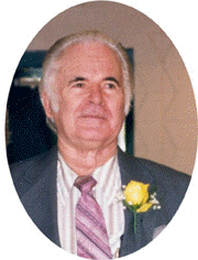
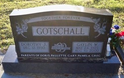
Gaylin W. Gotschall
| Birth | : | 24 May 1925 Springfield, Bon Homme County, South Dakota, USA |
| Death | : | 10 Aug 2000 Columbus, Platte County, Nebraska, USA |
| Burial | : | Saint Anns Cemetery, Vail, Crawford County, USA |
| Coordinate | : | 42.0513992, -95.1868973 |
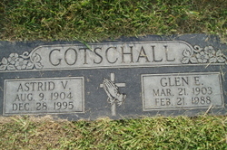
| Description | : | Son of Glen & Astrid (Nelson) Gotschall. lived in Knox County until 1938 and then moved to Monroe, NE area. He graduated from high school in Monroe. He entered the Navy on October 13, 1943 (enlisting in Farragut, ID). He went to Oceanside, CA as part of the Boat Base Amphibious Forces. He studied voice code and short wave radio. He shipped out of San Francisco on a Danish freighter. He spent time on New Guinea, Woendi, Palau Island and other islands. From this area he went to Leyte where he drove a jeep for Lt. Hall, liaison officer for Base... Read More |
frequently asked questions (FAQ):
-
Where is Gaylin W. Gotschall's memorial?
Gaylin W. Gotschall's memorial is located at: Saint Anns Cemetery, Vail, Crawford County, USA.
-
When did Gaylin W. Gotschall death?
Gaylin W. Gotschall death on 10 Aug 2000 in Columbus, Platte County, Nebraska, USA
-
Where are the coordinates of the Gaylin W. Gotschall's memorial?
Latitude: 42.0513992
Longitude: -95.1868973
Family Members:
Parent
Siblings
Flowers:
Nearby Cemetories:
1. Saint Anns Cemetery
Vail, Crawford County, USA
Coordinate: 42.0513992, -95.1868973
2. Vail Cemetery
Vail, Crawford County, USA
Coordinate: 42.0647011, -95.2102966
3. King Cemetery
Vail, Crawford County, USA
Coordinate: 42.1007996, -95.2319031
4. Hayes Township Cemetery
Westside, Crawford County, USA
Coordinate: 42.0083199, -95.1216583
5. Westside Cemetery
Westside, Crawford County, USA
Coordinate: 42.0602989, -95.0922012
6. Old Catholic Cemetery
Denison, Crawford County, USA
Coordinate: 42.0043983, -95.3189011
7. Deloit Cemetery
Deloit, Crawford County, USA
Coordinate: 42.1075325, -95.3136520
8. Saint Rose of Lima Cemetery
Denison, Crawford County, USA
Coordinate: 42.0247002, -95.3394012
9. Saint Johns Catholic Cemetery
Arcadia, Carroll County, USA
Coordinate: 42.0855406, -95.0341577
10. Crawford Heights Memory Gardens
Denison, Crawford County, USA
Coordinate: 42.0008011, -95.3469009
11. Zion Lutheran Cemetery
Denison, Crawford County, USA
Coordinate: 41.9958000, -95.3450012
12. Oakland Cemetery
Denison, Crawford County, USA
Coordinate: 41.9972000, -95.3478012
13. Arcadia Cemetery
Arcadia Township, Carroll County, USA
Coordinate: 42.1000680, -95.0130550
14. Saint John Lutheran Church Cemetery
Crawford County, USA
Coordinate: 42.1780000, -95.2650000
15. Iowa Township Cemetery
Aspinwall, Crawford County, USA
Coordinate: 41.9216995, -95.1113968
16. Nishnabotna Cemetery
Manilla, Crawford County, USA
Coordinate: 41.9086952, -95.2464447
17. Kiron Cemetery
Kiron, Crawford County, USA
Coordinate: 42.1817017, -95.3133011
18. Mount Olivet Cemetery
Manilla, Crawford County, USA
Coordinate: 41.8922005, -95.2200012
19. Wheatland Cemetery
Carroll County, USA
Coordinate: 42.1814003, -95.0582962
20. Washington Township Cemetery
Buck Grove, Crawford County, USA
Coordinate: 41.9354000, -95.3387000
21. Saint Augustine Cemetery
Halbur, Carroll County, USA
Coordinate: 42.0066986, -94.9744034
22. Lehfeldt Cemetery
Kiron, Crawford County, USA
Coordinate: 42.1458170, -95.3724972
23. Sacred Heart Cemetery
Manning, Carroll County, USA
Coordinate: 41.9132500, -95.0540000
24. Manning Cemetery
Manning, Carroll County, USA
Coordinate: 41.8990000, -95.0620000


