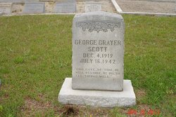
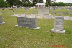
George Grayer Scott
| Birth | : | 4 Dec 1919 |
| Death | : | 16 Jul 1942 Cope, Orangeburg County, South Carolina, USA |
| Burial | : | Saint Marys Roman Catholic Cemetery, Woodstock, Oxford County Municipality, Canada |
| Coordinate | : | 43.1089400, -80.7998900 |
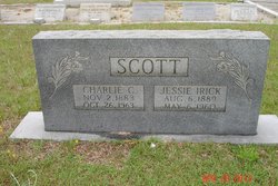
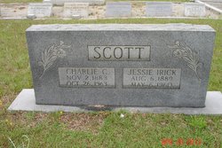
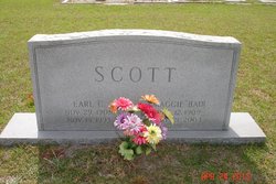
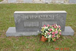
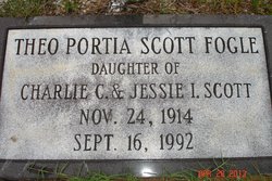
| Description | : | Orangeburg, July 18 - Funeral services for George Grayer Scott, twenty-two years old, who died at his home near Cope Thursday night, were held Friday afternoon at St. George Baptist church with the Rev. Paul A. Bolen in charge. He was a farmer. Surviving are the widow, Mrs. Eloise Thompson Scott, and one son, Grayer Scott, Jr., of Cope; his parents, Mr. and Mrs. Charlie Scott, of Cope; two brothers, Earl Scott, of Cope, and Thomas Scott, Orangeburg; and two sisters, Mrs. Dan Whisenhunt, of Cope, and Mrs. Theo Fogle, of Orangeburg. © The News and Courier, Charleston, SC, 19... Read More |
frequently asked questions (FAQ):
-
Where is George Grayer Scott's memorial?
George Grayer Scott's memorial is located at: Saint Marys Roman Catholic Cemetery, Woodstock, Oxford County Municipality, Canada.
-
When did George Grayer Scott death?
George Grayer Scott death on 16 Jul 1942 in Cope, Orangeburg County, South Carolina, USA
-
Where are the coordinates of the George Grayer Scott's memorial?
Latitude: 43.1089400
Longitude: -80.7998900
Family Members:
Parent
Spouse
Siblings
Children
Flowers:
Nearby Cemetories:
1. Saint Marys Roman Catholic Cemetery
Woodstock, Oxford County Municipality, Canada
Coordinate: 43.1089400, -80.7998900
2. Oxford Memorial Park Cemetery
Woodstock, Oxford County Municipality, Canada
Coordinate: 43.1148200, -80.8150400
3. Hillview Cemetery
Woodstock, Oxford County Municipality, Canada
Coordinate: 43.1206703, -80.7675400
4. Beachville Cemetery
Beachville, Oxford County Municipality, Canada
Coordinate: 43.0889511, -80.8313599
5. House of Refuge Cemetery
Woodstock, Oxford County Municipality, Canada
Coordinate: 43.1476245, -80.7873872
6. Woodstock Presbyterian Cemetery
Woodstock, Oxford County Municipality, Canada
Coordinate: 43.1409440, -80.7651600
7. Woodstock Baptist Cemetery
Woodstock, Oxford County Municipality, Canada
Coordinate: 43.1416460, -80.7655790
8. Anglican Cemetery
Woodstock, Oxford County Municipality, Canada
Coordinate: 43.1426000, -80.7653300
9. Old St. Paul's Anglican Cemetery
Woodstock, Oxford County Municipality, Canada
Coordinate: 43.1325600, -80.7462300
10. Sweaburg Union Cemetery
Sweaburg, Oxford County Municipality, Canada
Coordinate: 43.0690800, -80.7623200
11. Old Log Church Cemetery
Embro, Oxford County Municipality, Canada
Coordinate: 43.1529121, -80.8626785
12. West Oxford United Church Cemetery
Centreville, Oxford County Municipality, Canada
Coordinate: 43.0521710, -80.8451320
13. Pleasant View Cemetery
Curries, Oxford County Municipality, Canada
Coordinate: 43.0716390, -80.7196470
14. Ingersoll Rural Cemetery
Ingersoll, Oxford County Municipality, Canada
Coordinate: 43.0545040, -80.8732690
15. Methodist Cemetery
Embro, Oxford County Municipality, Canada
Coordinate: 43.1495018, -80.8983841
16. Oxford Centre Christ Church Anglican Cemetery
Oxford Centre, Oxford County Municipality, Canada
Coordinate: 43.0996310, -80.6814490
17. East Oxford Pioneer Cemetery
Oxford Centre, Oxford County Municipality, Canada
Coordinate: 43.0999370, -80.6804350
18. Sacred Heart Cemetery
Ingersoll, Oxford County Municipality, Canada
Coordinate: 43.0514300, -80.8917200
19. Huntingford Christ Church Anglican Cemetery
Huntingford, Oxford County Municipality, Canada
Coordinate: 43.2000280, -80.7960970
20. Vandecar Cemetery
Vandecar, Oxford County Municipality, Canada
Coordinate: 43.2010640, -80.8148020
21. North Embro Cemetery
Embro, Oxford County Municipality, Canada
Coordinate: 43.1667920, -80.9040350
22. Red Star Cemetery
Embro, Oxford County Municipality, Canada
Coordinate: 43.1124175, -80.9326897
23. Harris Street Cemetery
Ingersoll, Oxford County Municipality, Canada
Coordinate: 43.0175743, -80.8451233
24. Saint Johns Anglican Cemetery
Eastwood, Oxford County Municipality, Canada
Coordinate: 43.1443080, -80.6575850

