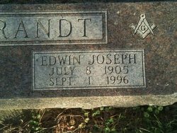
| Birth | : | 24 Jul 1909 Cherokee, Cherokee County, Iowa, USA |
| Death | : | 6 Nov 2007 Remsen, Plymouth County, Iowa, USA |
| Burial | : | Stanthorpe Cemetery, Stanthorpe, Southern Downs Region, Australia |
| Coordinate | : | -28.6452210, 151.9332990 |
| Description | : | George Lowell "Bill" Willbrandt, 98, of Cherokee, Iowa, died Tuesday, Nov. 6, 2007, in Remsen, Iowa, following a brief illness. Memorial services was 11 a.m. Friday at Greenwood Funeral Home in Cherokee, with the Rev. Ethan Sayler officiating. Burial was in Oak Hill Cemetery. Bill was a lifelong resident of Cherokee, born July 24, 1909, to George and Ethel (Burch) Willbrandt. He attended school in Cherokee and graduated from Wilson High School in 1927. He was married to Dorothy Love and had two daughters, Dolowa and Joan Willbrandt. In 1939, he married Lois Fellom and had one son, Terry Lowell Willbrandt. He... Read More |
frequently asked questions (FAQ):
-
Where is George Lowell “Bill” Willbrandt's memorial?
George Lowell “Bill” Willbrandt's memorial is located at: Stanthorpe Cemetery, Stanthorpe, Southern Downs Region, Australia.
-
When did George Lowell “Bill” Willbrandt death?
George Lowell “Bill” Willbrandt death on 6 Nov 2007 in Remsen, Plymouth County, Iowa, USA
-
Where are the coordinates of the George Lowell “Bill” Willbrandt's memorial?
Latitude: -28.6452210
Longitude: 151.9332990
Family Members:
Parent
Spouse
Siblings
Children
Flowers:
Nearby Cemetories:
1. Stanthorpe Cemetery
Stanthorpe, Southern Downs Region, Australia
Coordinate: -28.6452210, 151.9332990
2. John Doro
Stanthorpe, Southern Downs Region, Australia
Coordinate: -28.6508250, 151.9208340
3. Strath Elbess Cemetery
Dalveen, Southern Downs Region, Australia
Coordinate: -28.4883070, 151.9692850
4. Dalveen-Mitchell Family Homestead Cemetery
Dalveen, Southern Downs Region, Australia
Coordinate: -28.4423200, 151.9604000
5. Ballandean Station Cemetery
Ballandean, Southern Downs Region, Australia
Coordinate: -28.8196000, 151.7880000
6. Wallangarra Cemetery
Wallangarra, Southern Downs Region, Australia
Coordinate: -28.9189280, 151.9230310
7. Lone Grave Warwick
Warwick, Southern Downs Region, Australia
Coordinate: -28.2316590, 151.9833180
8. Killarney Lawn Cemetery
Killarney, Southern Downs Region, Australia
Coordinate: -28.3475760, 152.2742790
9. Eden Gardens Memorial Park
Warwick, Southern Downs Region, Australia
Coordinate: -28.2229690, 152.0031130
10. St Marks Anglican Church Columbarium Wall
Warwick, Southern Downs Region, Australia
Coordinate: -28.2161000, 152.0347600
11. Warwick General Lawn Cemetery
Warwick, Southern Downs Region, Australia
Coordinate: -28.2106310, 152.0039087
12. Warwick General Cemetery
Warwick, Southern Downs Region, Australia
Coordinate: -28.2100890, 152.0044080
13. Warwick War Cemetery
Warwick, Southern Downs Region, Australia
Coordinate: -28.2089620, 152.0033530
14. Lone Graves
Coolmunda, Goondiwindi Region, Australia
Coordinate: -28.6256043, 151.4111058
15. Swan Creek Anglican Cemetery
Swan Creek, Southern Downs Region, Australia
Coordinate: -28.1974400, 152.1364830
16. Yangan General and Anglican Cemetery
Emu Vale, Southern Downs Region, Australia
Coordinate: -28.2059990, 152.2207110
17. Yangan Presbyterian Church Cemetery
Yangan, Southern Downs Region, Australia
Coordinate: -28.1972310, 152.2142130
18. Warwick-Conway Family Homestead Cemetery
Warwick, Southern Downs Region, Australia
Coordinate: -28.1258400, 152.0395700
19. Arlington Cemetery
Graysholm, Goondiwindi Region, Australia
Coordinate: -28.3259160, 151.4372210
20. Glengallan Station
Warwick, Southern Downs Region, Australia
Coordinate: -28.1027016, 152.0585067
21. Pratten Cemetery
Pratten, Southern Downs Region, Australia
Coordinate: -28.0858450, 151.7790540
22. Old Bonalbo Cemetery
Old Bonalbo, Kyogle Council, Australia
Coordinate: -28.6499996, 152.6000061
23. Bonalbo Cemetery
Bonalbo, Kyogle Council, Australia
Coordinate: -28.7180970, 152.6050560
24. Tabulam Cemetery
Tabulam, Kyogle Council, Australia
Coordinate: -28.9078060, 152.5581050


