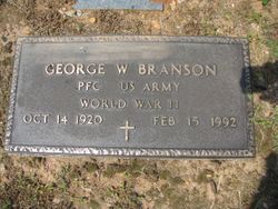
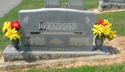
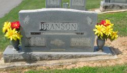
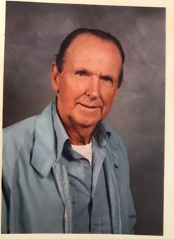
George Washington Branson
| Birth | : | 14 Oct 1920 Carroll County, Virginia, USA |
| Death | : | 15 Feb 1992 Forsyth County, North Carolina, USA |
| Burial | : | Rocky Ford Christian Church Cemetery, Cana, Carroll County, USA |
| Coordinate | : | 36.6080580, -80.6857110 |
frequently asked questions (FAQ):
-
Where is George Washington Branson's memorial?
George Washington Branson's memorial is located at: Rocky Ford Christian Church Cemetery, Cana, Carroll County, USA.
-
When did George Washington Branson death?
George Washington Branson death on 15 Feb 1992 in Forsyth County, North Carolina, USA
-
Where are the coordinates of the George Washington Branson's memorial?
Latitude: 36.6080580
Longitude: -80.6857110
Family Members:
Parent
Spouse
Siblings
Children
Flowers:
Nearby Cemetories:
1. Rocky Ford Christian Church Cemetery
Cana, Carroll County, USA
Coordinate: 36.6080580, -80.6857110
2. Edwards Cemetery
Cana, Carroll County, USA
Coordinate: 36.6154480, -80.6904890
3. Pauls Creek Baptist Church Cemetery
Cana, Carroll County, USA
Coordinate: 36.6072870, -80.6976360
4. Leftwich Family Cemetery
Cana, Carroll County, USA
Coordinate: 36.6211110, -80.6758350
5. Rigney Family Cemetery
Cana, Carroll County, USA
Coordinate: 36.6233650, -80.6806990
6. Wisler Cemetery
Cana, Carroll County, USA
Coordinate: 36.5933240, -80.6756550
7. King Family Cemetery
Cana, Carroll County, USA
Coordinate: 36.6211420, -80.7020900
8. Primitive Baptist Church Of Jesus Christ Cemetery
Cana, Carroll County, USA
Coordinate: 36.5917320, -80.6737210
9. King Cemetery
Cana, Carroll County, USA
Coordinate: 36.6170430, -80.7070900
10. Cana Baptist Church Cemetery
Cana, Carroll County, USA
Coordinate: 36.5920764, -80.6717347
11. Gray Cemetery
Cana, Carroll County, USA
Coordinate: 36.5943420, -80.7034040
12. King-Jones Cemetery
Cana, Carroll County, USA
Coordinate: 36.6224890, -80.7033540
13. Jones-Fleming Cemetery
Carroll County, USA
Coordinate: 36.6012360, -80.7114230
14. Sandy Ridge Primitive Baptist Church Cemetery
Cana, Carroll County, USA
Coordinate: 36.6089030, -80.7131890
15. Bear Trail Baptist Church Cemetery
Cana, Carroll County, USA
Coordinate: 36.6263910, -80.6655010
16. Nathaniel Samuel Jones Family Cemetery
Cana, Carroll County, USA
Coordinate: 36.6047060, -80.7186010
17. Frances Caroline Edwards Family Cemetery
Cana, Carroll County, USA
Coordinate: 36.6089000, -80.7193140
18. Fancy Gap Pentecostal Holiness Church Cemetery
Cana, Carroll County, USA
Coordinate: 36.6227090, -80.7150880
19. Claucy William Hawks Family Cemetery
Cana, Carroll County, USA
Coordinate: 36.6236190, -80.7151980
20. Christopher W Jones Cemetery
Cana, Carroll County, USA
Coordinate: 36.5819178, -80.7000292
21. Thomas Cemetery
Fancy Gap, Carroll County, USA
Coordinate: 36.6312940, -80.6592180
22. Marion Cemetery
Cana, Carroll County, USA
Coordinate: 36.6055090, -80.7284550
23. Oak Ridge Baptist Church Cemetery
Cana, Carroll County, USA
Coordinate: 36.5718760, -80.6800790
24. Vernon-Leonard Cemetery
Cana, Carroll County, USA
Coordinate: 36.5841200, -80.7217600

