
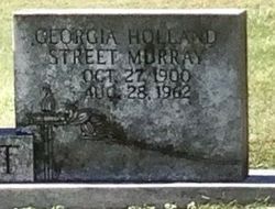

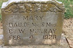
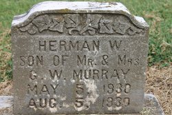
Georgia Holland Murray
| Birth | : | 27 Oct 1900 |
| Death | : | 28 Aug 1962 |
| Burial | : | St. Mary's Churchyard, Cholsey, South Oxfordshire District, England |
| Coordinate | : | 51.5788078, -1.1589500 |
| Description | : | Provided by member #47639367 Obituaries Forest City Courier - thursday, August 30 1962 Mrs. Murray Mrs. Georgianna Holland Murray, 61, of Forest City, died Tuesday morning at a local rest home following a lengthy illness. She was the daughter of the late W. D. and Mandy Street Holland of Rutherford county. Surviving are three sons, Clifford and Samuel and Lloyd Murray, all of Shelby; two daughters, Mrs. J. M. Long of Morristown, Tenn., and Mrs. Irene Segers of Richmond, Calif.; 17 grandchildren; three great-grandchildren; snd seven Step-Children; one sister, Mrs Maggie Huneycutt of Forest City.She was the widow of the late George W.... Read More |
frequently asked questions (FAQ):
-
Where is Georgia Holland Murray's memorial?
Georgia Holland Murray's memorial is located at: St. Mary's Churchyard, Cholsey, South Oxfordshire District, England.
-
When did Georgia Holland Murray death?
Georgia Holland Murray death on 28 Aug 1962 in
-
Where are the coordinates of the Georgia Holland Murray's memorial?
Latitude: 51.5788078
Longitude: -1.1589500
Family Members:
Parent
Spouse
Siblings
Children

Flowers:


Nearby Cemetories:
1. St. Mary's Churchyard
Cholsey, South Oxfordshire District, England
Coordinate: 51.5788078, -1.1589500
2. St. John the Baptist South Moreton
South Moreton, South Oxfordshire District, England
Coordinate: 51.5881630, -1.1895850
3. St. John the Baptist Church (Defunct)
Mongwell, South Oxfordshire District, England
Coordinate: 51.5860980, -1.1233580
4. St. Mary's Churchyard
North Stoke, South Oxfordshire District, England
Coordinate: 51.5714910, -1.1228080
5. South Moreton Strict Baptist Chapel
South Moreton, South Oxfordshire District, England
Coordinate: 51.5900300, -1.1924310
6. St Michael's Cemetery
Aston Tirrold, South Oxfordshire District, England
Coordinate: 51.5730994, -1.1967145
7. St John the Baptist
Moulsford, South Oxfordshire District, England
Coordinate: 51.5531050, -1.1482640
8. All Saints Churchyard
Aston Upthorpe, South Oxfordshire District, England
Coordinate: 51.5715900, -1.2037500
9. St. Leonard's Churchyard
Wallingford, South Oxfordshire District, England
Coordinate: 51.5972711, -1.1230712
10. St. Mary-le-More Churchyard
Wallingford, South Oxfordshire District, England
Coordinate: 51.5993878, -1.1249488
11. All Saints Churchyard
North Moreton, South Oxfordshire District, England
Coordinate: 51.6021922, -1.1898247
12. All Hallows Graveyard
Wallingford, South Oxfordshire District, England
Coordinate: 51.6020520, -1.1242267
13. Saint Peter's Churchyard
Wallingford, South Oxfordshire District, England
Coordinate: 51.6005819, -1.1215970
14. Saint James Churchyard
Brightwell cum Sotwell, South Oxfordshire District, England
Coordinate: 51.6120200, -1.1549800
15. St Andrew Churchyard
South Stoke, South Oxfordshire District, England
Coordinate: 51.5479065, -1.1377167
16. St Mary Magdalene Churchyard
Crowmarsh Gifford, South Oxfordshire District, England
Coordinate: 51.5992169, -1.1139564
17. St. Agatha New Churchyard
Brightwell cum Sotwell, South Oxfordshire District, England
Coordinate: 51.6131480, -1.1665480
18. Wallingford Cemetery
Wallingford, South Oxfordshire District, England
Coordinate: 51.6058200, -1.1232000
19. St. Mary the Virgin Cemetery
Ipsden, South Oxfordshire District, England
Coordinate: 51.5674164, -1.0866686
20. St. Michael Churchyard
Blewbury, Vale of White Horse District, England
Coordinate: 51.5693100, -1.2346100
21. St. Helen's Churchyard
Benson, South Oxfordshire District, England
Coordinate: 51.6200200, -1.1127400
22. St. Helen Churchyard Extension
Benson, South Oxfordshire District, England
Coordinate: 51.6201400, -1.1121200
23. Benson War Memorial
Benson, South Oxfordshire District, England
Coordinate: 51.6207890, -1.1108700
24. St Andrew's Church
East Hagbourne, South Oxfordshire District, England
Coordinate: 51.5901700, -1.2427700