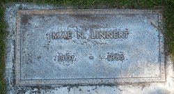
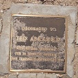
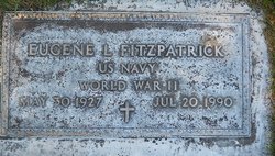
Geraldine “Jerry” Fitzpatrick Abramson
| Birth | : | 5 Aug 1929 Los Angeles, Los Angeles County, California, USA |
| Death | : | 17 Nov 2010 Templeton, San Luis Obispo County, California, USA |
| Burial | : | Templeton Cemetery, Templeton, San Luis Obispo County, USA |
| Coordinate | : | 35.5714455, -120.7022095 |
| Description | : | Geraldine "Jerry" Fitzpatrick Abramson passed away in Templeton on Wednesday, November 17 after a lengthy illness. Geraldine was born in Los Angeles, CA, on August 5, 1929, and moved to Templeton in her early teens. She graduated from Templeton High School where she was active in sports. She married Theodore "Ted" Abramson and raised their two children on the family farm in Templeton. Together they were charter members of the Do Pasos Square Dance Club, were active 4-H club leaders, and traveled many miles with the Happy Trails RV Club. Many people around the county enjoyed one of Jerry's beautifully decorated cakes... Read More |
frequently asked questions (FAQ):
-
Where is Geraldine “Jerry” Fitzpatrick Abramson's memorial?
Geraldine “Jerry” Fitzpatrick Abramson's memorial is located at: Templeton Cemetery, Templeton, San Luis Obispo County, USA.
-
When did Geraldine “Jerry” Fitzpatrick Abramson death?
Geraldine “Jerry” Fitzpatrick Abramson death on 17 Nov 2010 in Templeton, San Luis Obispo County, California, USA
-
Where are the coordinates of the Geraldine “Jerry” Fitzpatrick Abramson's memorial?
Latitude: 35.5714455
Longitude: -120.7022095
Family Members:
Parent
Spouse
Siblings
Nearby Cemetories:
1. Templeton Cemetery
Templeton, San Luis Obispo County, USA
Coordinate: 35.5714455, -120.7022095
2. Saint James Episcopal Church Inurnment Garden
Paso Robles, San Luis Obispo County, USA
Coordinate: 35.6283460, -120.6929780
3. Chapel of the Roses Cemetery
Atascadero, San Luis Obispo County, USA
Coordinate: 35.5027340, -120.6881430
4. Paso Robles District Cemetery
Paso Robles, San Luis Obispo County, USA
Coordinate: 35.6424700, -120.7035000
5. Atascadero Pine Mountain Cemetery
Atascadero, San Luis Obispo County, USA
Coordinate: 35.4960835, -120.6565582
6. Willow Creek Mennonite Cemetery
Wilson Corner, San Luis Obispo County, USA
Coordinate: 35.5890410, -120.8215860
7. Dove Cemetery
San Luis Obispo County, USA
Coordinate: 35.4482231, -120.6344299
8. Estrella Adobe Cemetery
Paso Robles, San Luis Obispo County, USA
Coordinate: 35.6975080, -120.6399460
9. San Marcos Mennonite Cemetery
San Luis Obispo County, USA
Coordinate: 35.6874570, -120.7995160
10. Adelaida Cemetery
Adelaida, San Luis Obispo County, USA
Coordinate: 35.5632085, -120.8956170
11. Creston Cemetery
Creston, San Luis Obispo County, USA
Coordinate: 35.5328640, -120.5121450
12. Pleasant Valley Cemetery
San Miguel, San Luis Obispo County, USA
Coordinate: 35.7181892, -120.6228485
13. Adelaida Cemetery
San Luis Obispo County, USA
Coordinate: 35.6563988, -120.8728027
14. San Miguel District Cemetery
San Miguel, San Luis Obispo County, USA
Coordinate: 35.7392006, -120.7013550
15. Mission San Miguel Cemetery
San Miguel, San Luis Obispo County, USA
Coordinate: 35.7452610, -120.6977370
16. Cayucos-Morro Bay District Cemetery
Cayucos, San Luis Obispo County, USA
Coordinate: 35.4371986, -120.8850021
17. Santa Margarita Cemetery
Santa Margarita, San Luis Obispo County, USA
Coordinate: 35.3913994, -120.5880966
18. Canet Cemetery
San Luis Obispo County, USA
Coordinate: 35.3522840, -120.7901660
19. St. Peter’s By-the-Sea Episcopal Church Memo
Morro Bay, San Luis Obispo County, USA
Coordinate: 35.3628700, -120.8467400
20. Los Osos Valley Memorial Park
Los Osos, San Luis Obispo County, USA
Coordinate: 35.3053017, -120.8011017
21. Porte Family Cemetery
San Simeon, San Luis Obispo County, USA
Coordinate: 35.6376400, -121.0379800
22. Mission San Luis Obispo Cemetery
San Luis Obispo, San Luis Obispo County, USA
Coordinate: 35.2806600, -120.6645200
23. Shandon Cemetery
San Luis Obispo County, USA
Coordinate: 35.6693993, -120.3525009
24. Saint Pauls Episcopal Church Memorial Garden
Cambria, San Luis Obispo County, USA
Coordinate: 35.5575200, -121.0757200


