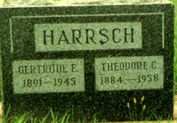
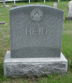
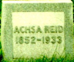
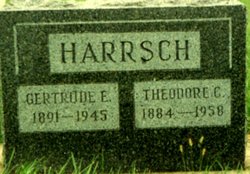
Gertrude Eva Reid Harrsch
| Birth | : | 31 May 1891 Niobrara, Knox County, Nebraska, USA |
| Death | : | 29 Mar 1945 Norfolk, Madison County, Nebraska, USA |
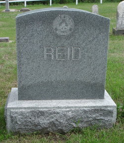
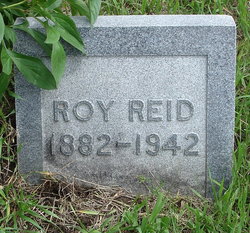
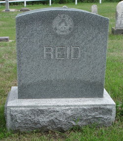
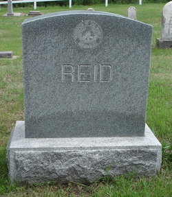
| Burial | : | L'Eau Qui Court Cemetery, Niobrara, Knox County, USA |
| Coordinate | : | 42.7458000, -98.0231018 |
| Plot | : | Blk 1E Lot 120 |
| Description | : | From the Niobrara Tribune Thursday, March 8, 1945 local news: Mrs. Theo Harrsch is in Our Lady of Lourdes Hospital in Norfolk as a result of hip injuries received Sunday morning in a fall in the yard of her home here. OBITUARY: Norfolk, Nebraska Daily News April 3, 1945 page 2: "Funeral services for Mrs. Gertrude Harrsch, 53, Niobrara, who died Thursday in a Norfolk hospital, were conducted Saturday at the Presbyterian church in Niobrara by the Rev. Norman Riedesel. Ivan Hansing, with Mrs. Elmer Lutt at the piano, sang three old hymns. John Blankenfeld, W.R. Pease, Howard Connick, Everett... Read More |
frequently asked questions (FAQ):
-
Where is Gertrude Eva Reid Harrsch's memorial?
Gertrude Eva Reid Harrsch's memorial is located at: L'Eau Qui Court Cemetery, Niobrara, Knox County, USA.
-
When did Gertrude Eva Reid Harrsch death?
Gertrude Eva Reid Harrsch death on 29 Mar 1945 in Norfolk, Madison County, Nebraska, USA
-
Where are the coordinates of the Gertrude Eva Reid Harrsch's memorial?
Latitude: 42.7458000
Longitude: -98.0231018
Family Members:
Parent
Spouse
Siblings
Flowers:
Nearby Cemetories:
1. L'Eau Qui Court Cemetery
Niobrara, Knox County, USA
Coordinate: 42.7458000, -98.0231018
2. Mormon Monument
Ponca, Knox County, USA
Coordinate: 42.7443000, -98.0632500
3. Ponka Tribal Cemetery
Knox County, USA
Coordinate: 42.7122700, -98.0830000
4. Bazile Creek Cemetery
Bazile Mills, Knox County, USA
Coordinate: 42.7377500, -97.9311500
5. Emanuel Cemetery
Springfield, Bon Homme County, USA
Coordinate: 42.8400002, -97.9903030
6. Kurka Family Cemetery
Dukesville, Knox County, USA
Coordinate: 42.6918000, -98.1374000
7. Ponca Evangelical Lutheran Cemetery
Niobrara, Knox County, USA
Coordinate: 42.7428000, -98.1621000
8. Riverview Cemetery
Knox County, USA
Coordinate: 42.7322006, -98.1619034
9. Pioneer Cemetery
Springfield, Bon Homme County, USA
Coordinate: 42.8513985, -98.0500031
10. Hillcrest Cemetery
Verdigre, Knox County, USA
Coordinate: 42.6356010, -98.0378036
11. Pleasant Hill Cemetery
Verdigre, Knox County, USA
Coordinate: 42.6837500, -98.1619500
12. Bethlehem Lutheran Cemetery
Springfield, Bon Homme County, USA
Coordinate: 42.8727989, -98.0494003
13. Saint Wenceslaus Cemetery
Verdigre, Knox County, USA
Coordinate: 42.6039009, -98.0428009
14. Riverside Cemetery
Verdigre, Knox County, USA
Coordinate: 42.6011009, -98.0286026
15. Ponca Valley Cemetery
Verdel, Knox County, USA
Coordinate: 42.8135000, -98.1990000
16. Springfield Cemetery
Springfield, Bon Homme County, USA
Coordinate: 42.8732986, -97.9132996
17. Saint Vincents Cemetery
Springfield, Bon Homme County, USA
Coordinate: 42.8744011, -97.9132996
18. Congregational Cemetery
Santee, Knox County, USA
Coordinate: 42.8330000, -97.8523000
19. Friedensberg Mennonite Cemetery
Avon, Bon Homme County, USA
Coordinate: 42.8958015, -98.0667038
20. Bohemian National Cemetery
Knox County, USA
Coordinate: 42.6178017, -98.1483002
21. Santee Mission Cemetery
Knox County, USA
Coordinate: 42.8408000, -97.8378200
22. Howe Creek Cemetery
Lindy, Knox County, USA
Coordinate: 42.6810000, -97.8127000
23. National Cemetery
Pishelville, Knox County, USA
Coordinate: 42.7190000, -98.2500000
24. Santee Catholic Cemetery
Santee, Knox County, USA
Coordinate: 42.8373000, -97.8287400

