| Birth | : | 15 Mar 1898 Nevada, Vernon County, Missouri, USA |
| Death | : | 19 Aug 1965 Phoenix, Maricopa County, Arizona, USA |
| Burial | : | Zions Hill Cemetery, North Chesterville, Franklin County, USA |
| Coordinate | : | 44.5918999, -70.1085968 |
| Plot | : | O'Leary Sec, Lot 486-E |
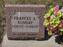
| Description | : | Services for Mrs. Gertrude Marie Degan, 2000 Collins, will be at 10 a.m. today at Most Pure Heart of Mary Catholic Church. Burial will be in Mount Calvary Cemetery. She died Thursday in Phoenix, Ariz. She was born March 15, 1898 in Nevada, Mo., and came to Topeka as a young woman. She was a member of Most Pure Heart of Mary Catholic Church. Her husband, Edgar W. Degan, died May 21, 1954. Survivors include one son, Edgar Jr., 1840 Arnold; three daughters, Mrs. Frances Sunday, Lamar, Colo., Mrs. Susanne O'Brien, Phoenix, Ariz.,... Read More |
frequently asked questions (FAQ):
-
Where is Gertrude Marie Meyer Degan's memorial?
Gertrude Marie Meyer Degan's memorial is located at: Zions Hill Cemetery, North Chesterville, Franklin County, USA.
-
When did Gertrude Marie Meyer Degan death?
Gertrude Marie Meyer Degan death on 19 Aug 1965 in Phoenix, Maricopa County, Arizona, USA
-
Where are the coordinates of the Gertrude Marie Meyer Degan's memorial?
Latitude: 44.5918999
Longitude: -70.1085968
Family Members:
Parent
Spouse
Children
Flowers:
Nearby Cemetories:
1. Zions Hill Cemetery
North Chesterville, Franklin County, USA
Coordinate: 44.5918999, -70.1085968
2. Webster Cemetery
Franklin County, USA
Coordinate: 44.5924988, -70.1241989
3. Lowell Cemetery
Chesterville, Franklin County, USA
Coordinate: 44.5742000, -70.0894000
4. Chesterville Hill Cemetery
Chesterville, Franklin County, USA
Coordinate: 44.6060982, -70.0721970
5. Borough Cemetery
Franklin County, USA
Coordinate: 44.5628014, -70.1391983
6. Lowell Cemetery
Franklin County, USA
Coordinate: 44.6292000, -70.1102982
7. Blake Cemetery
Farmington Falls, Franklin County, USA
Coordinate: 44.6258011, -70.0817032
8. Chesterville Center Cemetery
Chesterville, Franklin County, USA
Coordinate: 44.5533000, -70.0894000
9. Center Cemetery
Franklin County, USA
Coordinate: 44.5532990, -70.0894012
10. Gower Cemetery
Franklin County, USA
Coordinate: 44.6380997, -70.1010971
11. Beans Corner Cemetery
Franklin County, USA
Coordinate: 44.5785800, -70.1788200
12. Red Schoolhouse Cemetery
Franklin County, USA
Coordinate: 44.6314011, -70.1600037
13. East Wilton Cemetery
Wilton, Franklin County, USA
Coordinate: 44.6124700, -70.1878800
14. Case Cemetery
Farmington, Franklin County, USA
Coordinate: 44.6518900, -70.1247900
15. Franklin Cemetery
Vienna, Kennebec County, USA
Coordinate: 44.5544014, -70.0333023
16. Butterfield Cemetery
Farmington, Franklin County, USA
Coordinate: 44.6520700, -70.1511140
17. Fairview Cemetery
Farmington, Franklin County, USA
Coordinate: 44.6581001, -70.1382980
18. Riverside Cemetery
Farmington, Franklin County, USA
Coordinate: 44.6587900, -70.1432600
19. New Sharon Village Cemetery
New Sharon, Franklin County, USA
Coordinate: 44.6385994, -70.0207977
20. Stubbs Mill Cemetery
Franklin County, USA
Coordinate: 44.5203018, -70.1532974
21. Old Burying Ground
Farmington, Franklin County, USA
Coordinate: 44.6638660, -70.1567270
22. Academy Hill Cemetery
Wilton, Franklin County, USA
Coordinate: 44.5930000, -70.2269700
23. Center Burying Ground
Farmington, Franklin County, USA
Coordinate: 44.6712700, -70.1514400
24. Seavey's Corner Cemetery
Vienna, Kennebec County, USA
Coordinate: 44.5237120, -70.0342910


