
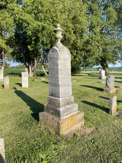
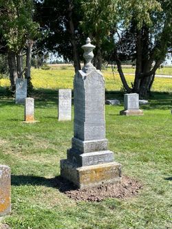
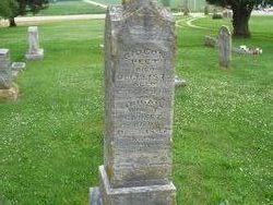
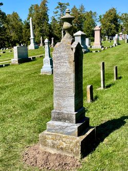
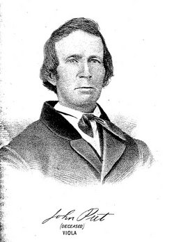
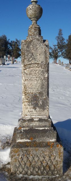
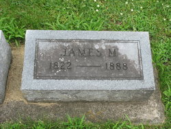
Gideon Nelson Peet
| Birth | : | 31 Jul 1776 Stratford, Fairfield County, Connecticut, USA |
| Death | : | 18 Oct 1843 Fairview, Jones County, Iowa, USA |
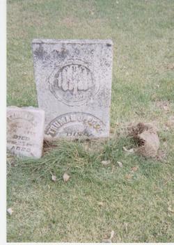
| Burial | : | Sophia Magdalena, Soderakra, Torsås kommun, Sweden |
| Coordinate | : | 56.4457031, 16.0717222 |
| Plot | : | Row 23 |
| Description | : | Removed to Cortland, NY in 1801; Gideon was an expert mechanic but followed farming as a life work. Shortly after marriage Gideon and Abigail packed all their personal possessions on a horse and set off for western New York, the young bride riding while the groom walked beside her. On the last three days of the journey, Gideon carefully blazed the trees to mark the way for others to come into the woods, or so they could find their way out if necessary. They slept and cooked as they journeyed and when they arrived at their destination the groom cut... Read More |
frequently asked questions (FAQ):
-
Where is Gideon Nelson Peet's memorial?
Gideon Nelson Peet's memorial is located at: Sophia Magdalena, Soderakra, Torsås kommun, Sweden.
-
When did Gideon Nelson Peet death?
Gideon Nelson Peet death on 18 Oct 1843 in Fairview, Jones County, Iowa, USA
-
Where are the coordinates of the Gideon Nelson Peet's memorial?
Latitude: 56.4457031
Longitude: 16.0717222
Family Members:
Parent
Spouse
Siblings
Children

Flowers:


Nearby Cemetories:
1. Sophia Magdalena
Soderakra, Torsås kommun, Sweden
Coordinate: 56.4457031, 16.0717222
2. Arby kyrka
Arby, Hjo kommun, Sweden
Coordinate: 56.5666670, 16.1227780
3. Gullabo kyrkogård
Gullabo, Torsås kommun, Sweden
Coordinate: 56.4636883, 15.8071821
4. Karlslunda churchyard
Paryd, Kalmar kommun, Sweden
Coordinate: 56.5685926, 15.9182519
5. Ljungby cemetery
Ljungbyholm, Kalmar kommun, Sweden
Coordinate: 56.6325710, 16.1683770
6. Mörbylånga Kyrkogård
Mörbylånga, Mörbylånga kommun, Sweden
Coordinate: 56.5197335, 16.3979088
7. Kastlösa Kyrkogård
Kastlosa, Mörbylånga kommun, Sweden
Coordinate: 56.4585433, 16.4293813
8. Resmo kyrkogård
Resmo, Mörbylånga kommun, Sweden
Coordinate: 56.5415446, 16.4438174
9. Sankt Sigfrids kyrkogård
Sankt Sigfrid, Nybro kommun, Sweden
Coordinate: 56.6944100, 15.9999200
10. Södra Kyrkogården
Kalmar, Kalmar kommun, Sweden
Coordinate: 56.6579816, 16.3514349
11. Hulterstad Kyrkogård
Hulterstad, Mörbylånga kommun, Sweden
Coordinate: 56.4494100, 16.5675470
12. Jämjö kyrkogård
Jamjo, Karlskrona kommun, Sweden
Coordinate: 56.1921200, 15.8318400
13. Torslunda kyrkogård
Torslunda, Mörbylånga kommun, Sweden
Coordinate: 56.6332780, 16.5152500
14. Lösens kyrka
Lyckeby, Karlskrona kommun, Sweden
Coordinate: 56.1965965, 15.6882357
15. Algutsrums Kyrkogård
Farjestaden, Mörbylånga kommun, Sweden
Coordinate: 56.6785456, 16.5280047
16. Fridlevstads Kyrkogård
Fridlevstad, Karlskrona kommun, Sweden
Coordinate: 56.2696868, 15.5388697
17. Åby kyrka
Kalmar, Kalmar kommun, Sweden
Coordinate: 56.7811110, 16.2872200
18. Tvings Kyrkogård
Tving, Karlskrona kommun, Sweden
Coordinate: 56.3092001, 15.4655756
19. Långasjö kyrkogård
Langasjo, Emmaboda kommun, Sweden
Coordinate: 56.5789481, 15.4445904
20. Wämö
Karlskrona, Karlskrona kommun, Sweden
Coordinate: 56.1804250, 15.6017650
21. Torhamns kyrkogård
Torhamn, Karlskrona kommun, Sweden
Coordinate: 56.0952220, 15.8329000
22. Sturkö Kyrkogård
Sturko, Karlskrona kommun, Sweden
Coordinate: 56.0886899, 15.6963390
23. Hjortsberga kyrkogård
Johannishus, Ronneby kommun, Sweden
Coordinate: 56.2255649, 15.4078853
24. Listerby Cemetery
Listerby, Ronneby kommun, Sweden
Coordinate: 56.1953366, 15.4065383