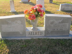
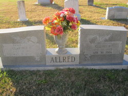
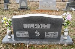
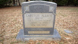
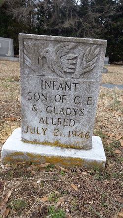
Gladys Irene Reitzel Allred
| Birth | : | 10 Aug 1905 Guilford County, North Carolina, USA |
| Death | : | 30 Apr 2004 Asheboro, Randolph County, North Carolina, USA |
| Burial | : | Stillman Valley Cemetery, Stillman Valley, Ogle County, USA |
| Coordinate | : | 42.1127892, -89.1784134 |
| Description | : | ASHEBORO— Mrs. Gladys Reitzel Allred, 98, died Friday, April 30, 2004, at Randolph Hospital. Funeral service will be held at 2 p.m. Sunday at Sandy Creek Baptist Church with Pastor Travis Brock and the Rev. James Cain officiating. Burial will follow in the church cemetery. Mrs. Allred was born in Guilford County on Aug. 10, 1905, the daughter of the late William D. and Flora Mae Brothers Reitzel. She was a member of Sandy Creek Baptist Church for 50 years. She was preceded in death by her husband, Clarence Edward Allred Sr., and sons, Carlton Allred and John D. Allred.... Read More |
frequently asked questions (FAQ):
-
Where is Gladys Irene Reitzel Allred's memorial?
Gladys Irene Reitzel Allred's memorial is located at: Stillman Valley Cemetery, Stillman Valley, Ogle County, USA.
-
When did Gladys Irene Reitzel Allred death?
Gladys Irene Reitzel Allred death on 30 Apr 2004 in Asheboro, Randolph County, North Carolina, USA
-
Where are the coordinates of the Gladys Irene Reitzel Allred's memorial?
Latitude: 42.1127892
Longitude: -89.1784134
Family Members:
Spouse
Children
Flowers:
Nearby Cemetories:
1. Stillman Valley Cemetery
Stillman Valley, Ogle County, USA
Coordinate: 42.1127892, -89.1784134
2. Stillmans Run Battlefield Memorial
Stillman Valley, Ogle County, USA
Coordinate: 42.1066399, -89.1760025
3. Mouth of Stillman Cemetery
Byron, Ogle County, USA
Coordinate: 42.1265182, -89.2269516
4. Beach Cemetery
Stillman Valley, Ogle County, USA
Coordinate: 42.0786018, -89.1299973
5. Byron Cemetery
Byron, Ogle County, USA
Coordinate: 42.1307716, -89.2521133
6. Big Mound Cemetery
Davis Junction, Ogle County, USA
Coordinate: 42.0793991, -89.1093979
7. Chaney Cemetery
Stillman Valley, Ogle County, USA
Coordinate: 42.0525017, -89.1631012
8. Saint Mary's Cemetery
Byron, Ogle County, USA
Coordinate: 42.1253014, -89.2742004
9. Lucas Cemetery
Lindenwood, Ogle County, USA
Coordinate: 42.0402908, -89.1215210
10. Emmanuel Lutheran Cemetery
Paynes Point, Ogle County, USA
Coordinate: 42.0264091, -89.2071533
11. Mount Pleasant Cemetery
Paynes Point, Ogle County, USA
Coordinate: 42.0258713, -89.2063065
12. Ebenezer Cemetery
Oregon, Ogle County, USA
Coordinate: 42.0572319, -89.2780380
13. Stinsonian Cemetery
Paynes Point, Ogle County, USA
Coordinate: 42.0236015, -89.2174988
14. Linn Farm Cemetery
Byron, Ogle County, USA
Coordinate: 42.1745834, -89.2744522
15. Kilbuck Cemetery
Monroe Center, Ogle County, USA
Coordinate: 42.1227989, -89.0425034
16. White Rock Cemetery
White Rock, Ogle County, USA
Coordinate: 42.0210495, -89.1152267
17. Brooklyn Cemetery
Oregon, Ogle County, USA
Coordinate: 42.0668907, -89.3221283
18. Lindenwood Cemetery
Lindenwood, Ogle County, USA
Coordinate: 42.0503006, -89.0355988
19. Bethel-Hayes Cemetery
Kings, Ogle County, USA
Coordinate: 42.0068703, -89.0851593
20. Monroe Center Cemetery
Monroe Center, Ogle County, USA
Coordinate: 42.1001587, -89.0048218
21. Better Place Forest
Ogle County, USA
Coordinate: 42.0411546, -89.3341425
22. Cooley Cemetery
Chana, Ogle County, USA
Coordinate: 41.9692001, -89.1746979
23. Riverview Cemetery
Oregon, Ogle County, USA
Coordinate: 42.0275002, -89.3399963
24. Riverside Cemetery
Oregon, Ogle County, USA
Coordinate: 42.0177994, -89.3308029

