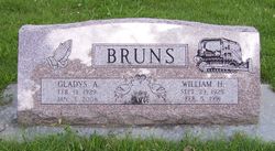
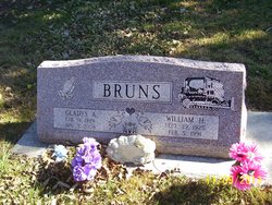
Gladys Trower Bruns
| Birth | : | 13 Feb 1929 Winchester, Jefferson County, Kansas, USA |
| Death | : | 3 Jan 2008 Topeka, Shawnee County, Kansas, USA |
| Burial | : | Dallas Park Cemetery, Ridgway, Ouray County, USA |
| Coordinate | : | 38.1591988, -107.7977982 |
| Plot | : | Section D |
| Description | : | married July 13, 1947, in Atchison, Kansas |
frequently asked questions (FAQ):
-
Where is Gladys Trower Bruns's memorial?
Gladys Trower Bruns's memorial is located at: Dallas Park Cemetery, Ridgway, Ouray County, USA.
-
When did Gladys Trower Bruns death?
Gladys Trower Bruns death on 3 Jan 2008 in Topeka, Shawnee County, Kansas, USA
-
Where are the coordinates of the Gladys Trower Bruns's memorial?
Latitude: 38.1591988
Longitude: -107.7977982
Family Members:
Parent
Spouse
Siblings
Flowers:
Nearby Cemetories:
1. Cedar Hill Cemetery
Ouray, Ouray County, USA
Coordinate: 38.0971985, -107.7093964
2. Dexter Creek Cemetery
Ridgway, Ouray County, USA
Coordinate: 38.0589090, -107.6900370
3. Grandview Cemetery
Ouray County, USA
Coordinate: 38.3293991, -107.7917023
4. Colona Cemetery
Colona, Ouray County, USA
Coordinate: 38.3294100, -107.7922100
5. Saint Johns Episcopal Church Columbarium
Ouray, Ouray County, USA
Coordinate: 38.0215000, -107.6705000
6. Fort Crawford Post Cemetery
Montrose County, USA
Coordinate: 38.3771170, -107.8181330
7. Lone Tree Cemetery
San Miguel County, USA
Coordinate: 37.9361000, -107.7996979
8. Button Cemetery
Montrose County, USA
Coordinate: 38.4014015, -107.8122025
9. Placerville Cemetery
Placerville, San Miguel County, USA
Coordinate: 38.0171432, -108.0519104
10. Valley Lawn Cemetery
Montrose, Montrose County, USA
Coordinate: 38.4249992, -107.8606033
11. Wilson Mesa Cemetery
San Miguel County, USA
Coordinate: 37.9176000, -107.9800000
12. Ouray Memorial Park
Montrose, Montrose County, USA
Coordinate: 38.4353600, -107.8681700
13. Ute Memorial Park
Montrose, Montrose County, USA
Coordinate: 38.4354200, -107.8681500
14. Chattanooga Cemetery
Chattanooga, San Juan County, USA
Coordinate: 37.8736170, -107.7253670
15. Oak Grove Cemetery
Montrose, Montrose County, USA
Coordinate: 38.4329000, -107.9378000
16. Grand View Cemetery
Montrose, Montrose County, USA
Coordinate: 38.4508018, -107.8786011
17. Capital City Cemetery
Henson, Hinsdale County, USA
Coordinate: 38.0072181, -107.4667248
18. Ophir Cemetery
Ophir, San Miguel County, USA
Coordinate: 37.8577000, -107.8247000
19. Cedar Creek Cemetery
Montrose, Montrose County, USA
Coordinate: 38.4832993, -107.8499985
20. Evergreen Terrace Memorial Park
Montrose, Montrose County, USA
Coordinate: 38.4908000, -107.8946000
21. Cimarron Cemetery
Cimarron, Montrose County, USA
Coordinate: 38.4435180, -107.5578700
22. Hillside Cemetery
Silverton, San Juan County, USA
Coordinate: 37.8194008, -107.6508026
23. Howardsville Cemetery
San Juan County, USA
Coordinate: 37.8351100, -107.5929700
24. Norwood Cemetery
Norwood, San Miguel County, USA
Coordinate: 38.1306000, -108.2694016


