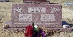
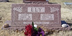
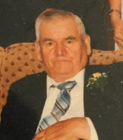
Glen William Ely
| Birth | : | 23 Mar 1913 Circleville, Jackson County, Kansas, USA |
| Death | : | Dec 1967 Holton, Jackson County, Kansas, USA |
| Burial | : | Campbell Cemetery, Claiborne County, USA |
| Coordinate | : | 36.3680992, -83.6406021 |
| Plot | : | Section J |
| Description | : | Glen William Ely, son of John and Ida May Jones Ely, was born on March 23, 1913 at Circleville and passed away at the home of friends in Holton of an apparent heart attack, at the age of 54 years, 8 months and 13 days. He was reared to manhood in the Wetmore and Pleasant Grove communities. He was united in marrage to Edna Pooler on April 22, 1939, to this union was born a daughter, Glenda Mae. He was a faithful member of the Mayetta Christian Church. He was preceded in death by his parents, 3 brothers, 2 sisters and 1 granddaughter,... Read More |
frequently asked questions (FAQ):
-
Where is Glen William Ely's memorial?
Glen William Ely's memorial is located at: Campbell Cemetery, Claiborne County, USA.
-
When did Glen William Ely death?
Glen William Ely death on Dec 1967 in Holton, Jackson County, Kansas, USA
-
Where are the coordinates of the Glen William Ely's memorial?
Latitude: 36.3680992
Longitude: -83.6406021
Family Members:
Parent
Spouse
Siblings
Children
Flowers:
Nearby Cemetories:
1. Campbell Cemetery
Claiborne County, USA
Coordinate: 36.3680992, -83.6406021
2. Brown Cemetery
Claiborne County, USA
Coordinate: 36.3614006, -83.6530991
3. Atkins Cemetery
Claiborne County, USA
Coordinate: 36.3814011, -83.6168976
4. Burch Cemetery
Claiborne County, USA
Coordinate: 36.3849983, -83.6699982
5. Cardwell Cemetery
Claiborne County, USA
Coordinate: 36.3911018, -83.6006012
6. Carr Cemetery
Claiborne County, USA
Coordinate: 36.3969002, -83.6810989
7. Butcher Cemetery
Union County, USA
Coordinate: 36.3511009, -83.6967010
8. Liberty Hill Cemetery
Liberty Hill, Grainger County, USA
Coordinate: 36.3171997, -83.6205978
9. Cardwell Cemetery
Claiborne County, USA
Coordinate: 36.4019012, -83.5789032
10. Frye Cemetery
Grainger County, USA
Coordinate: 36.3432610, -83.5725660
11. Hammock Cemetery
Grainger County, USA
Coordinate: 36.3097000, -83.6641998
12. Hopson Cemetery
Grainger County, USA
Coordinate: 36.3044014, -83.6157990
13. Coffey Cemetery
Claiborne County, USA
Coordinate: 36.4099998, -83.5753021
14. Days Cemetery
Claiborne County, USA
Coordinate: 36.3843994, -83.5594025
15. Johnson Cemetery
Grainger County, USA
Coordinate: 36.3130989, -83.5916977
16. Carr Cemetery
Claiborne County, USA
Coordinate: 36.3936900, -83.7184200
17. Barton Cemetery
Claiborne County, USA
Coordinate: 36.4110985, -83.5746994
18. Clapp Cemetery
Grainger County, USA
Coordinate: 36.3208008, -83.5772018
19. Boruff Cemetery
Union County, USA
Coordinate: 36.3100014, -83.6908035
20. Hopson Cemetery
Grainger County, USA
Coordinate: 36.3535995, -83.5460968
21. I. C. Hurst Cemetery
Union County, USA
Coordinate: 36.3086014, -83.7024994
22. Edwards Cemetery
Claiborne County, USA
Coordinate: 36.3857994, -83.7347031
23. Beason Cemetery
Claiborne County, USA
Coordinate: 36.3739014, -83.7375031
24. Freedom Missionary Baptist Church Cemetery
Claiborne County, USA
Coordinate: 36.4450310, -83.6214950


