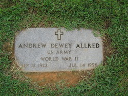
| Birth | : | 29 Mar 1932 Randolph County, North Carolina, USA |
| Death | : | 7 Jan 2018 Ramseur, Randolph County, North Carolina, USA |
| Burial | : | Whites Memorial Baptist Church Cemetery, Franklinville, Randolph County, USA |
| Coordinate | : | 35.7939680, -79.7149760 |
| Description | : | Glenna Rich Allred, 85, of Ramseur, died Sunday, January 7, 2018 at Universal Health Care in Ramseur. Funeral Services, 3:00 PM, Wednesday, January 10, 2018, at Whites Memorial Baptist Church, Franklinville. Officiating, Rev. Jeff Joyce. Burial will follow in the church cemetery. Glenna was a native of Randolph County, retired with Common Wealth Hosiery, a member of Cedar Falls Community Association and attended Whites Memorial Baptist Church. She was preceded in death by her husband, Andrew D. Allred, her parents, Glenn and Joyce York Rich and her daughter, Eva Cehen. Survivors: daughter, Barbara Hollady, and... Read More |
frequently asked questions (FAQ):
-
Where is Glenna Lee Rich Allred's memorial?
Glenna Lee Rich Allred's memorial is located at: Whites Memorial Baptist Church Cemetery, Franklinville, Randolph County, USA.
-
When did Glenna Lee Rich Allred death?
Glenna Lee Rich Allred death on 7 Jan 2018 in Ramseur, Randolph County, North Carolina, USA
-
Where are the coordinates of the Glenna Lee Rich Allred's memorial?
Latitude: 35.7939680
Longitude: -79.7149760
Family Members:
Flowers:
Nearby Cemetories:
1. Whites Memorial Baptist Church Cemetery
Franklinville, Randolph County, USA
Coordinate: 35.7939680, -79.7149760
2. Odell Trogdon Cemetery
Grays Chapel, Randolph County, USA
Coordinate: 35.7947200, -79.7300200
3. Faith Temple Baptist Church Cemetery
Franklinville, Randolph County, USA
Coordinate: 35.8023770, -79.7460950
4. Grays Chapel Cemetery
Grays Chapel, Randolph County, USA
Coordinate: 35.8183570, -79.6986060
5. Cool Springs Baptist Church Cemetery
Franklinville, Randolph County, USA
Coordinate: 35.8072420, -79.6805660
6. Bethany United Methodist Church Cemetery #1
Franklinville, Randolph County, USA
Coordinate: 35.8101300, -79.7606200
7. Clear View Baptist Church Cemetery
Franklinville, Randolph County, USA
Coordinate: 35.7530800, -79.7234300
8. Franklinville United Methodist Church Cemetery
Franklinville, Randolph County, USA
Coordinate: 35.7462900, -79.7037500
9. Cedar Falls Baptist Church Cemetery
Cedar Falls, Randolph County, USA
Coordinate: 35.7480800, -79.7357800
10. Cedar Falls United Methodist Church Cemetery
Asheboro, Randolph County, USA
Coordinate: 35.7472920, -79.7338990
11. First Baptist Church Cemetery
Franklinville, Randolph County, USA
Coordinate: 35.7482230, -79.6908630
12. Patterson Grove Christian Church Cemetery
Ramseur, Randolph County, USA
Coordinate: 35.7743940, -79.6536550
13. J. E. Groce Memorial Cemetery
Worthville, Randolph County, USA
Coordinate: 35.8032620, -79.7813460
14. Billy Trogdon Cemetery
Asheboro, Randolph County, USA
Coordinate: 35.7392800, -79.7219100
15. Liberty Road Baptist Church Cemetery
Randleman, Randolph County, USA
Coordinate: 35.7715500, -79.7808130
16. Whites Chapel United Methodist Church Cemetery
Liberty, Randolph County, USA
Coordinate: 35.7850520, -79.6422990
17. Old Salem Cemetery
Franklinville, Randolph County, USA
Coordinate: 35.7414017, -79.6742020
18. Sandy Creek Baptist Church Cemetery
Liberty, Randolph County, USA
Coordinate: 35.8235550, -79.6429050
19. Sandy Creek Primitive Baptist Church Cemetery
Liberty, Randolph County, USA
Coordinate: 35.8239020, -79.6406560
20. Giles Chapel United Methodist Church Cemetery
Asheboro, Randolph County, USA
Coordinate: 35.7462270, -79.7752450
21. Pleasant Cross Christian Church Cemetery
Asheboro, Randolph County, USA
Coordinate: 35.7254000, -79.7268740
22. Midway Wesleyan Church Cemetery
Randleman, Randolph County, USA
Coordinate: 35.8018900, -79.8006990
23. Country Holiness Cemetery
Randleman, Randolph County, USA
Coordinate: 35.8016800, -79.8016900
24. Providence Baptist Church Cemetery
Asheboro, Randolph County, USA
Coordinate: 35.7231400, -79.7237930

