
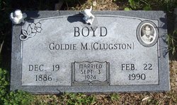
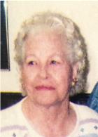
Goldie Myrtle Clugston Boyd
| Birth | : | 19 Dec 1886 Heizer, Barton County, Kansas, USA |
| Death | : | 22 Feb 1990 Pittsburg, Crawford County, Kansas, USA |
| Burial | : | Swinton Cemetery, Swinton, Metropolitan Borough of Salford, England |
| Coordinate | : | 53.5183372, -2.3457739 |
| Plot | : | Section 8, Row 7, Lot 21 |
frequently asked questions (FAQ):
-
Where is Goldie Myrtle Clugston Boyd's memorial?
Goldie Myrtle Clugston Boyd's memorial is located at: Swinton Cemetery, Swinton, Metropolitan Borough of Salford, England.
-
When did Goldie Myrtle Clugston Boyd death?
Goldie Myrtle Clugston Boyd death on 22 Feb 1990 in Pittsburg, Crawford County, Kansas, USA
-
Where are the coordinates of the Goldie Myrtle Clugston Boyd's memorial?
Latitude: 53.5183372
Longitude: -2.3457739
Family Members:
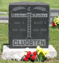
Parent

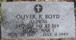
Spouse
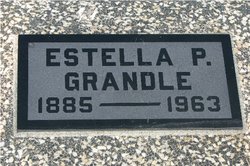
Siblings
Children

Flowers:


Nearby Cemetories:
1. Swinton Cemetery
Swinton, Metropolitan Borough of Salford, England
Coordinate: 53.5183372, -2.3457739
2. St. Paul's Wesleyan Methodist Churchyard
Swinton, Metropolitan Borough of Salford, England
Coordinate: 53.5133900, -2.3397500
3. St. Peter's Churchyard
Swinton, Metropolitan Borough of Salford, England
Coordinate: 53.5119130, -2.3413860
4. St Anne Churchyard
Clifton, Metropolitan Borough of Salford, England
Coordinate: 53.5277070, -2.3391650
5. St Mary's Catholic Cemetery
Wardley, Metropolitan Borough of Salford, England
Coordinate: 53.5163700, -2.3645900
6. Saint Augustine's Churchyard
Pendlebury, Metropolitan Borough of Salford, England
Coordinate: 53.5107070, -2.3223960
7. St Stephen churchyard
Kearsley, Metropolitan Borough of Bolton, England
Coordinate: 53.5381650, -2.3717160
8. St John The Evangelist Churchyard
Pendlebury, Metropolitan Borough of Salford, England
Coordinate: 53.5036200, -2.3088500
9. St Saviour churchyard
Ringley, Metropolitan Borough of Bolton, England
Coordinate: 53.5439030, -2.3576830
10. St Mark Churchyard
Worsley, Metropolitan Borough of Salford, England
Coordinate: 53.5024361, -2.3833430
11. St Paul Churchyard
Walkden, Metropolitan Borough of Salford, England
Coordinate: 53.5231133, -2.3947620
12. Agecroft Jewish Cemetery
Pendlebury, Metropolitan Borough of Salford, England
Coordinate: 53.5110302, -2.2955830
13. Agecroft Cemetery and Crematorium
Salford, Metropolitan Borough of Salford, England
Coordinate: 53.5100250, -2.2940500
14. Rainsough Jewish Cemetery
Prestwich, Metropolitan Borough of Bury, England
Coordinate: 53.5185530, -2.2906950
15. St Mary the Virgin Churchyard
Eccles, Metropolitan Borough of Salford, England
Coordinate: 53.4843810, -2.3346810
16. New Jerusalem Church Churchyard
Kearsley, Metropolitan Borough of Bolton, England
Coordinate: 53.5435770, -2.3877380
17. Kearsley New Church Burial Ground
Farnworth, Metropolitan Borough of Bolton, England
Coordinate: 53.5435500, -2.3879200
18. St. Mary the Virgin Churchyard
Prestwich, Metropolitan Borough of Bury, England
Coordinate: 53.5294033, -2.2864891
19. Stand United Reformed Church Burial Ground
Radcliffe, Metropolitan Borough of Bury, England
Coordinate: 53.5512300, -2.3140600
20. Great Synagogue Cemetery
Prestwich, Metropolitan Borough of Bury, England
Coordinate: 53.5315510, -2.2845730
21. New Jerusalem Church Burial
Radcliffe, Metropolitan Borough of Bury, England
Coordinate: 53.5542680, -2.3174070
22. Market Street Congregational Churchyard
Farnworth, Metropolitan Borough of Bolton, England
Coordinate: 53.5475620, -2.3911703
23. Manchester Reform Jewish Old Cemetery
Whitefield, Metropolitan Borough of Bury, England
Coordinate: 53.5442728, -2.2918894
24. St. John Parish Churchyard
Radcliffe, Metropolitan Borough of Bury, England
Coordinate: 53.5571400, -2.3206700