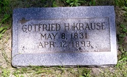
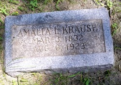
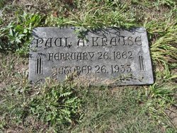
Gotfried H. Krause
| Birth | : | 8 May 1831 Brandenburg, Germany |
| Death | : | 12 Apr 1893 Albion, Boone County, Nebraska, USA |
| Burial | : | Saint Andrews Churchyard, Bedingham, South Norfolk District, England |
| Coordinate | : | 52.4902500, 1.3643180 |
| Description | : | From the web site: http://www.usgennet.org/usa/ne/county/platte/vitals/vitals1893.html Columbus Journal, April 19, 1893 DIED KRAUSE--At Albion, Nebraska, Thursday, April 13th, at 10 p.m., while on a visit to his son Paul, G.H. Krause. His health had been greatly impaired by la grippe for about two years, and his weaknesses increased until they culminated on Thursday night in his death. Mr. Krause was born in Prussia in 1832, and was consequently 61 years old at the time of his death. In 1858 he was married to Miss Amalie Krueger, moving the same year to Wisconsin. In 1872 they moved... Read More |
frequently asked questions (FAQ):
-
Where is Gotfried H. Krause's memorial?
Gotfried H. Krause's memorial is located at: Saint Andrews Churchyard, Bedingham, South Norfolk District, England.
-
When did Gotfried H. Krause death?
Gotfried H. Krause death on 12 Apr 1893 in Albion, Boone County, Nebraska, USA
-
Where are the coordinates of the Gotfried H. Krause's memorial?
Latitude: 52.4902500
Longitude: 1.3643180
Family Members:
Spouse
Children
Flowers:
Nearby Cemetories:
1. Saint Andrews Churchyard
Bedingham, South Norfolk District, England
Coordinate: 52.4902500, 1.3643180
2. St. Peter's Churchyard
Hedenham, South Norfolk District, England
Coordinate: 52.4891780, 1.4041660
3. St Margaret Churchyard
Hempnall, South Norfolk District, England
Coordinate: 52.5018500, 1.3004810
4. St. Mary's Churchyard
Ditchingham, South Norfolk District, England
Coordinate: 52.4776358, 1.4282946
5. Ditchingham Cemetery
Ditchingham, South Norfolk District, England
Coordinate: 52.4793614, 1.4307304
6. United Reformed Churchyard
Denton, South Norfolk District, England
Coordinate: 52.4465510, 1.3532090
7. St Margaret's Churchyard
Kirstead, South Norfolk District, England
Coordinate: 52.5358860, 1.3840860
8. St Catherine Churchyard
Fritton, Great Yarmouth Borough, England
Coordinate: 52.4919750, 1.2796600
9. St Margaret and St Remigius Churchyard
Seething, South Norfolk District, England
Coordinate: 52.5303390, 1.4185000
10. St. Mary's Churchyard
Denton, South Norfolk District, England
Coordinate: 52.4364500, 1.3618770
11. All Saints Churchyard
Earsham, South Norfolk District, England
Coordinate: 52.4480480, 1.4212330
12. St Peter's Churchyard
Mundham, South Norfolk District, England
Coordinate: 52.5303890, 1.4260120
13. St Michael's Churchyard
Broome, South Norfolk District, England
Coordinate: 52.4860360, 1.4547410
14. St Peters Churchyard
Brooke, South Norfolk District, England
Coordinate: 52.5452560, 1.3814930
15. All Saints Churchyard
Alburgh, South Norfolk District, England
Coordinate: 52.4362610, 1.3386490
16. St. Mary's Churchyard and Priory
Bungay, Waveney District, England
Coordinate: 52.4555100, 1.4375800
17. St Edmunds RC Churchyard
Bungay, Waveney District, England
Coordinate: 52.4550570, 1.4381220
18. Holy Trinity Churchyard
Bungay, Waveney District, England
Coordinate: 52.4553310, 1.4399650
19. Emmanuel Church Cemetery
Bungay, Waveney District, England
Coordinate: 52.4526800, 1.4382410
20. St. Mary's Churchyard
Saxlingham Nethergate, South Norfolk District, England
Coordinate: 52.5268910, 1.2880390
21. St Mary Churchyard
Howe, South Norfolk District, England
Coordinate: 52.5497970, 1.3541770
22. Saint John the Baptist Churchyard
Morningthorpe, South Norfolk District, England
Coordinate: 52.4859170, 1.2654150
23. St. Mary's Churchyard
Shelton, South Norfolk District, England
Coordinate: 52.4720940, 1.2686120
24. All Saints Church
Shotesham, South Norfolk District, England
Coordinate: 52.5428610, 1.3120560

