
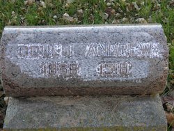
Gould Albert Andrew
| Birth | : | 24 Jul 1886 Pierce, Pierce County, Nebraska, USA |
| Death | : | 17 Dec 1918 Cadams, Nuckolls County, Nebraska, USA |
| Burial | : | Fernwood Cemetery, Henderson, Henderson County, USA |
| Coordinate | : | 37.8243294, -87.5912018 |
| Plot | : | Block 29 Lot 10 Grave 311 |
| Description | : | Cause of death: Spanish Influenza |
frequently asked questions (FAQ):
-
Where is Gould Albert Andrew's memorial?
Gould Albert Andrew's memorial is located at: Fernwood Cemetery, Henderson, Henderson County, USA.
-
When did Gould Albert Andrew death?
Gould Albert Andrew death on 17 Dec 1918 in Cadams, Nuckolls County, Nebraska, USA
-
Where are the coordinates of the Gould Albert Andrew's memorial?
Latitude: 37.8243294
Longitude: -87.5912018
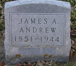
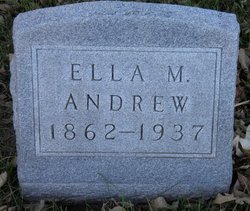
Family Members:
Parent
Siblings
Flowers:


Nearby Cemetories:
1. Fernwood Cemetery
Henderson, Henderson County, USA
Coordinate: 37.8243294, -87.5912018
2. Saint Louis Cemetery
Henderson, Henderson County, USA
Coordinate: 37.8231010, -87.6066971
3. Mount Zion Cemetery
Henderson, Henderson County, USA
Coordinate: 37.8128014, -87.6188965
4. Fairmont Cemetery
Henderson, Henderson County, USA
Coordinate: 37.8149986, -87.6203003
5. Roselawn Memorial Gardens
Henderson, Henderson County, USA
Coordinate: 37.7999992, -87.5693970
6. Barret Cemetery
Henderson, Henderson County, USA
Coordinate: 37.8546900, -87.5699400
7. Neale - King Cemetery
Vanderburgh County, USA
Coordinate: 37.8650000, -87.5927000
8. Pauper Cemetery
Graham Hill, Henderson County, USA
Coordinate: 37.8240800, -87.5368200
9. Mount Pisgah Cemetery
Henderson County, USA
Coordinate: 37.8241997, -87.5366974
10. Stroud Cemetery
Evansville, Vanderburgh County, USA
Coordinate: 37.8342018, -87.6455994
11. Thorn Hill Cemetery
Henderson, Henderson County, USA
Coordinate: 37.8641000, -87.5560300
12. Barker Cemetery
Evansville, Vanderburgh County, USA
Coordinate: 37.8768000, -87.5951000
13. Holloway Cemetery
Graham Hill, Henderson County, USA
Coordinate: 37.8296880, -87.5163720
14. Audubon Memorial Cemetery
Henderson County, USA
Coordinate: 37.8818000, -87.5641600
15. Watson Cemetery
Anthoston, Henderson County, USA
Coordinate: 37.7703420, -87.5446410
16. Watson Cemetery #2
Henderson, Henderson County, USA
Coordinate: 37.8789500, -87.5394900
17. McClain Family Cemetery
Henderson County, USA
Coordinate: 37.8899210, -87.5545510
18. Larkin White Family Cemetery
Zion, Henderson County, USA
Coordinate: 37.8105300, -87.5020100
19. Brooks Cemetery
Anthoston, Henderson County, USA
Coordinate: 37.7827550, -87.5049680
20. Gish Cemetery
Anthoston, Henderson County, USA
Coordinate: 37.7564040, -87.5363400
21. Cabell Cemetery
Henderson County, USA
Coordinate: 37.8529810, -87.4941110
22. Davis Cemetery
Henderson County, USA
Coordinate: 37.8303700, -87.6947700
23. Zion Cemetery
Zion, Henderson County, USA
Coordinate: 37.8085250, -87.4889690
24. Sandefur Cemetery
Geneva, Henderson County, USA
Coordinate: 37.8215240, -87.6959170