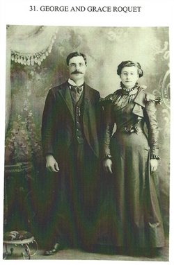
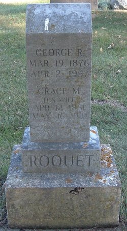
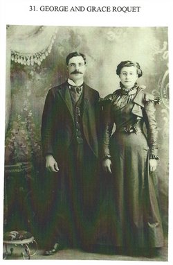
Grace May Lamphiear Roquet
| Birth | : | 14 Apr 1881 Strawberry Point, Clayton County, Iowa, USA |
| Death | : | 16 May 1941 Arlington, Fayette County, Iowa, USA |
| Burial | : | St Pancras Church, Wroot, North Lincolnshire Unitary Authority, England |
| Coordinate | : | 53.5158350, -0.9209990 |
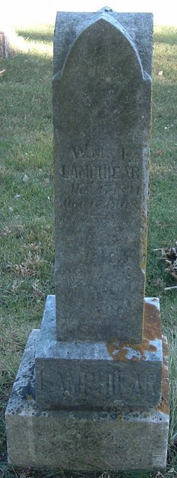
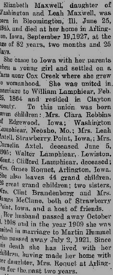
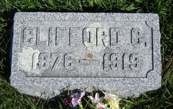
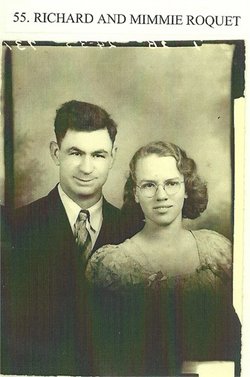
| Description | : | Daughter of William Jasper Lamphiear 1841-1908 and Elizabeth Maxwell 1845-1927 Siblings Clara Etta Lamphiear 1865-1947, Washington Myron Lamphiear 1867-1950, Leah Virginia Lamphiear Axtell 1869-1939, Cornelia Lamphiear Axtell 1871-1905, Walter Lamphiear 1874-1891, Clifford C Lamphiear 1876-1919 Married to George Riley Roquet Children:Clyde Clifford Roquet 1899-1952, Vernie Roquet 1903-1988, Donald William Roquet, 1904-1984, Georgia May Roquet 1907- , Edna Leah Roquet 1908-2001, Dollie Corine Roquet 1909- , Richard Louis Roquet 1912-1985, John D Roquet 1920-1992, Waneta Muriel Roquet 1923- OBITUARY Oelwein Daily Register Sat May 24, 1941 Mrs. George Roquet Grace May Lamphiear... Read More |
frequently asked questions (FAQ):
-
Where is Grace May Lamphiear Roquet's memorial?
Grace May Lamphiear Roquet's memorial is located at: St Pancras Church, Wroot, North Lincolnshire Unitary Authority, England.
-
When did Grace May Lamphiear Roquet death?
Grace May Lamphiear Roquet death on 16 May 1941 in Arlington, Fayette County, Iowa, USA
-
Where are the coordinates of the Grace May Lamphiear Roquet's memorial?
Latitude: 53.5158350
Longitude: -0.9209990
Family Members:
Parent
Spouse
Siblings
Children
Flowers:
Nearby Cemetories:
1. St Pancras Church
Wroot, North Lincolnshire Unitary Authority, England
Coordinate: 53.5158350, -0.9209990
2. St. Nicholas' Churchyard
Haxey, North Lincolnshire Unitary Authority, England
Coordinate: 53.4896400, -0.8489650
3. Holy Trinity & St. Oswald Churchyard Extension
Finningley, Metropolitan Borough of Doncaster, England
Coordinate: 53.4849100, -0.9933700
4. Holy Trinity and St. Oswald's Churchyard
Finningley, Metropolitan Borough of Doncaster, England
Coordinate: 53.4849100, -0.9933700
5. Epworth Municipal Cemetery
Epworth, North Lincolnshire Unitary Authority, England
Coordinate: 53.5206600, -0.8239000
6. St Andrew Churchyard
Epworth, North Lincolnshire Unitary Authority, England
Coordinate: 53.5256450, -0.8231740
7. St. Saviour's Churchyard
Auckley, Metropolitan Borough of Doncaster, England
Coordinate: 53.4993980, -1.0188490
8. All Saints Churchyard
Belton, North Lincolnshire Unitary Authority, England
Coordinate: 53.5478600, -0.8199200
9. Hatfield Woodhouse
Hatfield, Metropolitan Borough of Doncaster, England
Coordinate: 53.5736500, -0.9855500
10. Rands Lane Cemetery
Armthorpe, Metropolitan Borough of Doncaster, England
Coordinate: 53.5414848, -1.0403739
11. Hatfield Memorial Park
Hatfield, Metropolitan Borough of Doncaster, England
Coordinate: 53.5775464, -1.0013126
12. St. Lawrence Churchyard
Hatfield, Metropolitan Borough of Doncaster, England
Coordinate: 53.5787230, -0.9999700
13. St Martin's Churchyard
Owston Ferry, North Lincolnshire Unitary Authority, England
Coordinate: 53.4933920, -0.7886380
14. All Saints Churchyard
Misterton, Bassetlaw District, England
Coordinate: 53.4442500, -0.8500830
15. Owston Ferry Cemetery
Owston Ferry, North Lincolnshire Unitary Authority, England
Coordinate: 53.4966300, -0.7827500
16. St. Leonard & St. Mary Churchyard
Armthorpe, Metropolitan Borough of Doncaster, England
Coordinate: 53.5368555, -1.0633563
17. St. Helena Churchyard
Austerfield, Metropolitan Borough of Doncaster, England
Coordinate: 53.4449200, -1.0062600
18. St. Wilfrid Churchyard
Cantley, Metropolitan Borough of Doncaster, England
Coordinate: 53.5058500, -1.0688800
19. St. Michael's Churchyard
Rossington, Metropolitan Borough of Doncaster, England
Coordinate: 53.4782772, -1.0596305
20. Thorne Cemetery
Thorne, Metropolitan Borough of Doncaster, England
Coordinate: 53.6084100, -0.9572000
21. Rose Hill Crematorium
Cantley, Metropolitan Borough of Doncaster, England
Coordinate: 53.5129200, -1.0813200
22. St. Peter's Churchyard
East Stockwith, West Lindsey District, England
Coordinate: 53.4415500, -0.8161400
23. Blessed Virgin Mary Churchyard
West Stockwith, Bassetlaw District, England
Coordinate: 53.4434410, -0.8117040
24. St. Nicholas Churchyard
Thorne, Metropolitan Borough of Doncaster, England
Coordinate: 53.6116500, -0.9580000

