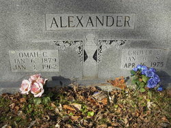
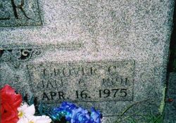
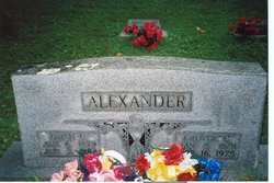
Grover Cleveland Alexander
| Birth | : | 6 Jan 1891 Stone County, Arkansas, USA |
| Death | : | 16 Apr 1975 Marshall, Searcy County, Arkansas, USA |
| Burial | : | Honeywood Cemetery, Honeywood, Dufferin County, Canada |
| Coordinate | : | 44.2249100, -80.1870100 |
| Description | : | Grover was the son of William Franklin Alexander and Mary Jane Ward. On 14 November 1909 in Stone County, Arkansas, Grover married the widow of Hugh Frank Rorie, Omah Catherine Stevens, whose brother, John W. "Johnny" Stevens, was married to Frank Rorie's sister, Belle. Omah had three children by Frank that Grover treated as his own, King, Doss, and Susie. Grover and Omah had the following children: Thurlow, Earlow, Edith, June, Buster, and G.C., who was stillborn. Photos courtesy of Nancy Baxter. |
frequently asked questions (FAQ):
-
Where is Grover Cleveland Alexander's memorial?
Grover Cleveland Alexander's memorial is located at: Honeywood Cemetery, Honeywood, Dufferin County, Canada.
-
When did Grover Cleveland Alexander death?
Grover Cleveland Alexander death on 16 Apr 1975 in Marshall, Searcy County, Arkansas, USA
-
Where are the coordinates of the Grover Cleveland Alexander's memorial?
Latitude: 44.2249100
Longitude: -80.1870100
Family Members:
Spouse
Flowers:
Nearby Cemetories:
1. Honeywood Cemetery
Honeywood, Dufferin County, Canada
Coordinate: 44.2249100, -80.1870100
2. Lavender Cemetery
Lavender, Simcoe County, Canada
Coordinate: 44.2690679, -80.1576552
3. Hornings Mills Cemetery
Horning's Mills, Dufferin County, Canada
Coordinate: 44.1574010, -80.2063900
4. Primrose Presbyterian Cemetery
Mulmur, Dufferin County, Canada
Coordinate: 44.1893219, -80.1026086
5. Dunedin Union Cemetery
Dunedin, Simcoe County, Canada
Coordinate: 44.2967200, -80.1721400
6. South Line Union Cemetery
Badjeros, Grey County, Canada
Coordinate: 44.2562700, -80.2834900
7. Spring Valley Cemetery
Horning's Mills, Dufferin County, Canada
Coordinate: 44.1466460, -80.2026950
8. Christ Church Anglican Whitfield Cemetery
Whitfield, Dufferin County, Canada
Coordinate: 44.1484800, -80.1363400
9. Whitfield United Church Cemetery
Whitfield, Dufferin County, Canada
Coordinate: 44.1457200, -80.1355400
10. Osprey Independent Old Order Mennonite Cemetery
Osprey Township, Grey County, Canada
Coordinate: 44.2880780, -80.2888780
11. Banda Methodist Cemetery
Mulmur, Dufferin County, Canada
Coordinate: 44.2868400, -80.0713300
12. Perm Methodist Cemetery
Perm, Dufferin County, Canada
Coordinate: 44.1618350, -80.0703890
13. Christ Church Anglican Cemetery
Clearview, Simcoe County, Canada
Coordinate: 44.2930555, -80.0680555
14. Creemore Union Cemetery
Creemore, Simcoe County, Canada
Coordinate: 44.3204440, -80.1070800
15. McIntyre Old Presbyterian Pioneer Cemetery
McIntyre, Grey County, Canada
Coordinate: 44.3122260, -80.2945380
16. McIntyre United Church Cemetery
Osprey Township, Grey County, Canada
Coordinate: 44.3193040, -80.2923770
17. Mansfield Presbyterian Cemetery
Mansfield, Dufferin County, Canada
Coordinate: 44.1644100, -80.0378170
18. Saint Paul's Anglican Cemetery
Melancthon, Dufferin County, Canada
Coordinate: 44.1028300, -80.2559300
19. Melancthon United Church Cemetery
Melancthon, Dufferin County, Canada
Coordinate: 44.1026710, -80.2557530
20. Singhampton Union Cemetery
Singhampton, Simcoe County, Canada
Coordinate: 44.3496900, -80.2478100
21. Shelburne Cemetery
Shelburne, Dufferin County, Canada
Coordinate: 44.0927010, -80.2090378
22. Old St. Patrick's R C Cemetery
Clearview, Simcoe County, Canada
Coordinate: 44.3519600, -80.1151600
23. Glencairn Cemetery
Glencairn, Simcoe County, Canada
Coordinate: 44.3034340, -80.0253210
24. Mulmur Pioneer Cemetery
Mulmur, Dufferin County, Canada
Coordinate: 44.1204900, -80.0423800


