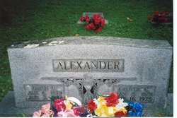
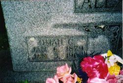
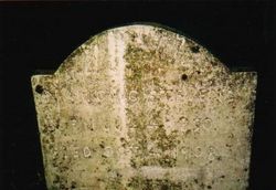
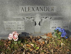
Omah Catherine Stevens Alexander
| Birth | : | 6 Jan 1879 Onia, Stone County, Arkansas, USA |
| Death | : | 3 Jan 1962 Onia, Stone County, Arkansas, USA |
| Burial | : | Frenchs Forest Cemetery, Davidson, Northern Beaches Council, Australia |
| Coordinate | : | -33.7392360, 151.2020750 |
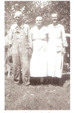
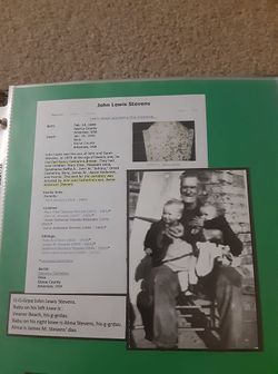
| Description | : | Omah was the daughter of John Lewis Stevens and Nancy Catherine Brewer. On the 13th of October 1895 at the age of sixteen in Dollie, Stone County, Arkansas, she married Hugh Frank Rorie. They had the following children: King, Idoss Herman, and Susie. The 14th of November 1909, following Frank's death in 1908 (Frank Rorie was fatally shot from ambush as he rode in a wagon with an unidentified woman. His brother-in-law, Johnny Stevens, was riding a horse along side the wagon but was not injured), Omah married Grover Cleveland Alexander. They had the following children: Thurlow, Earlow, Edith,... Read More |
frequently asked questions (FAQ):
-
Where is Omah Catherine Stevens Alexander's memorial?
Omah Catherine Stevens Alexander's memorial is located at: Frenchs Forest Cemetery, Davidson, Northern Beaches Council, Australia.
-
When did Omah Catherine Stevens Alexander death?
Omah Catherine Stevens Alexander death on 3 Jan 1962 in Onia, Stone County, Arkansas, USA
-
Where are the coordinates of the Omah Catherine Stevens Alexander's memorial?
Latitude: -33.7392360
Longitude: 151.2020750
Family Members:
Parent
Spouse
Siblings
Flowers:
Nearby Cemetories:
1. Frenchs Forest Cemetery
Davidson, Northern Beaches Council, Australia
Coordinate: -33.7392360, 151.2020750
2. Church of St. Francis and St. Alban
Gordon, Ku-ring-gai Council, Australia
Coordinate: -33.7563700, 151.1522220
3. St. John's Anglican Church Cemetery
Gordon, Ku-ring-gai Council, Australia
Coordinate: -33.7571060, 151.1519580
4. Northern Suburbs Memorial Gardens and Crematorium
North Ryde, Ryde City, Australia
Coordinate: -33.7954460, 151.1511550
5. Macquarie Park Cemetery and Crematorium
North Ryde, Ryde City, Australia
Coordinate: -33.7937180, 151.1420060
6. Manly Cemetery
Manly, Northern Beaches Council, Australia
Coordinate: -33.7922700, 151.2715000
7. Gore Hill Cemetery
St Leonards, North Sydney Council, Australia
Coordinate: -33.8229500, 151.1887590
8. St. Thomas Rest Park
Crows Nest, North Sydney Council, Australia
Coordinate: -33.8244490, 151.2063050
9. St Aidan's Anglican Church
Longueville, Lane Cove Municipality, Australia
Coordinate: -33.8281510, 151.1709560
10. Mona Vale Cemetery
Mona Vale, Northern Beaches Council, Australia
Coordinate: -33.6752140, 151.2879720
11. Field of Mars Cemetery
East Ryde, Ryde City, Australia
Coordinate: -33.8120030, 151.1246480
12. The Old Man's Valley Cemetery
Hornsby, Hornsby Shire, Australia
Coordinate: -33.6994480, 151.0923970
13. Mary MacKillop Memorial Chapel
North Sydney, North Sydney Council, Australia
Coordinate: -33.8388250, 151.2049160
14. Ryde Baptist Graveyard
Ryde, Ryde City, Australia
Coordinate: -33.8062930, 151.1119180
15. Rawson Park
Mosman, Mosman Municipality, Australia
Coordinate: -33.8350640, 151.2504980
16. Mona Vale Anglican Church
Mona Vale, Northern Beaches Council, Australia
Coordinate: -33.6745924, 151.3031547
17. St Charles Borromeo Cemetery
Ryde, Ryde City, Australia
Coordinate: -33.8188360, 151.1146200
18. Sydney North Head Quarantine Cemetery
Manly, Northern Beaches Council, Australia
Coordinate: -33.8177130, 151.2947000
19. Saint Annes Church Cemetery
Ryde, Ryde City, Australia
Coordinate: -33.8156960, 151.1042650
20. Gladesville Asylum Cemetery
Gladesville, Hunter's Hill Municipality, Australia
Coordinate: -33.8393010, 151.1342490
21. Church Point Historic Cemetery
Church Point, Northern Beaches Council, Australia
Coordinate: -33.6450120, 151.2841090
22. Garden Island
Potts Point, City of Sydney, Australia
Coordinate: -33.8613635, 151.2280308
23. Royal Botanic Gardens
Sydney, City of Sydney, Australia
Coordinate: -33.8647440, 151.2170610
24. Carlingford Anglican Cemetery
Carlingford, City of Parramatta Council, Australia
Coordinate: -33.7833430, 151.0598510

