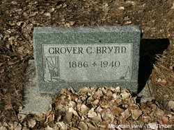
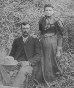
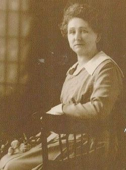
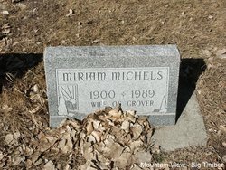
Grover Cole Bryan
| Birth | : | 27 Sep 1886 Good Water, Iron County, Missouri, USA |
| Death | : | 16 Oct 1940 Big Timber, Sweet Grass County, Montana, USA |
| Burial | : | Mountain View Cemetery, Big Timber, Sweet Grass County, USA |
| Coordinate | : | 45.8243660, -109.9660960 |
| Plot | : | Section 5 Block 17 Lot 2 Grave 9 |
| Description | : | Big Timber Pioneer, October 17, 1940 Grover C. Bryan Accident Victim on Opening Day of Deer Hunting Tragedy marred the first day of the deer hunting season in this county, with Grover Bryan the victim of an accidental discharge of a high-powered rifle. Bryan, his father Charles Bryan, George Alden, and Will Churchill had spent the day hunting in the Crazy mountains. They were to stay overnight in the Bryan-Alden cabin at the Ward & Parker sawmill about 20 miles above Melville and 40 miles from Big Timber. After supper Bryan and Churchill were cleaning their guns, only the two... Read More |
frequently asked questions (FAQ):
-
Where is Grover Cole Bryan's memorial?
Grover Cole Bryan's memorial is located at: Mountain View Cemetery, Big Timber, Sweet Grass County, USA.
-
When did Grover Cole Bryan death?
Grover Cole Bryan death on 16 Oct 1940 in Big Timber, Sweet Grass County, Montana, USA
-
Where are the coordinates of the Grover Cole Bryan's memorial?
Latitude: 45.8243660
Longitude: -109.9660960
Family Members:
Parent
Spouse
Siblings
Children
Flowers:
Nearby Cemetories:
1. Mountain View Cemetery
Big Timber, Sweet Grass County, USA
Coordinate: 45.8243660, -109.9660960
2. Thomas Massacre Gravesite
Greycliff, Sweet Grass County, USA
Coordinate: 45.7351500, -109.7144000
3. Hunters Hot Springs Cemetery
Hunters Hot Springs, Park County, USA
Coordinate: 45.7551000, -110.2570000
4. Kent Cemetery
Sweet Grass County, USA
Coordinate: 45.7308006, -109.6722031
5. Melville Lutheran Cemetery
Melville, Sweet Grass County, USA
Coordinate: 46.1074982, -110.0397034
6. Reed Point Cemetery
Sweet Grass County, USA
Coordinate: 45.7033005, -109.5622025
7. Bruffey Cemetery
Livingston, Park County, USA
Coordinate: 45.6206200, -110.3741910
8. Rock Creek Cemetery
Park County, USA
Coordinate: 45.8944016, -110.4993973
9. Park County Poor Farm Cemetery
Livingston, Park County, USA
Coordinate: 45.6860470, -110.4924250
10. Calvary Cemetery
Livingston, Park County, USA
Coordinate: 45.6913986, -110.5282974
11. Nye Cemetery
Nye, Stillwater County, USA
Coordinate: 45.4272003, -109.7630997
12. Hopkins Cemetery
Sweet Grass County, USA
Coordinate: 46.2113991, -110.2205963
13. Saint Margarets Cemetery
Clyde Park, Park County, USA
Coordinate: 45.9000810, -110.6005990
14. Clyde Park Cemetery
Clyde Park, Park County, USA
Coordinate: 45.9000850, -110.6013180
15. Mountain View Cemetery
Livingston, Park County, USA
Coordinate: 45.6617012, -110.5883026
16. Park View Memorial Gardens
Livingston, Park County, USA
Coordinate: 45.5739288, -110.5668182
17. Rosebud Cemetery
Stillwater County, USA
Coordinate: 45.4807014, -109.4459000
18. Wilsall Cemetery
Wilsall, Park County, USA
Coordinate: 45.9824982, -110.6549988
19. Holland Settlement Cemetery
Stillwater County, USA
Coordinate: 45.8280983, -109.2331009
20. Rapelje Cemetery
Stillwater County, USA
Coordinate: 45.9552994, -109.2544022
21. Mountain View Cemetery
Columbus, Stillwater County, USA
Coordinate: 45.6417007, -109.2727966
22. Strickland Cemetery
Livingston, Park County, USA
Coordinate: 45.5435982, -110.6168976
23. Cokedale Cemetery
Livingston, Park County, USA
Coordinate: 45.6402140, -110.7229940
24. Shorthill Cemetery
Park County, USA
Coordinate: 45.4558500, -110.5771600

