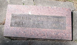
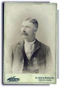
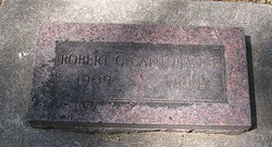
Hannibal Lincoln “Winfield S.” Cantonwine
| Birth | : | 14 May 1861 Vinton, Benton County, Iowa, USA |
| Death | : | 17 Sep 1920 Walla Walla County, Washington, USA |
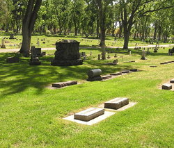
| Burial | : | Peel Cemetery, Dove Creek, Dolores County, USA |
| Coordinate | : | 37.8656006, -108.9483032 |
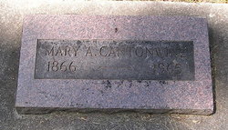
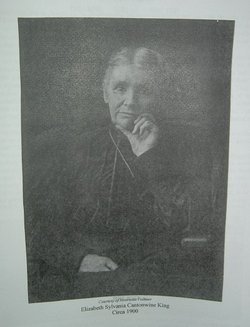
| Description | : | Hannibal Lincoln "Winfield S." or "W. S." Cantonwine was the son of George C. and Mary Melinda/Malinda (Lewis) Cantonwine and the grandson of Charles and Mary Magdalena (Scholl) Cantonwine. Charles, the patriarch of the Cantonwine family, immigrated to America from Prussia in 1806, arriving in Philadelphia, Penn., aboard the ship Orlando. The ship's passenger list shows Chr. Kuntentwine, single man. The name Kuntentwine later evolved to Cantonwine, and Charles appears to be the only surnamed Kuntentwine/ Cantonwine to immigrate to America. Eight or so years after his arrival in Philadelphia, in about 1814, Charles married Mary Magdalena Scholl, daughter of... Read More |
frequently asked questions (FAQ):
-
Where is Hannibal Lincoln “Winfield S.” Cantonwine's memorial?
Hannibal Lincoln “Winfield S.” Cantonwine's memorial is located at: Peel Cemetery, Dove Creek, Dolores County, USA.
-
When did Hannibal Lincoln “Winfield S.” Cantonwine death?
Hannibal Lincoln “Winfield S.” Cantonwine death on 17 Sep 1920 in Walla Walla County, Washington, USA
-
Where are the coordinates of the Hannibal Lincoln “Winfield S.” Cantonwine's memorial?
Latitude: 37.8656006
Longitude: -108.9483032
Family Members:
Parent
Spouse
Siblings
Children
Flowers:
Nearby Cemetories:
1. Peel Cemetery
Dove Creek, Dolores County, USA
Coordinate: 37.8656006, -108.9483032
2. Burns Cemetery
Egnar, San Miguel County, USA
Coordinate: 37.9098740, -109.0136871
3. Dove Creek Cemetery
Dove Creek, Dolores County, USA
Coordinate: 37.7649700, -108.9123600
4. Mountain View Cemetery
Eastland, San Juan County, USA
Coordinate: 37.7999992, -109.1081009
5. Poverty Flat Cemetery
Egnar, San Miguel County, USA
Coordinate: 38.0430400, -108.9150400
6. Cedar Point Cemetery
San Juan County, USA
Coordinate: 37.7057000, -109.0819000
7. Westcott Cemetery
San Miguel County, USA
Coordinate: 37.9209900, -108.6799900
8. Hardman Family Cemetery
San Miguel County, USA
Coordinate: 37.9944200, -108.7210200
9. Cahone Cemetery
Cahone, Dolores County, USA
Coordinate: 37.6774000, -108.7886000
10. Urado Cemetery
San Juan County, USA
Coordinate: 37.6459000, -109.0590000
11. Sylvan Cemetery
Pleasant View, Montezuma County, USA
Coordinate: 37.5797005, -108.8850021
12. Monticello City Cemetery
Monticello, San Juan County, USA
Coordinate: 37.8683014, -109.3300018
13. Verdure Cemetery
Verdure, San Juan County, USA
Coordinate: 37.7837000, -109.3461000
14. Fairview Cemetery
Yellow Jacket, Montezuma County, USA
Coordinate: 37.5438995, -108.7397003
15. Harry Hopkins Gravesite
San Juan County, USA
Coordinate: 37.7830010, -109.4367980
16. Home of Truth Cemetery
Dry Valley, San Juan County, USA
Coordinate: 38.0598500, -109.4044900
17. Nash Cemetery
Dolores County, USA
Coordinate: 37.8581009, -108.4300003
18. Sunnyside Cemetery
Lewis, Montezuma County, USA
Coordinate: 37.5014000, -108.6594009
19. Blanding City Cemetery
Blanding, San Juan County, USA
Coordinate: 37.6307983, -109.4682999
20. Benjamin Sutherland Gravesite
Montezuma County, USA
Coordinate: 37.4540151, -108.6137229
21. Goodman Point Cemetery
Montezuma County, USA
Coordinate: 37.4127998, -108.7121964
22. Paradox Cemetery
Paradox, Montrose County, USA
Coordinate: 38.3608017, -108.9458008
23. Eaton Cemetery
Cortez, Montezuma County, USA
Coordinate: 37.4132000, -108.6824000
24. Lebanon Cemetery
Lebanon, Montezuma County, USA
Coordinate: 37.4510994, -108.5905991

