
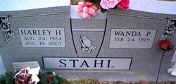
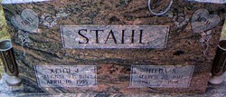
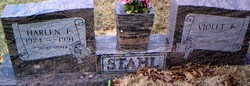
Harley Howard Stahl
| Birth | : | 24 Aug 1924 Crellin, Garrett County, Maryland, USA |
| Death | : | 18 Aug 2007 Garrett County, Maryland, USA |
| Burial | : | Franklin Cemetery, Franklin, Brooke County, USA |
| Coordinate | : | 40.2758800, -80.5449300 |
frequently asked questions (FAQ):
-
Where is Harley Howard Stahl's memorial?
Harley Howard Stahl's memorial is located at: Franklin Cemetery, Franklin, Brooke County, USA.
-
When did Harley Howard Stahl death?
Harley Howard Stahl death on 18 Aug 2007 in Garrett County, Maryland, USA
-
Where are the coordinates of the Harley Howard Stahl's memorial?
Latitude: 40.2758800
Longitude: -80.5449300
Family Members:
Parent

Spouse

Siblings
Children
Flowers:


Nearby Cemetories:
1. Franklin Cemetery
Franklin, Brooke County, USA
Coordinate: 40.2758800, -80.5449300
2. St John's Cemetery
Brooke County, USA
Coordinate: 40.2697156, -80.5840881
3. Ebenezer Church Cemetery
Brooke County, USA
Coordinate: 40.3071090, -80.5622320
4. Lower Buffalo Cemetery
Brooke County, USA
Coordinate: 40.2435989, -80.5297012
5. Cross Creek Cemetery
Brooke County, USA
Coordinate: 40.3060989, -80.5792007
6. Knights of Saint George Cemetery
Wellsburg, Brooke County, USA
Coordinate: 40.2859920, -80.5989860
7. Independence Cemetery
Independence, Washington County, USA
Coordinate: 40.2531013, -80.4916992
8. Brooke Cemetery
Wellsburg, Brooke County, USA
Coordinate: 40.2874985, -80.6053009
9. Brooke County Public Library Cremation Niches
Wellsburg, Brooke County, USA
Coordinate: 40.2725410, -80.6128480
10. Unidentified Cemetery
McKinleyville, Brooke County, USA
Coordinate: 40.2402083, -80.5980333
11. Oak Grove Cemetery
Follansbee, Brooke County, USA
Coordinate: 40.3274994, -80.5766983
12. Bethel Methodist Protestant Church Cemetery
Washington County, USA
Coordinate: 40.3152700, -80.4889800
13. Georges Run Cemetery
Steubenville, Jefferson County, USA
Coordinate: 40.3022920, -80.6189630
14. Historic Bethany Church of Christ Cemetery
Bethany, Brooke County, USA
Coordinate: 40.2063866, -80.5542908
15. Bethany Church of Christ Cemetery
Bethany, Brooke County, USA
Coordinate: 40.2061730, -80.5539410
16. Campbell Cemetery
Bethany, Brooke County, USA
Coordinate: 40.2054430, -80.5467340
17. Bethany Community Cemetery
Brooke County, USA
Coordinate: 40.2054130, -80.5477620
18. Cross Creek United Presbyterian Church Cemetery
Colliers, Brooke County, USA
Coordinate: 40.3458430, -80.5316650
19. Saint John Cemetery Haven of Rest
Colliers, Brooke County, USA
Coordinate: 40.3486160, -80.5502720
20. Saint Andrews Cemetery
Mingo Junction, Jefferson County, USA
Coordinate: 40.3250008, -80.6172028
21. West Point Cemetery
Avella, Washington County, USA
Coordinate: 40.2891500, -80.4457700
22. Oakland Cemetery
Mingo Junction, Jefferson County, USA
Coordinate: 40.3285790, -80.6184240
23. Saint Johns Cemetery
Avella, Washington County, USA
Coordinate: 40.2893000, -80.4447300
24. Saint Michael Cemetery
Avella, Washington County, USA
Coordinate: 40.2902800, -80.4443600