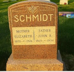
| Birth | : | 24 Feb 1824 Leer, Landkreis Leer, Lower Saxony (Niedersachsen), Germany |
| Death | : | 12 May 1907 Rosemont, Webster County, Nebraska, USA |
| Burial | : | Saint Pauls Lutheran Cemetery, Adams County, USA |
| Coordinate | : | 40.5104530, -98.2872960 |
| Plot | : | Record # 375, Section A, Block 10, Lot 10, Grave 3 |
| Description | : | He was born in Riepe, Ostfriesland, a son of Elias and Johanna Maria Bohlen Claassen. Harm emigrated on the ship Stella, arriving in New York 28 October 1856. From the newspaper Ostfriesische Nachrichten: To our friends, relatives and acquaintances we bring the news that our father, grandfather, and great grandfather, Harm Rudolph Schmidt, died on Sunday morning, May 12, 1907. He was born on February 24, 1824 in Riepe, Ostfriesland near Aurich. He was baptised and confirmed there. In 1846 he entered into marriage with Ida (Reverts). She died in 1898. In 1856 he came with his family... Read More |
frequently asked questions (FAQ):
-
Where is Harm Rudolf Schmidt's memorial?
Harm Rudolf Schmidt's memorial is located at: Saint Pauls Lutheran Cemetery, Adams County, USA.
-
When did Harm Rudolf Schmidt death?
Harm Rudolf Schmidt death on 12 May 1907 in Rosemont, Webster County, Nebraska, USA
-
Where are the coordinates of the Harm Rudolf Schmidt's memorial?
Latitude: 40.5104530
Longitude: -98.2872960
Family Members:
Spouse
Children
Flowers:
Nearby Cemetories:
1. Saint Pauls Lutheran Cemetery
Adams County, USA
Coordinate: 40.5104530, -98.2872960
2. Glenvil Cemetery
Glenvil, Clay County, USA
Coordinate: 40.5088400, -98.2604700
3. True Dutch Reformed Cemetery
Pauline, Adams County, USA
Coordinate: 40.4801300, -98.3160600
4. Scandinavian Lutheran Cemetery
Pauline, Adams County, USA
Coordinate: 40.4800700, -98.3162900
5. Hanover Presbyterian Church Cemetery
Adams County, USA
Coordinate: 40.4802900, -98.3353850
6. Fleming Farm Pet Cemetery
Hastings, Adams County, USA
Coordinate: 40.5547500, -98.3156100
7. Glenville Union Cemetery
Glenvil, Clay County, USA
Coordinate: 40.5308980, -98.2052220
8. South Inland Cemetery
Clay County, USA
Coordinate: 40.5682900, -98.2217500
9. Old Inland Cemetery
Hastings, Adams County, USA
Coordinate: 40.5872300, -98.2974500
10. Anandale Cemetery
Glenvil, Clay County, USA
Coordinate: 40.4661900, -98.1935300
11. Inland Cemetery
Clay County, USA
Coordinate: 40.5964012, -98.2581024
12. Kingston Cemetery
Adams County, USA
Coordinate: 40.4383250, -98.3695220
13. Zion Cemetery
Clay County, USA
Coordinate: 40.5382996, -98.1643982
14. Mount Sinai Cemetery
Hastings, Adams County, USA
Coordinate: 40.5978012, -98.3647003
15. Blue Valley Cemetery
Ayr, Adams County, USA
Coordinate: 40.4488983, -98.4011002
16. Parkview Cemetery
Hastings, Adams County, USA
Coordinate: 40.5985985, -98.3677979
17. Spring Ranch Cemetery
Clay County, USA
Coordinate: 40.4065100, -98.2484100
18. Saint Marks Episcopal Chapel Columbarium
Hastings, Adams County, USA
Coordinate: 40.5877800, -98.3922100
19. First Presbyterian Columbarium
Hastings, Adams County, USA
Coordinate: 40.5895900, -98.3913100
20. Crosier Monastery Cemetery
Hastings, Adams County, USA
Coordinate: 40.6014740, -98.3787920
21. Highland Cemetery
Hastings, Adams County, USA
Coordinate: 40.5983009, -98.3906021
22. Grace Methodist Church Memorial Columbarium
Hastings, Adams County, USA
Coordinate: 40.5937480, -98.4082340
23. Immanuel Lutheran Church Cemetery
Ayr, Adams County, USA
Coordinate: 40.5247870, -98.4583300
24. Ingleside Cemetery
Adams County, USA
Coordinate: 40.5862340, -98.4464990


