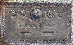
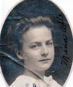
Harold Edwin Adle
| Birth | : | 15 Jan 1899 Maryville, Nodaway County, Missouri, USA |
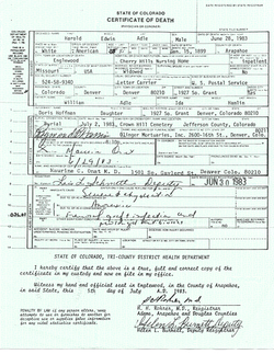
| Death | : | 2 Jul 1983 Englewood, Arapahoe County, Colorado, USA |
| Burial | : | Crown Hill Cemetery, Wheat Ridge, Jefferson County, USA |
| Coordinate | : | 39.7580986, -105.0942001 |
| Plot | : | Block 66, Lot 271 |
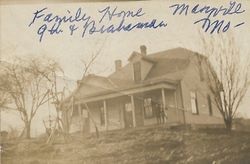
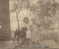
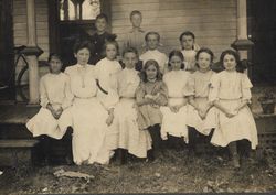
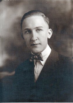
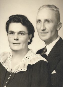
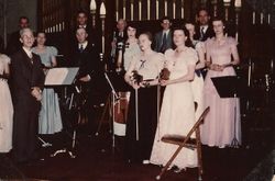
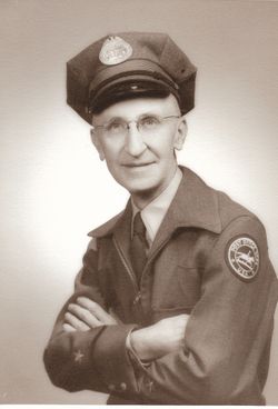
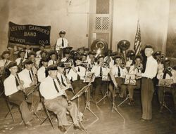
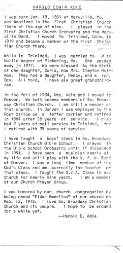
| Description | : | Harold Edwin Adle was born in Maryville, Missouri on January 1899. He graduated from high school in Maryville and attended several years at the Northwest Missouri State Teachers College, Maryville. His passion was always music and this involved playing in the First Christian Church Orchestra and the Maryville Band. He was a self taught clarinet player and offered lessons for many years. He wrote some lyrics including "I'm Glad That I'm An American" during the WWII period and it was performed for the first time in Denver by the Denver Post Office Band, which he directed.... Read More |
frequently asked questions (FAQ):
-
Where is Harold Edwin Adle's memorial?
Harold Edwin Adle's memorial is located at: Crown Hill Cemetery, Wheat Ridge, Jefferson County, USA.
-
When did Harold Edwin Adle death?
Harold Edwin Adle death on 2 Jul 1983 in Englewood, Arapahoe County, Colorado, USA
-
Where are the coordinates of the Harold Edwin Adle's memorial?
Latitude: 39.7580986
Longitude: -105.0942001
Family Members:
Parent
Spouse
Siblings
Children
Flowers:
Nearby Cemetories:
1. Crown Hill Cemetery
Wheat Ridge, Jefferson County, USA
Coordinate: 39.7580986, -105.0942001
2. Our Lady of Fatima Catholic Church Cemetery
Lakewood, Jefferson County, USA
Coordinate: 39.7472000, -105.1146000
3. Holy Cross Lutheran Church Columbarium
Wheat Ridge, Jefferson County, USA
Coordinate: 39.7799500, -105.1090300
4. Saint Pauls Episcopal Columbarium
Lakewood, Jefferson County, USA
Coordinate: 39.7328000, -105.1004000
5. Shepherd of The Hills Presbyterian Church Cemetery
Lakewood, Jefferson County, USA
Coordinate: 39.7472000, -105.1278000
6. Holy Shepherd Lutheran Church Columbarium
Lakewood, Jefferson County, USA
Coordinate: 39.7314900, -105.1089000
7. Glory of God Lutheran Church Columbarium
Wheat Ridge, Jefferson County, USA
Coordinate: 39.7680000, -105.1352000
8. Golden Hill Cemetery
Lakewood, Jefferson County, USA
Coordinate: 39.7392006, -105.1346970
9. Arvada Cemetery
Arvada, Jefferson County, USA
Coordinate: 39.7969017, -105.1077805
10. Mount Olivet Catholic Cemetery
Wheat Ridge, Jefferson County, USA
Coordinate: 39.7832985, -105.1477966
11. Green Mountain United Methodist Church Columbarium
Lakewood, Jefferson County, USA
Coordinate: 39.7126260, -105.1419500
12. Acacia Cemetery (Defunct)
Denver, Denver County, USA
Coordinate: 39.7603680, -105.0138070
13. Auraria Cemetery
Denver County, USA
Coordinate: 39.7526500, -105.0096400
14. Ralston Cemetery
Arvada, Jefferson County, USA
Coordinate: 39.8088989, -105.1603012
15. Saint Joseph Episcopal Church Columbarium
Lakewood, Jefferson County, USA
Coordinate: 39.6809780, -105.1239520
16. Belgin Cemetery
Arvada, Jefferson County, USA
Coordinate: 39.8349037, -105.1306610
17. First Mennonite Church Memorial Garden
Denver, Denver County, USA
Coordinate: 39.7302000, -104.9933000
18. Golden Cemetery
Golden, Jefferson County, USA
Coordinate: 39.7280617, -105.1961136
19. Saint Paul Lutheran Church Columbarium
Denver, Denver County, USA
Coordinate: 39.7419000, -104.9834500
20. Cathedral Basilica of the Immaculate Conception
Denver, Denver County, USA
Coordinate: 39.7405070, -104.9819330
21. Westminster Presbyterian Church Columbarium
Westminster, Adams County, USA
Coordinate: 39.8370620, -105.0357056
22. All Souls Walk at Saint Johns Cathedral
Denver, Denver County, USA
Coordinate: 39.7380600, -104.9780000
23. Atonement Lutheran Church Columbarium
Lakewood, Jefferson County, USA
Coordinate: 39.6682340, -105.0654750
24. Calvary Episcopal Church Columbarium
Golden, Jefferson County, USA
Coordinate: 39.7539291, -105.2214203

