Harold Edwin Johnson
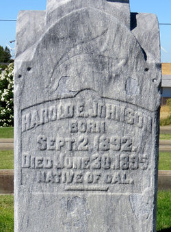
| Birth | : | 2 Sep 1892 Isleton, Sacramento County, California, USA |
| Death | : | 30 Jun 1895 Sacramento County, California, USA |
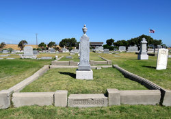
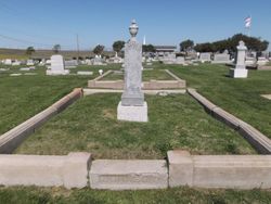
| Burial | : | Old Garber Cemetery, Garber, Clayton County, USA |
| Coordinate | : | 42.7560005, -91.2580032 |
| Plot | : | Sec 1, Lot 32, Grave 6 |
| Inscription | : | NATIVE OF CAL. |
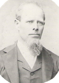
| Description | : | Son of John Johnson & Mary (Peterson) Johnson. Brother of Esther (Johnson) Brown. Half Brother of John Henry Johnson, Hilda (Johnson) Davis & Christopher A. Johnson. Resident of Grand Island Township, CA. Harold Johnson was buried, in the plot noted, on July 6, 1895, per Rio Vista Cemetery burial records. |
frequently asked questions (FAQ):
-
Where is Harold Edwin Johnson's memorial?
Harold Edwin Johnson's memorial is located at: Old Garber Cemetery, Garber, Clayton County, USA.
-
When did Harold Edwin Johnson death?
Harold Edwin Johnson death on 30 Jun 1895 in Sacramento County, California, USA
-
Where are the coordinates of the Harold Edwin Johnson's memorial?
Latitude: 42.7560005
Longitude: -91.2580032
Family Members:
Parent
Siblings
Flowers:
Nearby Cemetories:
1. Old Garber Cemetery
Garber, Clayton County, USA
Coordinate: 42.7560005, -91.2580032
2. Immanuel Lutheran Cemetery
Elkport, Clayton County, USA
Coordinate: 42.7433014, -91.2733002
3. Saint Michaels Cemetery
Elkport, Clayton County, USA
Coordinate: 42.7433014, -91.2733002
4. Mount Harmony Cemetery
Elkport, Clayton County, USA
Coordinate: 42.7181015, -91.2799988
5. Saint Paula Cemetery
Osterdock, Clayton County, USA
Coordinate: 42.7635994, -91.1992035
6. Krumm Cemetery
Garber, Clayton County, USA
Coordinate: 42.7913760, -91.3023559
7. Hansel Cemetery
Mallory Township, Clayton County, USA
Coordinate: 42.7066994, -91.2433014
8. Storck Cemetery
Guttenberg, Clayton County, USA
Coordinate: 42.7694335, -91.1834638
9. Lewis Cemetery
Osterdock, Clayton County, USA
Coordinate: 42.7416000, -91.1834000
10. Musfeldt Cemetery
Littleport, Clayton County, USA
Coordinate: 42.7402992, -91.3339005
11. Blanchaine Cemetery
Volga, Clayton County, USA
Coordinate: 42.7676210, -91.3389040
12. Eberhard Cemetery
Littleport, Clayton County, USA
Coordinate: 42.7583201, -91.3418020
13. Asbury Cemetery
Elkport, Clayton County, USA
Coordinate: 42.7106018, -91.3202972
14. Saint Michael Cemetery
Clayton County, USA
Coordinate: 42.8055992, -91.1802979
15. McClelland Cemetery
Garnavillo, Clayton County, USA
Coordinate: 42.8249879, -91.2084641
16. Communia Cemetery
Volga Township, Clayton County, USA
Coordinate: 42.7868996, -91.3630981
17. Bethel Cemetery
Osterdock, Clayton County, USA
Coordinate: 42.7041702, -91.1688919
18. Pioneer Rock Cemetery
Ceres, Clayton County, USA
Coordinate: 42.8230591, -91.1863937
19. Meenan Cemetery
Communia, Clayton County, USA
Coordinate: 42.7999862, -91.3584693
20. Sacred Heart Cemetery
Littleport, Clayton County, USA
Coordinate: 42.7425003, -91.3747025
21. Elk Creek Cemetery
Elk Township, Clayton County, USA
Coordinate: 42.6711006, -91.2897034
22. Union Cemetery
Littleport, Clayton County, USA
Coordinate: 42.7388992, -91.3780975
23. Saint Marys Cemetery
Guttenberg, Clayton County, USA
Coordinate: 42.7691994, -91.1352997
24. Ebenezer Cemetery
Elk Township, Clayton County, USA
Coordinate: 42.6782990, -91.3249969

