
| Memorials | : | 139 |
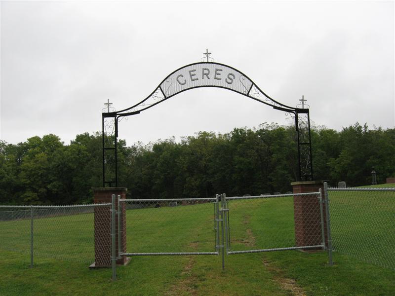
| Location | : | Ceres, Clayton County, USA |
| Coordinate | : | 42.8230591, -91.1863937 |
| Description | : | Located in Ceres, Section 34, NW/SW, Garnavillo Township. The cemetery is approximately 4.2 miles south of Garnavillo and approximately 6 miles north of Guttenberg, on Highway 52, a short distance west of the intersection of Highway 52 and Kale Ave. |
frequently asked questions (FAQ):
-
Where is Pioneer Rock Cemetery?
Pioneer Rock Cemetery is located at Ceres, Clayton County ,Iowa ,USA.
-
Pioneer Rock Cemetery cemetery's updated grave count on graveviews.com?
139 memorials
-
Where are the coordinates of the Pioneer Rock Cemetery?
Latitude: 42.8230591
Longitude: -91.1863937

Nearby Cemetories:
1. McClelland Cemetery
Garnavillo, Clayton County, USA
Coordinate: 42.8249879, -91.2084641
2. Saint Michael Cemetery
Clayton County, USA
Coordinate: 42.8055992, -91.1802979
3. Borcherding Cemetery
Jefferson Township, Clayton County, USA
Coordinate: 42.8182983, -91.1414032
4. Tangeman Family Cemetery
Garnavillo, Clayton County, USA
Coordinate: 42.8580000, -91.1420000
5. Storck Cemetery
Guttenberg, Clayton County, USA
Coordinate: 42.7694335, -91.1834638
6. Garnavillo Cemetery
Garnavillo, Clayton County, USA
Coordinate: 42.8660300, -91.2390100
7. Garnavillo Community Cemetery
Garnavillo, Clayton County, USA
Coordinate: 42.8656000, -91.2422100
8. Saint Paula Cemetery
Osterdock, Clayton County, USA
Coordinate: 42.7635994, -91.1992035
9. Saint Joseph Cemetery
Garnavillo, Clayton County, USA
Coordinate: 42.8628006, -91.2502975
10. Saint Marys Cemetery
Guttenberg, Clayton County, USA
Coordinate: 42.7691994, -91.1352997
11. Mount Olivet Cemetery
Guttenberg, Clayton County, USA
Coordinate: 42.7764840, -91.1083560
12. Guttenberg Cemetery
Guttenberg, Clayton County, USA
Coordinate: 42.7691994, -91.1035995
13. Lewis Cemetery
Osterdock, Clayton County, USA
Coordinate: 42.7416000, -91.1834000
14. Clayton Cemetery
Clayton, Clayton County, USA
Coordinate: 42.9043999, -91.1641998
15. Duncan Cemetery
Glen Haven, Grant County, USA
Coordinate: 42.8325540, -91.0725940
16. Old Garber Cemetery
Garber, Clayton County, USA
Coordinate: 42.7560005, -91.2580032
17. Old Saint Marys Cemetery
Glen Haven, Grant County, USA
Coordinate: 42.8078100, -91.0675330
18. Krumm Cemetery
Garber, Clayton County, USA
Coordinate: 42.7913760, -91.3023559
19. Saint Johns Cemetery
Jefferson Township, Clayton County, USA
Coordinate: 42.7497000, -91.1133000
20. Immanuel Lutheran Cemetery
Elkport, Clayton County, USA
Coordinate: 42.7433014, -91.2733002
21. Saint Michaels Cemetery
Elkport, Clayton County, USA
Coordinate: 42.7433014, -91.2733002
22. Bagley Cemetery
Bagley, Grant County, USA
Coordinate: 42.9019012, -91.0907974
23. Gockel Cemetery
Glen Haven, Grant County, USA
Coordinate: 42.8224983, -91.0385971
24. Charlotte Cemetery
Glen Haven, Grant County, USA
Coordinate: 42.7933006, -91.0381012