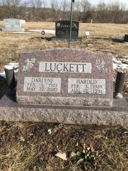
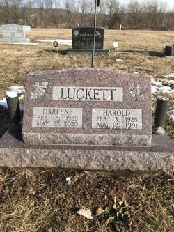
Harold Robert Luckett
| Birth | : | 3 Feb 1928 Truxton, Lincoln County, Missouri, USA |
| Death | : | 12 Aug 1991 Fort Madison, Lee County, Iowa, USA |
| Burial | : | Red Hill Cemetery, Utica, Daviess County, USA |
| Coordinate | : | 37.6165300, -87.0424000 |
| Description | : | Harold R. Luckett, 63, of 2715 Avenue N, Fort Madison, died at 9:35 a.m. Monday, August 12, 1991 at Fort Madison Community Hospital. Born Feb. 3, 1928 in Truxton, MO, he was the son of Marion and Kathryn Schultz Luckett. He married Darlene Fine Feb. 27, 1954 in Keosauqua. He was employed with Burlington Railroad, retiring with 33 years of service. He was as member of the First United Penecostal Church, Ft. Madison. Survivors include his wife; one son, Robert Luckett, Burlington; one daughter, Donna Fitzgibbon, West Burlington; one stepson, Rick McGlothlin, LaMont, MO; one stepdaughter, Sharon Harris, New London; one... Read More |
frequently asked questions (FAQ):
-
Where is Harold Robert Luckett's memorial?
Harold Robert Luckett's memorial is located at: Red Hill Cemetery, Utica, Daviess County, USA.
-
When did Harold Robert Luckett death?
Harold Robert Luckett death on 12 Aug 1991 in Fort Madison, Lee County, Iowa, USA
-
Where are the coordinates of the Harold Robert Luckett's memorial?
Latitude: 37.6165300
Longitude: -87.0424000
Family Members:
Parent
Spouse
Siblings
Flowers:
Nearby Cemetories:
1. Red Hill Cemetery
Utica, Daviess County, USA
Coordinate: 37.6165300, -87.0424000
2. Green Brier Cemetery
Utica, Daviess County, USA
Coordinate: 37.5802900, -87.0578900
3. Pleasant Point Baptist Cemetery
Pleasant Ridge, Daviess County, USA
Coordinate: 37.6095600, -86.9947000
4. Bethlehem Baptist Cemetery
Utica, Daviess County, USA
Coordinate: 37.6066000, -87.0986200
5. Masonville United Methodist Church Cemetery
Masonville, Daviess County, USA
Coordinate: 37.6716900, -87.0358700
6. Trunnell Family Cemetery
Browns Valley, Daviess County, USA
Coordinate: 37.6320700, -87.1150200
7. Utica Baptist Church Cemetery
Utica, Daviess County, USA
Coordinate: 37.6021300, -87.1182400
8. Mobberly Cemetery
Masonville, Daviess County, USA
Coordinate: 37.6778000, -87.0204600
9. Saint Anthony Church Cemetery
Browns Valley, Daviess County, USA
Coordinate: 37.6431300, -87.1157100
10. Graves Family Cemetery
Ohio County, USA
Coordinate: 37.5919912, -86.9651932
11. Jackson Cemetery
Masonville, Daviess County, USA
Coordinate: 37.6397018, -86.9593964
12. New Bethel Cemetery
Heflin, Ohio County, USA
Coordinate: 37.5448300, -87.0274600
13. Hix Cemetery
Pettit, Daviess County, USA
Coordinate: 37.6716995, -87.1085968
14. Hix Cemetery
Sutherland, Daviess County, USA
Coordinate: 37.6716580, -87.1088040
15. Friendship Baptist Church Cemetery
Philpot, Daviess County, USA
Coordinate: 37.6520600, -86.9565100
16. Mount Carmel Cemetery
Buford, Ohio County, USA
Coordinate: 37.5540000, -86.9820000
17. Richardson Jones Cemetery
Habit, Daviess County, USA
Coordinate: 37.6865005, -86.9959030
18. McCormick Family Cemetery
Masonville, Daviess County, USA
Coordinate: 37.6967600, -87.0598830
19. Dodson-King Cemetery
Buford, Ohio County, USA
Coordinate: 37.5667000, -86.9558029
20. Underwood Family Cemetery
McLean County, USA
Coordinate: 37.5542412, -87.1169968
21. Bell's Run Cemetery
Bells Run, Ohio County, USA
Coordinate: 37.5929500, -86.9293900
22. Atherton Cemetery
McLean County, USA
Coordinate: 37.5382996, -87.1057968
23. Old Bells Run Cemetery
Bells Run, Ohio County, USA
Coordinate: 37.5937400, -86.9280300
24. Bethabara Baptist Church Cemetery
Habit, Daviess County, USA
Coordinate: 37.7033005, -86.9944000


