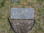
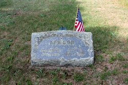
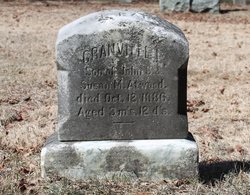
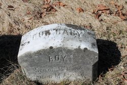
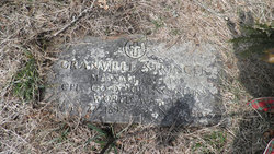
Harriet Ames “Hattie” Atwood Stringer/Snell
| Birth | : | 26 Jun 1871 Charlestown, Suffolk County, Massachusetts, USA |
| Death | : | 1953 Massachusetts, USA |
| Burial | : | Oak Grove Methodist Church Cemetery, Fruitland, Gibson County, USA |
| Coordinate | : | 35.8820900, -88.9653800 |
frequently asked questions (FAQ):
-
Where is Harriet Ames “Hattie” Atwood Stringer/Snell's memorial?
Harriet Ames “Hattie” Atwood Stringer/Snell's memorial is located at: Oak Grove Methodist Church Cemetery, Fruitland, Gibson County, USA.
-
When did Harriet Ames “Hattie” Atwood Stringer/Snell death?
Harriet Ames “Hattie” Atwood Stringer/Snell death on 1953 in Massachusetts, USA
-
Where are the coordinates of the Harriet Ames “Hattie” Atwood Stringer/Snell's memorial?
Latitude: 35.8820900
Longitude: -88.9653800
Family Members:
Parent
Spouse
Siblings
Children
Flowers:
Nearby Cemetories:
1. Oak Grove Methodist Church Cemetery
Fruitland, Gibson County, USA
Coordinate: 35.8820900, -88.9653800
2. Old Gibson Primitive Baptist Church Cemetery
Fruitland, Gibson County, USA
Coordinate: 35.8838570, -88.9709760
3. Smyrna Primitive Baptist Church Cemetery
Fruitland, Gibson County, USA
Coordinate: 35.8783530, -88.9786840
4. Jones Grove Cemetery
Humboldt, Gibson County, USA
Coordinate: 35.8796630, -88.9796610
5. Oak Grove MB Church Cemetery
Fruitland, Gibson County, USA
Coordinate: 35.8852000, -88.9885480
6. Smyrna Cemetery
Gibson County, USA
Coordinate: 35.8856010, -88.9891968
7. Center Baptist Church Cemetery
Edison, Gibson County, USA
Coordinate: 35.8953018, -88.9875870
8. Underwood Cemetery
Trenton, Gibson County, USA
Coordinate: 35.9069000, -88.9639000
9. Motley Cemetery
Gibson County, USA
Coordinate: 35.8535995, -88.9702988
10. Newhouse Cemetery
Gibson County, USA
Coordinate: 35.8466988, -88.9586029
11. McLeary Cemetery
Humboldt, Gibson County, USA
Coordinate: 35.8478012, -88.9499969
12. Wortham Cemetery
Christian Chapel, Gibson County, USA
Coordinate: 35.8791400, -89.0127300
13. Salem Missionary Baptist Church Cemetery
Humboldt, Gibson County, USA
Coordinate: 35.8814000, -88.9147000
14. Sharp Cemetery
Gibson County, USA
Coordinate: 35.9131012, -88.9308014
15. Follis Chapel Cemetery
Gibson County, USA
Coordinate: 35.9301200, -88.9962000
16. Old Shiloh Burying Ground
Fruitland, Gibson County, USA
Coordinate: 35.8684770, -88.8980490
17. James Cemetery
Coxville, Crockett County, USA
Coordinate: 35.8268170, -88.9797220
18. Jake's Cemetery
Trenton, Gibson County, USA
Coordinate: 35.9118220, -88.9029680
19. Porter Grove Baptist Church Cemetery
Coxville, Crockett County, USA
Coordinate: 35.8322080, -89.0034930
20. Jones Family Cemetery
Frog Jump, Gibson County, USA
Coordinate: 35.9322750, -89.0048020
21. Dial Cemetery
Humboldt, Gibson County, USA
Coordinate: 35.8698600, -89.0374100
22. New Shiloh United Methodist Cemetery
Humboldt, Gibson County, USA
Coordinate: 35.8668710, -88.8919400
23. Blakemore Cemetery
Humboldt, Gibson County, USA
Coordinate: 35.8229100, -88.9450790
24. McLeary-James Graveyard
Coxville, Crockett County, USA
Coordinate: 35.8252360, -88.9943360


