
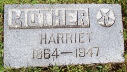
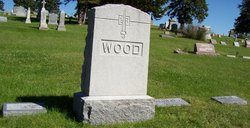
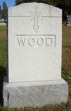
Harriet Elizabeth “Hattie” Montgomery Wood
| Birth | : | 3 Jan 1864 Monroe, Jasper County, Iowa, USA |
| Death | : | 21 Jan 1947 Stanton, Stanton County, Nebraska, USA |
| Burial | : | Stanton Cemetery, Stanton, Stanton County, USA |
| Coordinate | : | 41.9599991, -97.2121964 |
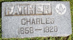
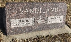
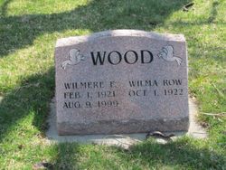
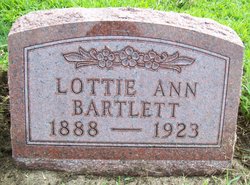
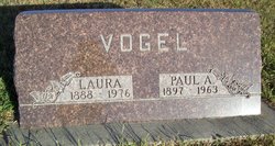
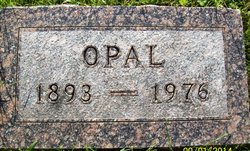
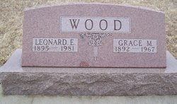
| Description | : | Harriet married Charles William Wood in 1882. Harriet and Charles are the parents of: Lulu Rilles Charles Calvin Walter S. Laura Jane Lottie Ann Effie May Orville Opal Leonard Elijah Verne Pearl E. Ruby B. |
frequently asked questions (FAQ):
-
Where is Harriet Elizabeth “Hattie” Montgomery Wood's memorial?
Harriet Elizabeth “Hattie” Montgomery Wood's memorial is located at: Stanton Cemetery, Stanton, Stanton County, USA.
-
When did Harriet Elizabeth “Hattie” Montgomery Wood death?
Harriet Elizabeth “Hattie” Montgomery Wood death on 21 Jan 1947 in Stanton, Stanton County, Nebraska, USA
-
Where are the coordinates of the Harriet Elizabeth “Hattie” Montgomery Wood's memorial?
Latitude: 41.9599991
Longitude: -97.2121964
Family Members:
Parent

Spouse
Siblings

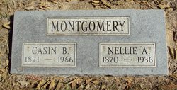
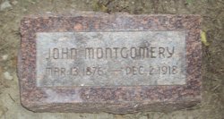
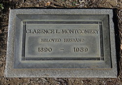
Children
Flowers:


Nearby Cemetories:
1. Stanton Cemetery
Stanton, Stanton County, USA
Coordinate: 41.9599991, -97.2121964
2. Zilmer Cemetery
Stanton, Stanton County, USA
Coordinate: 41.9464000, -97.2528000
3. Belz Cemetery
Stanton, Stanton County, USA
Coordinate: 41.9528008, -97.2619019
4. Koch Cemetery
Stanton County, USA
Coordinate: 41.9855995, -97.1731033
5. Zander Cemetery
Stanton County, USA
Coordinate: 41.9888992, -97.1750031
6. Hoosier Hollow Pioneer Cemetery
Stanton County, USA
Coordinate: 41.9900017, -97.2814026
7. Elkhorn Cemetery
Pilger, Stanton County, USA
Coordinate: 41.9899910, -97.1316720
8. Norwegian Cemetery
Stanton, Stanton County, USA
Coordinate: 41.9171600, -97.2907160
9. Bethlehem Cemetery
Stanton County, USA
Coordinate: 42.0332985, -97.2241974
10. Kuehn Cemetery
Pilger, Stanton County, USA
Coordinate: 41.9682000, -97.1049000
11. Erychleb Cemetery
Stanton County, USA
Coordinate: 41.8664017, -97.2138977
12. Bega Cemetery
Stanton County, USA
Coordinate: 42.0736008, -97.2343979
13. Muller Cemetery
Pilger, Stanton County, USA
Coordinate: 42.0780940, -97.1781920
14. Schwedt Cemetery
Pilger, Stanton County, USA
Coordinate: 41.9240000, -97.0480000
15. Pilger Cemetery
Pilger, Stanton County, USA
Coordinate: 42.0217018, -97.0591965
16. Zion Cemetery
Stanton County, USA
Coordinate: 42.0421982, -97.3638992
17. Christ Lutheran Cemetery
Stanton County, USA
Coordinate: 42.0433006, -97.3636017
18. Norfolk State Hospital New Cemetery
Norfolk, Madison County, USA
Coordinate: 42.0475500, -97.3698300
19. Spring Branch Cemetery
Spring Branch Township, Stanton County, USA
Coordinate: 42.0789400, -97.3297400
20. Saint Matthews Lutheran Cemetery
Wisner, Cuming County, USA
Coordinate: 41.9175000, -97.0189000
21. Norfolk State Hospital Old Cemetery
Norfolk, Madison County, USA
Coordinate: 42.0535400, -97.3733100
22. Pleasant Valley Cemetery
Madison County, USA
Coordinate: 41.8877983, -97.3972015
23. E U B Cemetery
Hoskins, Wayne County, USA
Coordinate: 42.1137900, -97.3015700
24. Trinity Cemetery
Hoskins, Wayne County, USA
Coordinate: 42.1055984, -97.3274994