
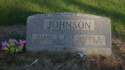
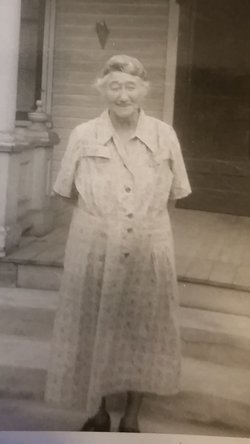
Harry E. Johnson
| Birth | : | 1 Dec 1877 Fulton County, Indiana, USA |
| Death | : | 26 May 1955 Fulton County, Indiana, USA |
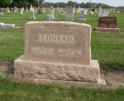
| Burial | : | St. Nicholas' Churchyard, Liverpool, Metropolitan Borough of Liverpool, England |
| Coordinate | : | 53.4069350, -2.9951480 |
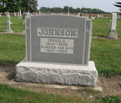
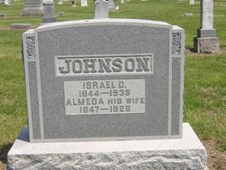
| Description | : | OBITUARY The Rochester Sentinel Friday, May 27, 1955 Harry G. JOHNSON, 77, Athens, died at noon Thursday in the Yocum nursing home this city. He had been seriously ill for the past six weeks. Practically all his life had been spent in the Athens community with the exception of 15 years' residency at Peru. He was born Dec. 1, 1877, on a farm near Millark. His parents were Israel and Almeda (ZARTMAN) JOHNSON. In 1899, he was married to Orpha MASTELLER. Mr. Johnson was a member of the I.O.O.F. lodge of Peru. Survivors are his wife, at home, and several nieces and nephews. Funeral services will... Read More |
frequently asked questions (FAQ):
-
Where is Harry E. Johnson's memorial?
Harry E. Johnson's memorial is located at: St. Nicholas' Churchyard, Liverpool, Metropolitan Borough of Liverpool, England.
-
When did Harry E. Johnson death?
Harry E. Johnson death on 26 May 1955 in Fulton County, Indiana, USA
-
Where are the coordinates of the Harry E. Johnson's memorial?
Latitude: 53.4069350
Longitude: -2.9951480
Family Members:
Parent
Siblings
Flowers:


Nearby Cemetories:
1. St. Nicholas' Churchyard
Liverpool, Metropolitan Borough of Liverpool, England
Coordinate: 53.4069350, -2.9951480
2. Liverpool Naval Memorial
Liverpool, Metropolitan Borough of Liverpool, England
Coordinate: 53.4061220, -2.9981050
3. St. Paul's Churchyard
Liverpool, Metropolitan Borough of Liverpool, England
Coordinate: 53.4099460, -2.9919370
4. St. George's Churchyard
Liverpool, Metropolitan Borough of Liverpool, England
Coordinate: 53.4049700, -2.9901030
5. St. Peter's Churchyard
Liverpool, Metropolitan Borough of Liverpool, England
Coordinate: 53.4051290, -2.9844200
6. St. Thomas Churchyard
Liverpool, Metropolitan Borough of Liverpool, England
Coordinate: 53.4010330, -2.9861190
7. St. John's Garden
Liverpool, Metropolitan Borough of Liverpool, England
Coordinate: 53.4087890, -2.9810070
8. Friends Burial Ground (Defunct)
Liverpool, Metropolitan Borough of Liverpool, England
Coordinate: 53.4111670, -2.9795830
9. Roscoe Memorial Gardens
Liverpool, Metropolitan Borough of Liverpool, England
Coordinate: 53.4044040, -2.9762180
10. Holy Trinity Churchyard
Liverpool, Metropolitan Borough of Liverpool, England
Coordinate: 53.4117490, -2.9759560
11. St. Anne's Churchyard
Liverpool, Metropolitan Borough of Liverpool, England
Coordinate: 53.4149050, -2.9782840
12. St. Michaels Churchyard
Liverpool, Metropolitan Borough of Liverpool, England
Coordinate: 53.3976599, -2.9789353
13. St. Andrew’s Churchyard
Liverpool, Metropolitan Borough of Liverpool, England
Coordinate: 53.4029730, -2.9726820
14. St Philip Graveyard
Liverpool, Metropolitan Borough of Liverpool, England
Coordinate: 53.4019240, -2.9719920
15. St Martin-in-the-Fields Churchyard
Liverpool, Metropolitan Borough of Liverpool, England
Coordinate: 53.4210110, -2.9877860
16. Metropolitan Cathedral of Christ the King
Liverpool, Metropolitan Borough of Liverpool, England
Coordinate: 53.4052820, -2.9685940
17. Liverpool Cathedral
Liverpool, Metropolitan Borough of Liverpool, England
Coordinate: 53.3974310, -2.9731610
18. Brunswick Chapel
Liverpool, Metropolitan Borough of Liverpool, England
Coordinate: 53.4111280, -2.9675500
19. St Mary’s Parochial Cemetery
Liverpool, Metropolitan Borough of Liverpool, England
Coordinate: 53.4024370, -2.9672760
20. St. James Churchyard
Toxteth, Metropolitan Borough of Liverpool, England
Coordinate: 53.3943720, -2.9750688
21. St. Anthony's Churchyard
Liverpool, Metropolitan Borough of Liverpool, England
Coordinate: 53.4223190, -2.9815350
22. St James Garden Cemetery
Liverpool, Metropolitan Borough of Liverpool, England
Coordinate: 53.3960744, -2.9715005
23. Wesleyan Methodist Chapel Graveyard
Liverpool, Metropolitan Borough of Liverpool, England
Coordinate: 53.3940590, -2.9719160
24. St. Mary's Churchyard
Birkenhead, Metropolitan Borough of Wirral, England
Coordinate: 53.3895930, -3.0112520