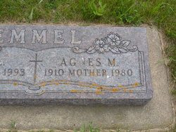
| Birth | : | 27 Jan 1905 Renville County, North Dakota, USA |
| Death | : | 21 Oct 2002 Kenmare, Ward County, North Dakota, USA |
| Burial | : | Uniontown Church of God Cemetery, Uniontown, Carroll County, USA |
| Coordinate | : | 39.5950012, -77.1194000 |
| Plot | : | Lot 160, Plot 3 |
frequently asked questions (FAQ):
-
Where is Harry W. “Hap” Johnson's memorial?
Harry W. “Hap” Johnson's memorial is located at: Uniontown Church of God Cemetery, Uniontown, Carroll County, USA.
-
When did Harry W. “Hap” Johnson death?
Harry W. “Hap” Johnson death on 21 Oct 2002 in Kenmare, Ward County, North Dakota, USA
-
Where are the coordinates of the Harry W. “Hap” Johnson's memorial?
Latitude: 39.5950012
Longitude: -77.1194000
Family Members:
Parent
Spouse
Siblings
Children
Flowers:
Nearby Cemetories:
1. Uniontown Church of God Cemetery
Uniontown, Carroll County, USA
Coordinate: 39.5950012, -77.1194000
2. Saint Pauls Lutheran Cemetery
Uniontown, Carroll County, USA
Coordinate: 39.5929222, -77.1208191
3. Mount Joy Cemetery
Carroll County, USA
Coordinate: 39.5922012, -77.1216965
4. Uniontown Methodist Cemetery
Uniontown, Carroll County, USA
Coordinate: 39.5940666, -77.1104202
5. Pipe Creek Church of the Brethren Cemetery
Union Bridge, Carroll County, USA
Coordinate: 39.5770721, -77.1260910
6. Stong Family Cemetery
Union Bridge, Carroll County, USA
Coordinate: 39.5901520, -77.1474440
7. Emmanuel Baust Church Cemetery
Westminster, Carroll County, USA
Coordinate: 39.6215400, -77.1002700
8. Saint Lukes Lutheran Church Cemetery
New Windsor, Carroll County, USA
Coordinate: 39.5572014, -77.1239014
9. Frizzellburg Bible Church Cemetery
Frizzellburg, Carroll County, USA
Coordinate: 39.6049900, -77.0645500
10. Mount Union Lutheran Church Cemetery
Union Bridge, Carroll County, USA
Coordinate: 39.5957985, -77.1772003
11. John Nicholas Leister Family Cemetery
Westminster, Carroll County, USA
Coordinate: 39.5871700, -77.0578500
12. Mayberry First Church of God Cemetery
Mayberry, Carroll County, USA
Coordinate: 39.6417800, -77.0985300
13. Pipe Creek Friends Cemetery
Union Bridge, Carroll County, USA
Coordinate: 39.5634956, -77.1700058
14. New Windsor Presbyterian Church Cemetery
New Windsor, Carroll County, USA
Coordinate: 39.5421982, -77.1078033
15. Wolf Cemetery
Union Bridge, Carroll County, USA
Coordinate: 39.5549800, -77.1656400
16. Mountain View Cemetery
Union Bridge, Carroll County, USA
Coordinate: 39.5639000, -77.1797028
17. Mount Pleasant United Methodist Cemetery
Taneytown, Carroll County, USA
Coordinate: 39.6455994, -77.1508026
18. Warehime Cemetery
Carroll County, USA
Coordinate: 39.5616989, -77.0516968
19. Pleasant Valley Cemetery
Pleasant Valley, Carroll County, USA
Coordinate: 39.6258500, -77.0494900
20. Cassell Cemetery
Westminster, Carroll County, USA
Coordinate: 39.5616600, -77.0511900
21. Saint James Cemetery
New Windsor, Carroll County, USA
Coordinate: 39.5304800, -77.1018000
22. Greenwood Church Cemetery
New Windsor, Carroll County, USA
Coordinate: 39.5283700, -77.1273600
23. Saint Pauls United Methodist Brick Chapel Cemetery
New Windsor, Carroll County, USA
Coordinate: 39.5411377, -77.0668106
24. Shriver Family Cemetery
Wakefield, Carroll County, USA
Coordinate: 39.5630200, -77.0410100


