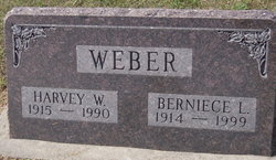
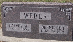
Harvey William Weber
| Birth | : | 29 Mar 1915 Otoe County, Nebraska, USA |
| Death | : | 25 Nov 1990 Nebraska City, Otoe County, Nebraska, USA |
| Burial | : | St. Swithin Churchyard, Bath, Bath and North East Somerset Unitary Authority, England |
| Coordinate | : | 51.3885480, -2.3594500 |
| Description | : | Harvey William Weber, 75, Nebraska City, died Sunday, Nov. 25 at his home. He was born March 29, 1915 in Otoe County, son-of Charles and Wilhelmina (Damme) Weber. He and Berniece Hansen were married Feb. 5, 1940 at Nebraska City. He lived at Cook and in the Talmage area before moving to Nebraska City. He was a retired farmer. Weber was a member of the Eagles Lodge in Nebraska City. Surviving are his wife, Berniece; a daughter, Mrs. Bruce (Faye) Merritt, Fairfax, Va., and a granddaughter, Elizabeth Merritt, Fairfax. He was preceded by his parents, six sisters and two brothers. The... Read More |
frequently asked questions (FAQ):
-
Where is Harvey William Weber's memorial?
Harvey William Weber's memorial is located at: St. Swithin Churchyard, Bath, Bath and North East Somerset Unitary Authority, England.
-
When did Harvey William Weber death?
Harvey William Weber death on 25 Nov 1990 in Nebraska City, Otoe County, Nebraska, USA
-
Where are the coordinates of the Harvey William Weber's memorial?
Latitude: 51.3885480
Longitude: -2.3594500
Family Members:
Parent
Spouse
Siblings
Children
Flowers:
Nearby Cemetories:
1. St. Swithin Churchyard
Bath, Bath and North East Somerset Unitary Authority, England
Coordinate: 51.3885480, -2.3594500
2. Walcot Methodist Chapel Burial Ground
Bath, Bath and North East Somerset Unitary Authority, England
Coordinate: 51.3897080, -2.3579610
3. St. John the Baptist Churchyard
Bathwick, Bath and North East Somerset Unitary Authority, England
Coordinate: 51.3886890, -2.3547030
4. St. Mary's Churchyard
Bathwick, Bath and North East Somerset Unitary Authority, England
Coordinate: 51.3876120, -2.3543540
5. St. Michael's Burial Ground
Bath, Bath and North East Somerset Unitary Authority, England
Coordinate: 51.3838810, -2.3594090
6. Ss Michael & Paul Churchyard
Bath, Bath and North East Somerset Unitary Authority, England
Coordinate: 51.3834970, -2.3596980
7. Independent Burial Ground Argyle Chapel
Bath, Bath and North East Somerset Unitary Authority, England
Coordinate: 51.3925420, -2.3536920
8. Bath General Hospital Burial Ground
Bath and North East Somerset Unitary Authority, England
Coordinate: 51.3824715, -2.3614742
9. Quaker Meeting House
Bath, Bath and North East Somerset Unitary Authority, England
Coordinate: 51.3823280, -2.3604380
10. St Mary's Chapel, Queens Square
Bath, Bath and North East Somerset Unitary Authority, England
Coordinate: 51.3827790, -2.3649790
11. Bath Abbey
Bath, Bath and North East Somerset Unitary Authority, England
Coordinate: 51.3815310, -2.3586640
12. St. Mary de Stall Churchyard (Defunct)
Bath, Bath and North East Somerset Unitary Authority, England
Coordinate: 51.3813350, -2.3600353
13. Old Orchard Street Catholic Burial Vault
Bath, Bath and North East Somerset Unitary Authority, England
Coordinate: 51.3800370, -2.3579910
14. St James Old Burial Ground
Bath, Bath and North East Somerset Unitary Authority, England
Coordinate: 51.3798600, -2.3610100
15. St Saviour's Church Crypt
Larkhall, Bath and North East Somerset Unitary Authority, England
Coordinate: 51.3956300, -2.3465100
16. St. James' Cemetery
Bath, Bath and North East Somerset Unitary Authority, England
Coordinate: 51.3802000, -2.3722200
17. Saint Mark's Churchyard
Widcombe, Bath and North East Somerset Unitary Authority, England
Coordinate: 51.3766660, -2.3588010
18. Baptist Burial Ground
Widcombe, Bath and North East Somerset Unitary Authority, England
Coordinate: 51.3764216, -2.3556947
19. Moravian Burial Ground
Bath, Bath and North East Somerset Unitary Authority, England
Coordinate: 51.3894150, -2.3798150
20. St Mary Magdalen Chapel
Widcombe, Bath and North East Somerset Unitary Authority, England
Coordinate: 51.3760486, -2.3643405
21. Old Baptist Burial Ground
Walcot, Bath and North East Somerset Unitary Authority, England
Coordinate: 51.3755070, -2.3544360
22. Abbey & St James' Graveyard for the Poor
Widcombe, Bath and North East Somerset Unitary Authority, England
Coordinate: 51.3753550, -2.3545640
23. St. Michael's Cemetery
Bath, Bath and North East Somerset Unitary Authority, England
Coordinate: 51.3859700, -2.3814500
24. Quaker Burial Ground
Widcombe, Bath and North East Somerset Unitary Authority, England
Coordinate: 51.3744350, -2.3498460

