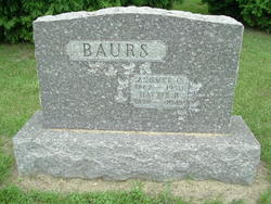
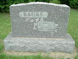
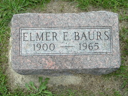
Hattie Bell Tooley Baurs
| Birth | : | 28 Aug 1874 Burlington, Calhoun County, Michigan, USA |
| Death | : | 29 Jan 1943 Battle Creek, Calhoun County, Michigan, USA |
| Burial | : | Winterton Cemetery, Winterton, North Lincolnshire Unitary Authority, England |
| Coordinate | : | 53.6548190, -0.5847270 |
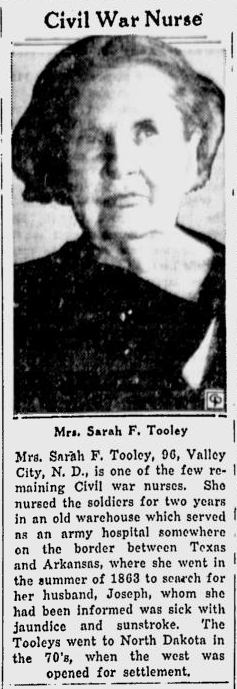
| Description | : | Hattie was born Hattie Bell Chapman parents were George H Chapman (George H Chapman (ID 20270748) and Sally Tooley. Her mother passed away soon after the birth of Hattie. Hattie's Siblings 1. Marguerite Chapman "Maggie" Chapman Brown (adopted by Joseph and Margaret "Tooley" Van Schoick (her Aunt)) 2. Jefferson Chapman 3. Jeddie C Chapman (foster parents Calvin and Emily Mann) 4. Minnie M Chapman (adopted by Augustus R Randall and Katharine Ann "Tooley" Randall(aunt)) Children from Father's second marriage 1. Orlie Roy Chapman 2. Jay Chapman 3. Lola Chapman 4. Lela Chapman Joseph W Tooley, Margaret... Read More |
frequently asked questions (FAQ):
-
Where is Hattie Bell Tooley Baurs's memorial?
Hattie Bell Tooley Baurs's memorial is located at: Winterton Cemetery, Winterton, North Lincolnshire Unitary Authority, England.
-
When did Hattie Bell Tooley Baurs death?
Hattie Bell Tooley Baurs death on 29 Jan 1943 in Battle Creek, Calhoun County, Michigan, USA
-
Where are the coordinates of the Hattie Bell Tooley Baurs's memorial?
Latitude: 53.6548190
Longitude: -0.5847270
Family Members:
Parent
Spouse
Siblings
Children
Flowers:
Nearby Cemetories:
1. Winterton Cemetery
Winterton, North Lincolnshire Unitary Authority, England
Coordinate: 53.6548190, -0.5847270
2. All Saints Churchyard
Winterton, North Lincolnshire Unitary Authority, England
Coordinate: 53.6555710, -0.5968640
3. St Bartholomew's Church
Appleby, North Lincolnshire Unitary Authority, England
Coordinate: 53.6234280, -0.5603240
4. All Saints Churchyard
Winteringham, North Lincolnshire Unitary Authority, England
Coordinate: 53.6902800, -0.6010700
5. All Saints Churchyard
Winteringham, North Lincolnshire Unitary Authority, England
Coordinate: 53.6904182, -0.6010190
6. St Maurice Churchyard
Horkstow, North Lincolnshire Unitary Authority, England
Coordinate: 53.6512040, -0.5079660
7. St Nicholas Churchyard
South Ferriby, North Lincolnshire Unitary Authority, England
Coordinate: 53.6746420, -0.5051450
8. All Saints' Churchyard
Saxby-All-Saints, North Lincolnshire Unitary Authority, England
Coordinate: 53.6372500, -0.5010260
9. Alkborough Cemetery
Alkborough, North Lincolnshire Unitary Authority, England
Coordinate: 53.6816460, -0.6686090
10. St Andrew's Church
Burton upon Stather, North Lincolnshire Unitary Authority, England
Coordinate: 53.6501180, -0.6850550
11. St John the Baptist
Whitton, North Lincolnshire Unitary Authority, England
Coordinate: 53.7093390, -0.6342340
12. All Saints' Churchyard
Flixborough, North Lincolnshire Unitary Authority, England
Coordinate: 53.6247100, -0.6819480
13. All Saints Churchyard Old
Flixborough, North Lincolnshire Unitary Authority, England
Coordinate: 53.6178950, -0.6754930
14. St Andrew Churchyard
Bonby, North Lincolnshire Unitary Authority, England
Coordinate: 53.6266000, -0.4838000
15. Scunthorpe Cemetery
Scunthorpe, North Lincolnshire Unitary Authority, England
Coordinate: 53.5932400, -0.6512140
16. Crosby Cemetery
Scunthorpe, North Lincolnshire Unitary Authority, England
Coordinate: 53.5978800, -0.6639600
17. St Mary the Virgin Church
Fockerby, North Lincolnshire Unitary Authority, England
Coordinate: 53.6613050, -0.7138730
18. Welton Church Cemetery
Brough, East Riding of Yorkshire Unitary Authority, England
Coordinate: 53.7297800, -0.5514800
19. St Lawrence Churchyard
Scunthorpe, North Lincolnshire Unitary Authority, England
Coordinate: 53.5864180, -0.6554010
20. St. Clement's Churchyard
Worlaby, North Lincolnshire Unitary Authority, England
Coordinate: 53.6129220, -0.4667760
21. St Marks Church
Amcotts, North Lincolnshire Unitary Authority, England
Coordinate: 53.6166950, -0.7088900
22. Brumby Cemetery
Scunthorpe, North Lincolnshire Unitary Authority, England
Coordinate: 53.5799400, -0.6448700
23. Broughton Cemetery
Broughton, North Lincolnshire Unitary Authority, England
Coordinate: 53.5732500, -0.5582900
24. All Saints Churchyard
Adlingfleet, East Riding of Yorkshire Unitary Authority, England
Coordinate: 53.6786760, -0.7238110

