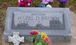
Hazel Dell Thornberry Brown
| Birth | : | 7 Jul 1900 Mount Vernon, Lawrence County, Missouri, USA |
| Death | : | 16 Nov 1969 Republican City, Harlan County, Nebraska, USA |
| Burial | : | Republican City Cemetery, Republican City, Harlan County, USA |
| Coordinate | : | 40.0905991, -99.2605972 |
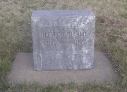
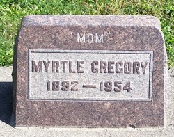
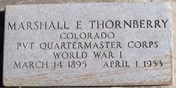
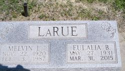
| Description | : | Hazel was born to Andrew Marion Thornberry and Mahala Jane Blanchard at Mt. Vernon, Lawrence, MO. She was one of eight children. As a child she moved with her family to Natoma, KS. It was here she received her schooling and grew to young womanhood. On Dec. 29th, 1926 she was married to Alfred Franklin Brown, at Smith Center, KS. Two children were born to this marriage, Eulalia Bettina Brown b. 1931 and Leonard Leon Brown b. 1935. After their marriage they farmed south of Woodston, KS for a few years and then moved to Hotchkiss, Co.where her sisters, Myrtle Grace Gregory... Read More |
frequently asked questions (FAQ):
-
Where is Hazel Dell Thornberry Brown's memorial?
Hazel Dell Thornberry Brown's memorial is located at: Republican City Cemetery, Republican City, Harlan County, USA.
-
When did Hazel Dell Thornberry Brown death?
Hazel Dell Thornberry Brown death on 16 Nov 1969 in Republican City, Harlan County, Nebraska, USA
-
Where are the coordinates of the Hazel Dell Thornberry Brown's memorial?
Latitude: 40.0905991
Longitude: -99.2605972
Family Members:
Parent
Spouse
Siblings
Children
Flowers:
Nearby Cemetories:
1. Republican City Cemetery
Republican City, Harlan County, USA
Coordinate: 40.0905991, -99.2605972
2. Saint Pauls Lutheran Cemetery
Republican City, Harlan County, USA
Coordinate: 40.1467700, -99.2185200
3. Saint Joseph Catholic Cemetery
Alma, Harlan County, USA
Coordinate: 40.1091156, -99.3494151
4. Alma Cemetery
Alma, Harlan County, USA
Coordinate: 40.1094322, -99.3493881
5. Naponee Cemetery
Naponee, Franklin County, USA
Coordinate: 40.0783997, -99.1456985
6. Pleasant Ridge Cemetery
Phillipsburg, Phillips County, USA
Coordinate: 39.9871500, -99.2575370
7. Chapman Cemetery
Woodruff, Phillips County, USA
Coordinate: 39.9930992, -99.1782990
8. Mount Zion Cemetery
Harlan County, USA
Coordinate: 40.2052200, -99.2364300
9. Huntley Zion Cemetery
Huntley, Harlan County, USA
Coordinate: 40.2057550, -99.2360690
10. Hoyt Cemetery
Orleans, Harlan County, USA
Coordinate: 40.1330190, -99.4316340
11. Orleans Cemetery
Orleans, Harlan County, USA
Coordinate: 40.1330000, -99.4436700
12. Calvary Cemetery
Orleans, Harlan County, USA
Coordinate: 40.1377983, -99.4421997
13. Bainbridge Cemetery
Huntley, Harlan County, USA
Coordinate: 40.2338982, -99.3143997
14. Haskett Cemetery
Phillips County, USA
Coordinate: 39.9696860, -99.1234470
15. Maple Grove Cemetery
Bloomington, Franklin County, USA
Coordinate: 40.1018791, -99.0402832
16. Woodruff Cemetery
Woodruff, Phillips County, USA
Coordinate: 39.9869003, -99.4356003
17. Mount Olive Cemetery
Kensington, Smith County, USA
Coordinate: 40.0014000, -99.0658035
18. Bailey Cemetery
Franklin County, USA
Coordinate: 40.1828003, -99.0342026
19. Lennemann Cemetery
Orleans, Harlan County, USA
Coordinate: 40.1757800, -99.4988700
20. Moline Cemetery
Hildreth, Franklin County, USA
Coordinate: 40.2630000, -99.1208000
21. Greenwood Township Cemetery
Phillipsburg, Phillips County, USA
Coordinate: 39.8863983, -99.2403030
22. Matteson Cemetery
Agra, Phillips County, USA
Coordinate: 39.8866800, -99.1606600
23. Freewater Cemetery
Ragan, Harlan County, USA
Coordinate: 40.3083000, -99.2071991
24. Homfeld Family Cemetery
Orleans, Harlan County, USA
Coordinate: 40.1658300, -99.5372300

