
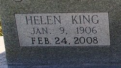
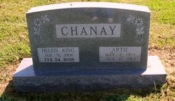
Helen Clarissa King Chanay
| Birth | : | 9 Jan 1906 Vinland, Douglas County, Kansas, USA |
| Death | : | 24 Feb 2008 Ottawa, Franklin County, Kansas, USA |
| Burial | : | Vinland Cemetery, Vinland, Douglas County, USA |
| Coordinate | : | 38.8485985, -95.1763992 |
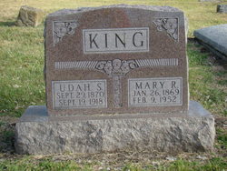
| Description | : | Funeral services for Helen Clarissa King Chanay, 102, Wellsville, will be 10 a.m. Thursday at Wellsville Baptist Church. Burial will follow in Vinland Cemetery. Mrs. Chanay died Sunday, Feb. 24, 2008, at Ottawa Retirement Village. She was born Jan. 9, 1906, in Vinland, the daughter of Udah and Mary Rodgers King. She grew up and attended school in Vinland. She graduated from high school in 1924. She attended Emporia Teachers College and Kansas University. Mrs. Chanay taught at Coal Creek Elementary School near Vinland and Linwood Elementary School. She and her husband owned and operated Chanay Truck Line for more than 30... Read More |
frequently asked questions (FAQ):
-
Where is Helen Clarissa King Chanay's memorial?
Helen Clarissa King Chanay's memorial is located at: Vinland Cemetery, Vinland, Douglas County, USA.
-
When did Helen Clarissa King Chanay death?
Helen Clarissa King Chanay death on 24 Feb 2008 in Ottawa, Franklin County, Kansas, USA
-
Where are the coordinates of the Helen Clarissa King Chanay's memorial?
Latitude: 38.8485985
Longitude: -95.1763992
Family Members:
Parent

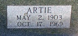
Spouse
Siblings

Children
Flowers:


Nearby Cemetories:
1. Stony Point Cemetery
Vinland, Douglas County, USA
Coordinate: 38.8249512, -95.2107391
2. Dow Cemetery
Vinland, Douglas County, USA
Coordinate: 38.8186620, -95.2143000
3. Brumbaugh Cemetery
Douglas County, USA
Coordinate: 38.8319200, -95.2330100
4. Breeze Family Cemetery
Pleasant Grove, Douglas County, USA
Coordinate: 38.8472800, -95.2480400
5. Blue Mound Cemetery
Lawrence, Douglas County, USA
Coordinate: 38.9046600, -95.1865400
6. Ulrich Cemetery
Pleasant Grove, Douglas County, USA
Coordinate: 38.8395740, -95.2531810
7. Clearfield Cemetery
Clearfield, Douglas County, USA
Coordinate: 38.8260002, -95.0930023
8. County Poor Farm Cemetery
Douglas County, USA
Coordinate: 38.9119400, -95.2214600
9. Richland Cemetery
Lawrence, Douglas County, USA
Coordinate: 38.8768997, -95.2630997
10. Kennedy Cemetery
Douglas County, USA
Coordinate: 38.9112900, -95.2269200
11. Marshall Cemetery
Douglas County, USA
Coordinate: 38.9040800, -95.2446700
12. Deay Cemetery
Eudora, Douglas County, USA
Coordinate: 38.8546486, -95.0749435
13. Oakwood Cemetery
Baldwin City, Douglas County, USA
Coordinate: 38.7694016, -95.1825027
14. Pleasant Hill Cemetery
Pleasant Grove, Douglas County, USA
Coordinate: 38.8535995, -95.2794037
15. Prairie City Cemetery
Baldwin City, Douglas County, USA
Coordinate: 38.7689018, -95.2050018
16. Mount Calvary Cemetery
Baldwin City, Douglas County, USA
Coordinate: 38.7687988, -95.2049713
17. Miller Family Cemetery
Baldwin City, Douglas County, USA
Coordinate: 38.7688751, -95.2146683
18. Baldwin City Cemetery
Baldwin City, Douglas County, USA
Coordinate: 38.7612953, -95.1862869
19. Cemetery Beni Israel
Eudora, Douglas County, USA
Coordinate: 38.9280128, -95.1122208
20. Dutton Cemetery
Douglas County, USA
Coordinate: 38.8989800, -95.2790600
21. Black Jack Cemetery
Douglas County, USA
Coordinate: 38.7660400, -95.1159400
22. Franklin Cemetery
Douglas County, USA
Coordinate: 38.9437523, -95.1869431
23. Haskell Cemetery
Lawrence, Douglas County, USA
Coordinate: 38.9353790, -95.2284241
24. Saint Johns Catholic Cemetery
Douglas County, USA
Coordinate: 38.9437900, -95.1919600