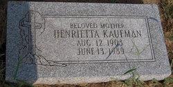
Henrietta Lamoine Schneider Kaufman
| Birth | : | 12 Aug 1903 Ithaca, Saunders County, Nebraska, USA |
| Death | : | 13 Jun 1989 Omaha, Douglas County, Nebraska, USA |
| Burial | : | Blain Cemetery, Cutlerville, Kent County, USA |
| Coordinate | : | 42.8414001, -85.6335983 |
| Plot | : | Section 2 Row 5 |
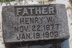
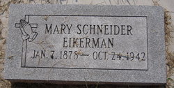
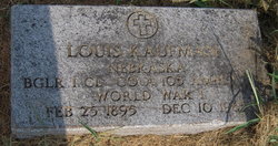
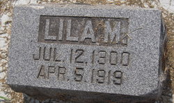
| Description | : | Henrietta was the daughter of Henry W & Mary (Schroeder) Schneider. She had a sister Lila. She married Louis Kaufman in 1923. They had one son. |
frequently asked questions (FAQ):
-
Where is Henrietta Lamoine Schneider Kaufman's memorial?
Henrietta Lamoine Schneider Kaufman's memorial is located at: Blain Cemetery, Cutlerville, Kent County, USA.
-
When did Henrietta Lamoine Schneider Kaufman death?
Henrietta Lamoine Schneider Kaufman death on 13 Jun 1989 in Omaha, Douglas County, Nebraska, USA
-
Where are the coordinates of the Henrietta Lamoine Schneider Kaufman's memorial?
Latitude: 42.8414001
Longitude: -85.6335983
Family Members:
Parent
Spouse
Siblings
Flowers:
Nearby Cemetories:
1. Blain Cemetery
Cutlerville, Kent County, USA
Coordinate: 42.8414001, -85.6335983
2. Pine Hill Cemetery
Kentwood, Kent County, USA
Coordinate: 42.8675003, -85.6363983
3. Dutton Cemetery
Dutton, Kent County, USA
Coordinate: 42.8366670, -85.5841670
4. Kent Memorial Gardens
Byron Center, Kent County, USA
Coordinate: 42.8356018, -85.6883011
5. Gaines Cemetery
Cutlerville, Kent County, USA
Coordinate: 42.7976036, -85.6240311
6. Holy Trinity Columbarium
Wyoming, Kent County, USA
Coordinate: 42.8669010, -85.6847490
7. Winchester Cemetery
Byron Center, Kent County, USA
Coordinate: 42.8246994, -85.6980972
8. Weaver Cemetery
Byron Township, Kent County, USA
Coordinate: 42.8041992, -85.6828003
9. Rest Lawn Memorial Park
Grand Rapids, Kent County, USA
Coordinate: 42.9007988, -85.6438980
10. Resurrection Cemetery
Wyoming, Kent County, USA
Coordinate: 42.8905983, -85.6819000
11. Maple Grove Cemetery
Kentwood, Kent County, USA
Coordinate: 42.9033300, -85.6203400
12. Oak Grove Cemetery
Grand Rapids, Kent County, USA
Coordinate: 42.9136009, -85.6314011
13. Sleepy Hollow Pet Cemetery and Crematory
Byron Center, Kent County, USA
Coordinate: 42.8477040, -85.7329940
14. Woodlawn Cemetery
Grand Rapids, Kent County, USA
Coordinate: 42.9160995, -85.6303024
15. Boynton Cemetery
Byron Center, Kent County, USA
Coordinate: 42.8377991, -85.7433014
16. Garfield Park Cemetery
Grand Rapids, Kent County, USA
Coordinate: 42.9221992, -85.6307983
17. Saint Marys Catholic Cemetery
Cascade Township, Kent County, USA
Coordinate: 42.8688890, -85.5283330
18. Holy Corners Cemetery
Caledonia, Kent County, USA
Coordinate: 42.8122220, -85.5272220
19. Chapel Hill Memorial Gardens
Cascade Township, Kent County, USA
Coordinate: 42.9089012, -85.5464020
20. Winegar Cemetery
Byron Center, Kent County, USA
Coordinate: 42.7933006, -85.7497025
21. Grace Episcopal Church Columbarium
Grand Rapids, Kent County, USA
Coordinate: 42.9413390, -85.6242730
22. Oakhill Cemetery
Grand Rapids, Kent County, USA
Coordinate: 42.9411011, -85.6517029
23. Teeple Cemetery (Defunct)
Cascade Township, Kent County, USA
Coordinate: 42.9134300, -85.5357790
24. Jones Cemetery
Dorr, Allegan County, USA
Coordinate: 42.7578011, -85.7130966

