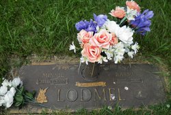
| Birth | : | 25 Apr 1906 Armour, Douglas County, South Dakota, USA |
| Death | : | 4 Feb 2012 Miller, Hand County, South Dakota, USA |
| Burial | : | St. George's Churchyard, Newcastle-under-Lyme, Newcastle-Under-Lyme Borough, England |
| Coordinate | : | 53.0141190, -2.2242070 |
| Description | : | Henrietta Shaw 1906-2012 (April 25, 1906 - February 4 2012) Henrietta (Heezen) Shaw, fondly known as "Sis" by her family and friends, died Saturday, Feb. 4, 2012 in Miller, S.D., at the age of 105. OBIT Shaw.psd Sis's funeral service will be 2 p.m. Thursday, Feb. 9 at the First Presbyterian Church in Miller with the Rev. Brian Jones officiating. Visitation will be Wednesday from 5 to 7 p.m. with a 7 p.m. prayer service, all at Rembold Funeral Home. Burial will be at G.A.R. Cemetery in Miller. Friends and family may sign Sis's online register at www.remboldfuneralhome.com. Sis was born April 25, 1906 in... Read More |
frequently asked questions (FAQ):
-
Where is Henrietta M. Heezen Shaw's memorial?
Henrietta M. Heezen Shaw's memorial is located at: St. George's Churchyard, Newcastle-under-Lyme, Newcastle-Under-Lyme Borough, England.
-
When did Henrietta M. Heezen Shaw death?
Henrietta M. Heezen Shaw death on 4 Feb 2012 in Miller, Hand County, South Dakota, USA
-
Where are the coordinates of the Henrietta M. Heezen Shaw's memorial?
Latitude: 53.0141190
Longitude: -2.2242070
Family Members:
Parent
Spouse
Siblings
Flowers:
Nearby Cemetories:
1. St. George's Churchyard
Newcastle-under-Lyme, Newcastle-Under-Lyme Borough, England
Coordinate: 53.0141190, -2.2242070
2. St. Giles' Churchyard
Newcastle-under-Lyme, Newcastle-Under-Lyme Borough, England
Coordinate: 53.0115110, -2.2301920
3. Newcastle Cemetery
Newcastle-under-Lyme, Newcastle-Under-Lyme Borough, England
Coordinate: 53.0062940, -2.2284440
4. Hartshill Cemetery
Hartshill, Stoke-on-Trent Unitary Authority, England
Coordinate: 53.0054283, -2.2035301
5. St Margaret Churchyard
Wolstanton, Newcastle-Under-Lyme Borough, England
Coordinate: 53.0296810, -2.2154990
6. Etruria Methodist Church
Stoke-on-Trent, Stoke-on-Trent Unitary Authority, England
Coordinate: 53.0209680, -2.1985840
7. Newcastle-Under-Lyme Knutton Cemetery
Newcastle-under-Lyme, Newcastle-Under-Lyme Borough, England
Coordinate: 53.0220500, -2.2495100
8. Silverdale Cemetery
Silverdale, Newcastle-Under-Lyme Borough, England
Coordinate: 53.0135400, -2.2559520
9. St Thomas the Apostle Churchyard
Penkhull, Stoke-on-Trent Unitary Authority, England
Coordinate: 53.0004170, -2.1964040
10. Hanley Cemetery
Hanley, Stoke-on-Trent Unitary Authority, England
Coordinate: 53.0143330, -2.1863120
11. Quakers Burial Ground
Stoke-on-Trent, Stoke-on-Trent Unitary Authority, England
Coordinate: 53.0052870, -2.1881570
12. St. Mark's Church Graveyard
Shelton, Stoke-on-Trent Unitary Authority, England
Coordinate: 53.0189000, -2.1820000
13. Chesterton Cemetery
Newcastle-under-Lyme, Newcastle-Under-Lyme Borough, England
Coordinate: 53.0352240, -2.2500500
14. St. Peter ad Vincula Churchyard
Stoke-on-Trent, Stoke-on-Trent Unitary Authority, England
Coordinate: 53.0041250, -2.1812460
15. St Luke the Evangelist Churchyard
Silverdale, Newcastle-Under-Lyme Borough, England
Coordinate: 53.0170300, -2.2736770
16. Sacred Heart Churchyard
Hanley, Stoke-on-Trent Unitary Authority, England
Coordinate: 53.0210590, -2.1737770
17. Holy Trinity Churchyard
Chesterton, Stratford-on-Avon District, England
Coordinate: 53.0418320, -2.2523770
18. St. John the Evangelist Churchyard
Hanley, Stoke-on-Trent Unitary Authority, England
Coordinate: 53.0280200, -2.1749590
19. St John the Baptist Churchyard
Burslem, Stoke-on-Trent Unitary Authority, England
Coordinate: 53.0425850, -2.1962510
20. Keele Cemetery
Keele, Newcastle-Under-Lyme Borough, England
Coordinate: 53.0087192, -2.2813113
21. St. Matthias Churchyard
Hanford, Stoke-on-Trent Unitary Authority, England
Coordinate: 52.9812170, -2.1962980
22. Holy Trinity Churchyard
Hanley, Stoke-on-Trent Unitary Authority, England
Coordinate: 53.0297350, -2.1672050
23. St John the Baptist Churchyard
Keele, Newcastle-Under-Lyme Borough, England
Coordinate: 53.0039410, -2.2848720
24. Britannia Stadium
Stoke-on-Trent, Stoke-on-Trent Unitary Authority, England
Coordinate: 52.9884070, -2.1754520


