
| Birth | : | 1798 Virginia, USA |
| Death | : | 1850 Stockton, San Joaquin County, California, USA |
| Burial | : | Stockton Rural Cemetery, Stockton, San Joaquin County, USA |
| Coordinate | : | 37.9794006, -121.2869034 |
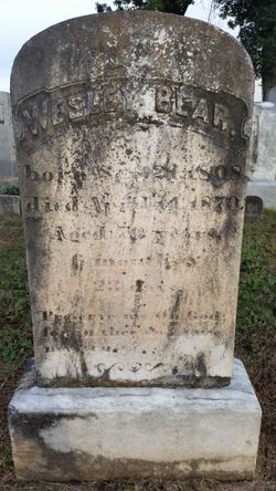
| Description | : | According to a Missouri Will & Probate Record for Cooper County, dated Aug. 25, 1852 & 1854, Henry Bear died in California (territory) during the gold rush in the year 1850. It is said he traveled there with his eldest son, James, but never obtained the gold riches he sought. He died in California of typhoid fever before he made it back home to his wife and family in Missouri. His son returned from the quest alone. Henry Bear Jr., was the son of Henry Bear, Sr. and Catherine Runkle. He married Jane Kennerly on... Read More |
frequently asked questions (FAQ):
-
Where is Henry Bear Jr.'s memorial?
Henry Bear Jr.'s memorial is located at: Stockton Rural Cemetery, Stockton, San Joaquin County, USA.
-
When did Henry Bear Jr. death?
Henry Bear Jr. death on 1850 in Stockton, San Joaquin County, California, USA
-
Where are the coordinates of the Henry Bear Jr.'s memorial?
Latitude: 37.9794006
Longitude: -121.2869034
Family Members:
Flowers:


Nearby Cemetories:
1. Stockton Rural Cemetery
Stockton, San Joaquin County, USA
Coordinate: 37.9794006, -121.2869034
2. Stockton Woodland Mausoleum
Stockton, San Joaquin County, USA
Coordinate: 37.9762400, -121.2878000
3. Casa Bonita Mausoleum
Stockton, San Joaquin County, USA
Coordinate: 37.9752340, -121.2877800
4. San Joaquin Catholic Cemetery
Stockton, San Joaquin County, USA
Coordinate: 37.9707830, -121.2850190
5. Stockton State Hospital Cemetery
Stockton, San Joaquin County, USA
Coordinate: 37.9663110, -121.2846850
6. Temple Israel Cemetery
Stockton, San Joaquin County, USA
Coordinate: 37.9640541, -121.2784348
7. Central United Methodist Church Columbarium
Stockton, San Joaquin County, USA
Coordinate: 37.9825710, -121.3078170
8. Thomas Lindsay Gravesite
San Joaquin County, USA
Coordinate: 37.9573110, -121.2918430
9. David Kelsey Gravesite
Stockton, San Joaquin County, USA
Coordinate: 37.9573110, -121.2918430
10. Citizens Cemetery
Stockton, San Joaquin County, USA
Coordinate: 37.9559410, -121.2769120
11. Chinese Cemetery
French Camp, San Joaquin County, USA
Coordinate: 37.8819962, -121.2805862
12. Congregation Adas Yeshuran of Stockton Cemetery
French Camp, San Joaquin County, USA
Coordinate: 37.8784065, -121.2740784
13. Congregation of Ahavas Achim Cemetery
French Camp, San Joaquin County, USA
Coordinate: 37.8778419, -121.2753067
14. Live Oak Cemetery
Lodi, San Joaquin County, USA
Coordinate: 38.0868760, -121.2874780
15. Cherokee Memorial Park
Lodi, San Joaquin County, USA
Coordinate: 38.1017303, -121.2585983
16. Park View Cemetery
Manteca, San Joaquin County, USA
Coordinate: 37.8617249, -121.2238312
17. Islamic Cemetery of California
Lodi, San Joaquin County, USA
Coordinate: 38.1091730, -121.2563590
18. Collegeville Cemetery
Collegeville, San Joaquin County, USA
Coordinate: 37.9044800, -121.1466141
19. Saint John The Baptist Episcopal Columbarium
Lodi, San Joaquin County, USA
Coordinate: 38.1213500, -121.3074400
20. Lodi Memorial Park and Cemetery
Lodi, San Joaquin County, USA
Coordinate: 38.1319008, -121.2455978
21. Linden Cemetery
Linden, San Joaquin County, USA
Coordinate: 38.0226707, -121.0889053
22. Woodbridge Masonic Cemetery
Woodbridge, San Joaquin County, USA
Coordinate: 38.1496506, -121.3016663
23. East Union Cemetery
Manteca, San Joaquin County, USA
Coordinate: 37.8114014, -121.2350006
24. Harmony Grove Cemetery
Lockeford, San Joaquin County, USA
Coordinate: 38.1478004, -121.1755981