
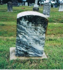
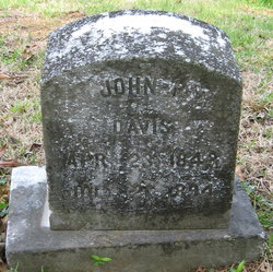
| Birth | : | 26 Apr 1817 Roane County, Tennessee, USA |
| Death | : | 13 Apr 1882 Bradley County, Tennessee, USA |
| Burial | : | Galien Township Cemetery, Galien, Berrien County, USA |
| Coordinate | : | 41.7975000, -86.4916660 |
| Plot | : | 14, Plot 148 |
| Description | : | Davis organized the stock company that built the Cleveland Flouring Mill, and for a number of years superintended the interests of the mill. He organized the stock company that established the first bank in Cleveland after the war. DAVIS was a stockholder and a director of this bank until his death. He was also connected with the East Tennessee Virginia & Georgia Railroad as a director for several years, and was a stockholder for a number of years. In his political views he was in sympathy with the Republican party. He was a member of the Methodist Church. (From Goodspeed's History... Read More |
frequently asked questions (FAQ):
-
Where is Henry Brazeel Davis's memorial?
Henry Brazeel Davis's memorial is located at: Galien Township Cemetery, Galien, Berrien County, USA.
-
When did Henry Brazeel Davis death?
Henry Brazeel Davis death on 13 Apr 1882 in Bradley County, Tennessee, USA
-
Where are the coordinates of the Henry Brazeel Davis's memorial?
Latitude: 41.7975000
Longitude: -86.4916660
Family Members:
Parent
Spouse

Siblings
Children
Flowers:


Nearby Cemetories:
1. Galien Township Cemetery
Galien, Berrien County, USA
Coordinate: 41.7975000, -86.4916660
2. Smith Property Cemetery
Galien, Berrien County, USA
Coordinate: 41.7987000, -86.5124800
3. Mount Zion Cemetery
Dayton, Berrien County, USA
Coordinate: 41.7839210, -86.4354520
4. McGowan Cemetery
Bertrand, Berrien County, USA
Coordinate: 41.7863889, -86.4211111
5. Hamilton Church Cemetery
Hamilton, St. Joseph County, USA
Coordinate: 41.7344100, -86.4768200
6. Bakertown Cemetery
Buchanan, Berrien County, USA
Coordinate: 41.8125000, -86.3975000
7. Maple Grove Cemetery
Hudson Lake, La Porte County, USA
Coordinate: 41.7535019, -86.5690994
8. Glendora Cemetery
Glendora, Berrien County, USA
Coordinate: 41.8786011, -86.4950027
9. Shedd Cemetery
Three Oaks, Berrien County, USA
Coordinate: 41.7625008, -86.5914001
10. Oak Ridge Cemetery
Buchanan, Berrien County, USA
Coordinate: 41.8244019, -86.3788986
11. Plainfield Cemetery
New Carlisle, St. Joseph County, USA
Coordinate: 41.7094100, -86.4758000
12. New Troy Cemetery
New Troy, Berrien County, USA
Coordinate: 41.8772011, -86.5578003
13. Hudson Cemetery
Hudson Lake, La Porte County, USA
Coordinate: 41.7087100, -86.5343100
14. New Carlisle Cemetery
New Carlisle, St. Joseph County, USA
Coordinate: 41.7056999, -86.5244980
15. Forest Lawn Cemetery
Three Oaks, Berrien County, USA
Coordinate: 41.7792015, -86.6196976
16. Riverside Cemetery
Three Oaks, Berrien County, USA
Coordinate: 41.8446999, -86.6089020
17. Virginians Burying Ground
Buchanan, Berrien County, USA
Coordinate: 41.8373070, -86.3694077
18. Kathryn Park Cemetery
Buchanan, Berrien County, USA
Coordinate: 41.8308100, -86.3634230
19. Howe Cemetery
Buchanan, Berrien County, USA
Coordinate: 41.7977982, -86.3531036
20. Boyle Cemetery
Oronoko, Berrien County, USA
Coordinate: 41.9013889, -86.4527778
21. Posey Chapel Cemetery
La Porte, La Porte County, USA
Coordinate: 41.7531052, -86.6272736
22. Portage Prairie Cemetery
Buchanan, Berrien County, USA
Coordinate: 41.7836110, -86.3402770
23. Saint John Kanty Cemetery
Rolling Prairie, La Porte County, USA
Coordinate: 41.7099266, -86.5927277
24. Portage Prairie Cemetery
St. Joseph County, USA
Coordinate: 41.7516085, -86.3477750