
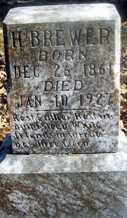
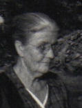
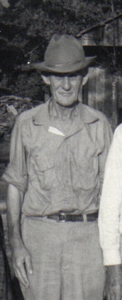
Henry H “Bud” Brewer
| Birth | : | 26 Dec 1861 Oregon County, Missouri, USA |
| Death | : | 10 Jan 1927 Oregon County, Missouri, USA |
| Burial | : | Mount Pleasant Cemetery, Seattle, King County, USA |
| Coordinate | : | 47.6432800, -122.3662643 |
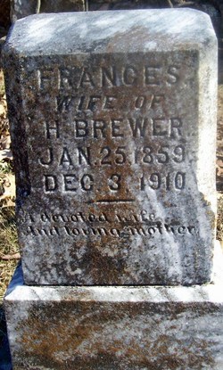
| Description | : | Son of Solomon P. "Saul" Brewer and Grandson of Henry Brewer and Elizabeth. His mother's name is shown as Mary Elizabeth Eaves/Eves on his death certificate, but may have been Mary Jane Storms. There is a marriage record for Mary Jane Storms and a younger brothers death certificate shows Mary Jane Storms as the mother. According to the 1910 census he and Frances had been married for 25 years which would mean they married about 1885. That census also indicates that it is a second marriage for him. Married Frances Foster. Farmer. Per MO Death certificate #2007, burial 11/Jan/1927. |
frequently asked questions (FAQ):
-
Where is Henry H “Bud” Brewer's memorial?
Henry H “Bud” Brewer's memorial is located at: Mount Pleasant Cemetery, Seattle, King County, USA.
-
When did Henry H “Bud” Brewer death?
Henry H “Bud” Brewer death on 10 Jan 1927 in Oregon County, Missouri, USA
-
Where are the coordinates of the Henry H “Bud” Brewer's memorial?
Latitude: 47.6432800
Longitude: -122.3662643
Family Members:
Parent
Spouse

Siblings
Children


Nearby Cemetories:
1. Mount Pleasant Cemetery
Seattle, King County, USA
Coordinate: 47.6432800, -122.3662643
2. Queen Anne Columbarium
Seattle, King County, USA
Coordinate: 47.6432000, -122.3644000
3. Hills of Eternity Reform Cemetery
Seattle, King County, USA
Coordinate: 47.6441994, -122.3643036
4. Saint Pauls Episcopal Church Memorial Garden
Seattle, King County, USA
Coordinate: 47.6254120, -122.3558890
5. Magnolia Lutheran Church Columbarium
Seattle, King County, USA
Coordinate: 47.6399755, -122.3973688
6. Church of the Ascension Episcopal Columbarium
Seattle, King County, USA
Coordinate: 47.6391740, -122.4012910
7. Seattle Cemetery (Defunct)
Seattle, King County, USA
Coordinate: 47.6191530, -122.3409240
8. Fort Lawton Cemetery
Seattle, King County, USA
Coordinate: 47.6601181, -122.4055252
9. Saint Mark's Episcopal Cathedral Columbarium
Seattle, King County, USA
Coordinate: 47.6319000, -122.3208000
10. Grand Army of the Republic Cemetery
Seattle, King County, USA
Coordinate: 47.6363602, -122.3162994
11. Lake View Cemetery
Seattle, King County, USA
Coordinate: 47.6342010, -122.3143997
12. Phinney Ridge Lutheran Church Columbarium
Seattle, King County, USA
Coordinate: 47.6837900, -122.3549100
13. Seattle First Baptist Church Columbarium
Seattle, King County, USA
Coordinate: 47.6124610, -122.3221970
14. Saint James Roman Catholic Cathedral Crypt
Seattle, King County, USA
Coordinate: 47.6075000, -122.3262000
15. Trinity Episcopal Parish Memorial Courtyard
Seattle, King County, USA
Coordinate: 47.6053220, -122.3263560
16. Crown Hill Cemetery
Seattle, King County, USA
Coordinate: 47.6935997, -122.3685989
17. Calvary Cemetery
Seattle, King County, USA
Coordinate: 47.6666985, -122.2917023
18. Saint John the Baptist Episcopal Churchyard
Seattle, King County, USA
Coordinate: 47.5759560, -122.3866190
19. Evergreen-Washelli Memorial Park
Seattle, King County, USA
Coordinate: 47.7104000, -122.3396400
20. Seattle Historic Sephardic Cemetery
Seattle, King County, USA
Coordinate: 47.7118900, -122.3399900
21. Orthodox Brotherly Cemetery of Saint Nicholas
Seattle, King County, USA
Coordinate: 47.7122002, -122.3377991
22. Pacific Lutheran Cemetery
Seattle, King County, USA
Coordinate: 47.7120520, -122.3360360
23. New Bikur Cholim Cemetery
Seattle, King County, USA
Coordinate: 47.7128800, -122.3402700
24. First Lutheran Church of West Seattle Columbarium
West Seattle, King County, USA
Coordinate: 47.5663000, -122.3870000