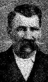
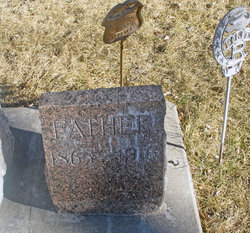
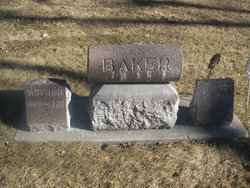
Henry L. “Hank” Baker
| Birth | : | 1864 Loami, Sangamon County, Illinois, USA |
| Death | : | 31 Oct 1916 North Platte, Lincoln County, Nebraska, USA |
| Burial | : | Gap Hill Baptist Church Cemetery, Six Mile, Pickens County, USA |
| Coordinate | : | 34.8293991, -82.8613968 |
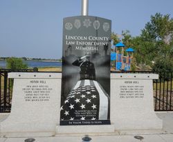
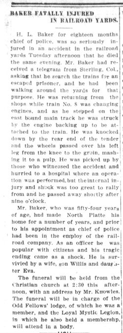
| Description | : | HANK L. BAKER Chief Hank Baker succumbed to injuries sustained the previous day when he was struck by a train. He was searching a train for a wanted man and as he stepped off of it he stepped into the patch of an oncoming engine. His leg was severed by the train's wheels and he died from his injury the following day. Chief Baker was survived by his wife, son and daughter. |
frequently asked questions (FAQ):
-
Where is Henry L. “Hank” Baker's memorial?
Henry L. “Hank” Baker's memorial is located at: Gap Hill Baptist Church Cemetery, Six Mile, Pickens County, USA.
-
When did Henry L. “Hank” Baker death?
Henry L. “Hank” Baker death on 31 Oct 1916 in North Platte, Lincoln County, Nebraska, USA
-
Where are the coordinates of the Henry L. “Hank” Baker's memorial?
Latitude: 34.8293991
Longitude: -82.8613968
Family Members:
Spouse
Children
Flowers:
Nearby Cemetories:
1. Gap Hill Baptist Church Cemetery
Six Mile, Pickens County, USA
Coordinate: 34.8293991, -82.8613968
2. Stephens Family Cemetery
Pickens, Pickens County, USA
Coordinate: 34.8521060, -82.8735060
3. Cedar Hill Holiness Church Cemetery
Six Mile, Pickens County, USA
Coordinate: 34.8324530, -82.8202970
4. Keowee Baptist Church Cemetery
Six Mile, Pickens County, USA
Coordinate: 34.8613830, -82.8759000
5. Powers Family Cemetery
Pickens County, USA
Coordinate: 34.7966500, -82.8755170
6. Mount Olivet Wesleyan Church Cemetery
Six Mile, Pickens County, USA
Coordinate: 34.8121430, -82.8242680
7. Six Mile Baptist Church Cemetery
Six Mile, Pickens County, USA
Coordinate: 34.8074989, -82.8214035
8. Mile Creek Baptist Church Cemetery
Six Mile, Pickens County, USA
Coordinate: 34.8685989, -82.8469009
9. Rhonda Thigpen Gravesite
Six Mile, Pickens County, USA
Coordinate: 34.8575190, -82.8226080
10. Newton Family Cemetery
Six Mile, Pickens County, USA
Coordinate: 34.8667170, -82.8365170
11. Crow Creek Church of God Cemetery
Six Mile, Pickens County, USA
Coordinate: 34.8689700, -82.8392900
12. Old Pickens Cemetery
Old Pickens, Oconee County, USA
Coordinate: 34.7910995, -82.8867035
13. Craig Memorial Cemetery
Old Pickens, Oconee County, USA
Coordinate: 34.7914848, -82.8876801
14. Kings Grove Baptist Church Cemetery
Central, Pickens County, USA
Coordinate: 34.7829000, -82.8574000
15. Robert Morgan-Cannon Family
Central, Pickens County, USA
Coordinate: 34.7820850, -82.8521350
16. Little-Jenkins Cemetery
Oconee County, USA
Coordinate: 34.7883730, -82.8916650
17. Morgan Family Cemetery
Central, Pickens County, USA
Coordinate: 34.7825670, -82.8750170
18. Church of God of Prophecy Cemetery
Six Mile, Pickens County, USA
Coordinate: 34.7962860, -82.8183080
19. Mountain View Baptist Church Cemetery
Six Mile, Pickens County, USA
Coordinate: 34.8577995, -82.8080978
20. Stamp Creek Cemetery
Oconee County, USA
Coordinate: 34.8417015, -82.9250031
21. Isaqueena Church of God Cemetery
Oconee County, USA
Coordinate: 34.8645160, -82.9189680
22. Ellenburg-Holden Family Cemetery
Nine Times, Pickens County, USA
Coordinate: 34.8904260, -82.8667350
23. Hunnicutt Family Cemetery
Salem, Oconee County, USA
Coordinate: 34.8339350, -82.9378370
24. High Falls Cemetery
Oconee County, USA
Coordinate: 34.8013992, -82.9310989

