
| Birth | : | 16 Mar 1817 Farmington, Franklin County, Maine, USA |
| Death | : | 29 Jun 1867 Farmington, Franklin County, Maine, USA |
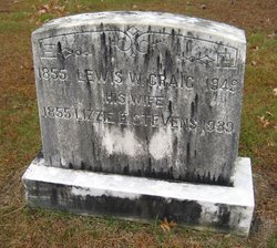
| Burial | : | Riverside Cemetery, Farmington, Franklin County, USA |
| Coordinate | : | 44.6587900, -70.1432600 |
| Description | : | Hiram was the son of John Craig & Charottle Stanley. He married Sophie W. Roberts on January 26, 1848 in Farmington, Franklin County, Maine. In March of 1849, Hiram & Sophie had a daugther, Sophie, named after her Mother. A few days after giving birth to little Sophie, her Mother died from giving birth to her. Hiram married a 2nd time to Harriet Whitter in Farmington, Franklin County, Maine. Hiram & Harriett never had any of children of their own. They decided to raise little Sophie into a fine young lady and she married Charles L. Hanscomb having many... Read More |
frequently asked questions (FAQ):
-
Where is Hiram Belcher Craig's memorial?
Hiram Belcher Craig's memorial is located at: Riverside Cemetery, Farmington, Franklin County, USA.
-
When did Hiram Belcher Craig death?
Hiram Belcher Craig death on 29 Jun 1867 in Farmington, Franklin County, Maine, USA
-
Where are the coordinates of the Hiram Belcher Craig's memorial?
Latitude: 44.6587900
Longitude: -70.1432600
Family Members:
Parent

Spouse
Children
Flowers:


Nearby Cemetories:
1. Riverside Cemetery
Farmington, Franklin County, USA
Coordinate: 44.6587900, -70.1432600
2. Fairview Cemetery
Farmington, Franklin County, USA
Coordinate: 44.6581001, -70.1382980
3. Butterfield Cemetery
Farmington, Franklin County, USA
Coordinate: 44.6520700, -70.1511140
4. Old Burying Ground
Farmington, Franklin County, USA
Coordinate: 44.6638660, -70.1567270
5. Center Burying Ground
Farmington, Franklin County, USA
Coordinate: 44.6712700, -70.1514400
6. Case Cemetery
Farmington, Franklin County, USA
Coordinate: 44.6518900, -70.1247900
7. Belcher Family Graveyard
Farmington, Franklin County, USA
Coordinate: 44.6739269, -70.1488538
8. Red Schoolhouse Cemetery
Franklin County, USA
Coordinate: 44.6314011, -70.1600037
9. Gower Cemetery
Franklin County, USA
Coordinate: 44.6380997, -70.1010971
10. Lowell Cemetery
Franklin County, USA
Coordinate: 44.6292000, -70.1102982
11. Russell Mills Cemetery
Farmington, Franklin County, USA
Coordinate: 44.6695862, -70.1945016
12. North Farmington Cemetery
Farmington, Franklin County, USA
Coordinate: 44.6981000, -70.1794000
13. Sewall Cemetery
Farmington, Franklin County, USA
Coordinate: 44.7001260, -70.0976010
14. Blake Cemetery
Farmington Falls, Franklin County, USA
Coordinate: 44.6258011, -70.0817032
15. East Wilton Cemetery
Wilton, Franklin County, USA
Coordinate: 44.6124700, -70.1878800
16. Holly Cemetery
Farmington, Franklin County, USA
Coordinate: 44.7178001, -70.1371994
17. Temple Village Cemetery
Temple, Franklin County, USA
Coordinate: 44.6831017, -70.2210999
18. Wendall Davis Cemetery
Farmington, Franklin County, USA
Coordinate: 44.7149000, -70.1110200
19. Orchard Hill Cemetery
Temple, Franklin County, USA
Coordinate: 44.6713680, -70.2318424
20. Webster Cemetery
Franklin County, USA
Coordinate: 44.5924988, -70.1241989
21. Zions Hill Cemetery
North Chesterville, Franklin County, USA
Coordinate: 44.5918999, -70.1085968
22. Weeks Mills Cemetery
New Sharon, Franklin County, USA
Coordinate: 44.6732600, -70.0429100
23. Chesterville Hill Cemetery
Chesterville, Franklin County, USA
Coordinate: 44.6060982, -70.0721970
24. Allens Mills Cemetery
Industry, Franklin County, USA
Coordinate: 44.7180800, -70.0780100