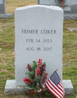
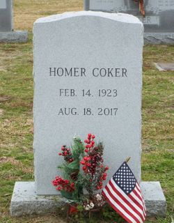
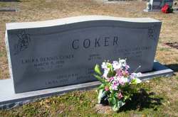
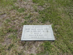
Homer Coker
| Birth | : | 14 Feb 1923 Turbeville, Clarendon County, South Carolina, USA |
| Death | : | 18 Aug 2017 Carrollton, Carroll County, Georgia, USA |
| Burial | : | Turbeville Southern Methodist Church Cemetery, Turbeville, Clarendon County, USA |
| Coordinate | : | 33.8944450, -80.0142490 |
| Description | : | Dr. Homer Coker passed away at Tanner Medical Center in Carrollton on August 18, 2017 at the age of 94. He was born in Turbeville, S.C. on February 14, 1923 to C.E. and Laura Jane D. Coker. He was an educator who served as teacher, coach, principal and superintendent in the South Carolina School System from 1948 to 1968. He became a professor at West Georgia College in 1968 until 1980 when he joined Georgia State University and retired in 1988. He attended Clemson College from 1940-43 when he joined the U.S. Navy; he attended Columbia University and became an officer. He spent... Read More |
frequently asked questions (FAQ):
-
Where is Homer Coker's memorial?
Homer Coker's memorial is located at: Turbeville Southern Methodist Church Cemetery, Turbeville, Clarendon County, USA.
-
When did Homer Coker death?
Homer Coker death on 18 Aug 2017 in Carrollton, Carroll County, Georgia, USA
-
Where are the coordinates of the Homer Coker's memorial?
Latitude: 33.8944450
Longitude: -80.0142490
Family Members:
Parent
Spouse
Siblings
Children
Flowers:
Nearby Cemetories:
1. Turbeville Southern Methodist Church Cemetery
Turbeville, Clarendon County, USA
Coordinate: 33.8944450, -80.0142490
2. Pine Grove United Methodist Church Cemetery
Turbeville, Clarendon County, USA
Coordinate: 33.8947890, -80.0141950
3. Turbeville First Baptist Church Cemetery
Turbeville, Clarendon County, USA
Coordinate: 33.8933570, -80.0149730
4. W.L. Coker Family Cemetery
Turbeville, Clarendon County, USA
Coordinate: 33.8945530, -80.0246780
5. Horse Branch Free Will Baptist Cemetery
Turbeville, Clarendon County, USA
Coordinate: 33.8907260, -79.9996940
6. Hickory Grove Baptist Church
Clarendon County, USA
Coordinate: 33.8797640, -80.0169150
7. Union Hill Baptist Church Cemetery
Turbeville, Clarendon County, USA
Coordinate: 33.9035810, -79.9789650
8. Olive Grove Church Cemetery
Clarendon County, USA
Coordinate: 33.9104040, -80.0482430
9. Gibbons Family Cemetery
Turbeville, Clarendon County, USA
Coordinate: 33.8571243, -80.0251007
10. New Covenant Pentecostal Holiness Church Cemetery
Turbeville, Clarendon County, USA
Coordinate: 33.9099510, -79.9706020
11. Edwards Cemetery
Shiloh, Sumter County, USA
Coordinate: 33.9275510, -80.0499570
12. Pinedale Pentecostal Holiness Church
Turbeville, Clarendon County, USA
Coordinate: 33.8885810, -79.9608860
13. Turbeville First Baptist Church Memorial Garden
Turbeville, Clarendon County, USA
Coordinate: 33.8558540, -80.0452330
14. New Zion United Methodist Church Cemetery
New Zion, Clarendon County, USA
Coordinate: 33.8444443, -80.0215302
15. Shiloh United Methodist Church Cemetery
Shiloh, Sumter County, USA
Coordinate: 33.9399986, -80.0402985
16. David Shaw Home Cemetery #1
Shiloh, Sumter County, USA
Coordinate: 33.9316910, -80.0611390
17. Gamble Cemetery
Clarendon County, USA
Coordinate: 33.8542710, -80.0595440
18. Ebenezer Cemetery
Clarendon County, USA
Coordinate: 33.8539009, -80.0597000
19. New McFadden Cemetery
Olanta, Florence County, USA
Coordinate: 33.8949090, -79.9445920
20. Rush Cemetery
Florence County, USA
Coordinate: 33.8998410, -79.9411660
21. Coker-Miles Cemetery
Florence County, USA
Coordinate: 33.9435530, -79.9664350
22. Goodman Cemetery
Shiloh, Sumter County, USA
Coordinate: 33.9542130, -80.0418000
23. Wheeler Cemetery
Turbeville, Clarendon County, USA
Coordinate: 33.8821720, -80.0901840
24. Asbury Cemetery
Sumter County, USA
Coordinate: 33.9561005, -80.0406036

